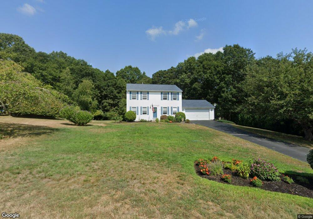
81 Mockingbird Dr North Kingstown, RI 02852
Saunderstown NeighborhoodEstimated Value: $610,000 - $785,000
3
Beds
2
Baths
1,632
Sq Ft
$407/Sq Ft
Est. Value
About This Home
This home is located at 81 Mockingbird Dr, North Kingstown, RI 02852 and is currently estimated at $664,364, approximately $407 per square foot. 81 Mockingbird Dr is a home located in Washington County with nearby schools including Stony Lane Elementary School, Davisville Middle School, and North Kingstown Sr. High School.
Ownership History
Date
Name
Owned For
Owner Type
Purchase Details
Closed on
Dec 10, 2003
Sold by
Hudson Rock and Hudson Angie
Bought by
Sisson Raymond and Sisson Margaret
Current Estimated Value
Purchase Details
Closed on
Sep 30, 1998
Sold by
R R Beaufort & Assoc
Bought by
Hudson Rock A and Hudson Angie
Create a Home Valuation Report for This Property
The Home Valuation Report is an in-depth analysis detailing your home's value as well as a comparison with similar homes in the area
Home Values in the Area
Average Home Value in this Area
Purchase History
| Date | Buyer | Sale Price | Title Company |
|---|---|---|---|
| Sisson Raymond | $312,500 | -- | |
| Hudson Rock A | $136,000 | -- |
Source: Public Records
Mortgage History
| Date | Status | Borrower | Loan Amount |
|---|---|---|---|
| Open | Hudson Rock A | $474,525 | |
| Closed | Hudson Rock A | $50,000 | |
| Closed | Hudson Rock A | $25,000 |
Source: Public Records
Tax History Compared to Growth
Tax History
| Year | Tax Paid | Tax Assessment Tax Assessment Total Assessment is a certain percentage of the fair market value that is determined by local assessors to be the total taxable value of land and additions on the property. | Land | Improvement |
|---|---|---|---|---|
| 2025 | $6,184 | $560,100 | $242,300 | $317,800 |
| 2024 | $5,664 | $395,000 | $160,900 | $234,100 |
| 2023 | $5,664 | $395,000 | $160,900 | $234,100 |
| 2022 | $5,554 | $395,000 | $160,900 | $234,100 |
| 2021 | $5,458 | $311,900 | $115,000 | $196,900 |
| 2020 | $5,330 | $311,900 | $115,000 | $196,900 |
| 2019 | $5,330 | $311,900 | $115,000 | $196,900 |
| 2018 | $5,296 | $279,200 | $107,300 | $171,900 |
| 2017 | $5,190 | $279,200 | $107,300 | $171,900 |
| 2016 | $5,042 | $279,200 | $107,300 | $171,900 |
| 2015 | $4,796 | $248,500 | $99,700 | $148,800 |
| 2014 | $4,699 | $248,500 | $99,700 | $148,800 |
Source: Public Records
Map
Nearby Homes
- 212 Vista Cir
- 84 Cardinal Dr
- 212 Orchard Woods Dr
- 74 Woodhaven Rd
- 38 Greenwood Rd
- 0 W Allenton Rd
- 75 Hickory Dr
- 210 Explorer Dr
- 158 Explorer Dr
- 168 Explorer Dr
- 202 Explorer Dr
- 331 Congdon Hill Rd
- 17 Jamaica Way
- 53 Morgan Ct
- 527 Hatchery Rd
- 76 W Allenton Rd
- 103 Rollingwood Dr
- 679 S County Trail
- 371 Glen Hill Dr
- 449 Sylvan Ct
- 91 Mockingbird Dr
- 73 Mockingbird Dr
- 63 Mockingbird Dr
- 101 Mockingbird Dr
- 76 Mockingbird Dr
- 92 Mockingbird Dr
- 104 Mockingbird Dr
- 64 Mockingbird Dr
- 109 Mockingbird Dr
- 54 Mockingbird Dr
- 112 Mockingbird Dr
- 1191 Lafayette Rd
- 1239 Lafayette Rd
- 1171 Lafayette Rd
- 1211 Lafayette Rd
- 1259 Lafayette Rd
- 1151 Lafayette Rd
- 75 Dawn Marie Ct
- 1220 Lafayette Rd
- 1131 Lafayette Rd