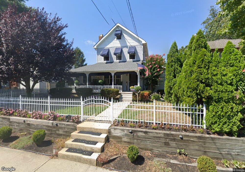
81 N Main St Manasquan, NJ 08736
Estimated Value: $1,130,000 - $1,631,000
3
Beds
3
Baths
2,435
Sq Ft
$550/Sq Ft
Est. Value
About This Home
This home is located at 81 N Main St, Manasquan, NJ 08736 and is currently estimated at $1,339,410, approximately $550 per square foot. 81 N Main St is a home located in Monmouth County with nearby schools including Manasquan Elementary School, Manasquan High School, and The Brookside School.
Ownership History
Date
Name
Owned For
Owner Type
Purchase Details
Closed on
Sep 30, 2002
Sold by
Mcfadden Paul
Bought by
Heinley Michael and Heinley Stephanie
Current Estimated Value
Home Financials for this Owner
Home Financials are based on the most recent Mortgage that was taken out on this home.
Original Mortgage
$388,500
Outstanding Balance
$164,184
Interest Rate
6.27%
Estimated Equity
$1,175,226
Purchase Details
Closed on
Dec 8, 1998
Sold by
Boden Kenneth
Bought by
Mcfadden Paul and Mcfadden Gail
Home Financials for this Owner
Home Financials are based on the most recent Mortgage that was taken out on this home.
Original Mortgage
$202,500
Interest Rate
6.74%
Create a Home Valuation Report for This Property
The Home Valuation Report is an in-depth analysis detailing your home's value as well as a comparison with similar homes in the area
Home Values in the Area
Average Home Value in this Area
Purchase History
| Date | Buyer | Sale Price | Title Company |
|---|---|---|---|
| Heinley Michael | $432,500 | -- | |
| Mcfadden Paul | $270,000 | -- |
Source: Public Records
Mortgage History
| Date | Status | Borrower | Loan Amount |
|---|---|---|---|
| Open | Heinley Michael | $388,500 | |
| Previous Owner | Mcfadden Paul | $202,500 |
Source: Public Records
Tax History Compared to Growth
Tax History
| Year | Tax Paid | Tax Assessment Tax Assessment Total Assessment is a certain percentage of the fair market value that is determined by local assessors to be the total taxable value of land and additions on the property. | Land | Improvement |
|---|---|---|---|---|
| 2025 | $10,476 | $589,200 | $329,000 | $260,200 |
| 2024 | $10,081 | $589,200 | $329,000 | $260,200 |
| 2023 | $10,081 | $589,200 | $329,000 | $260,200 |
| 2022 | $9,704 | $589,200 | $329,000 | $260,200 |
| 2021 | $9,704 | $589,200 | $329,000 | $260,200 |
| 2020 | $9,569 | $589,200 | $329,000 | $260,200 |
| 2019 | $9,209 | $589,200 | $329,000 | $260,200 |
| 2018 | $9,003 | $589,200 | $329,000 | $260,200 |
| 2017 | $8,661 | $589,200 | $329,000 | $260,200 |
| 2016 | $8,431 | $589,200 | $329,000 | $260,200 |
| 2015 | $8,244 | $482,400 | $190,900 | $291,500 |
| 2014 | $8,349 | $489,100 | $197,600 | $291,500 |
Source: Public Records
Map
Nearby Homes
- 15 Spruce Ave
- 42 Willow Way
- 3 Central Ave
- 22 Woodland Ave
- 34 Broad St Unit 306
- 2253 Wagner Ln
- 34 Wigwam Path
- 80 Stockton Lake Blvd
- 2164 Old Mill Rd
- 708 New York Blvd
- 2174 Begonia Ave
- 10 Acpoan Place
- 504 Crescent Pkwy
- 1314 Willow Dr
- 507 Crescent Pkwy
- 116 Curtis Ave
- 85 Virginia Ave
- 1334 Willow Dr
- 105 Mount Ln Unit 3
- 800 Fourth St
- 75 N Main St
- 75 N Main St Unit 15
- 75 N Main St Unit 2
- 75 N Main St Unit 16
- 75 N Main St Unit 11
- 75 N Main St Unit 1
- 75 N Main St Unit 13
- 75 N Main St Unit 14
- 85 N Main St
- 10 Ridge Ave
- 69 N Main St
- 14 Ridge Ave
- 76 N Main St
- 70 N Main St
- 67 N Main St
- 15 Ridge Ave
- 18 Ridge Ave
- 66 N Main St
- 34 Newark Ave
- 63 N Main St