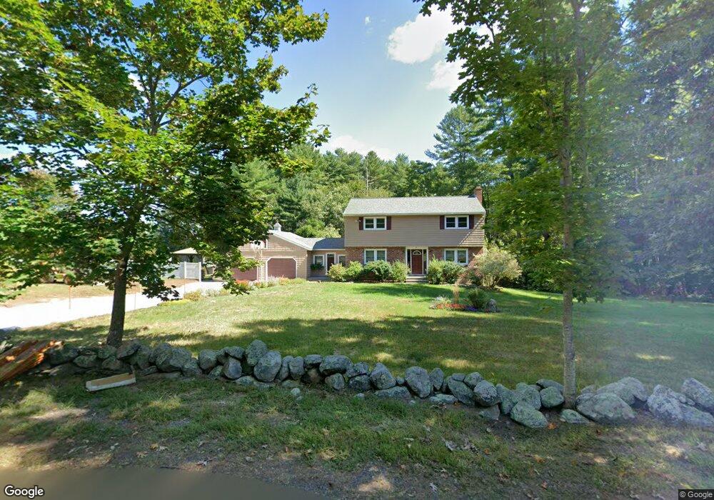
81 Oak St Dunstable, MA 01827
Estimated Value: $649,000 - $786,000
4
Beds
2
Baths
2,568
Sq Ft
$273/Sq Ft
Est. Value
About This Home
This home is located at 81 Oak St, Dunstable, MA 01827 and is currently estimated at $701,974, approximately $273 per square foot. 81 Oak St is a home located in Middlesex County with nearby schools including Groton Dunstable Regional High School and 2nd Nature Academy.
Ownership History
Date
Name
Owned For
Owner Type
Purchase Details
Closed on
Dec 28, 2011
Sold by
Sanville Daniel and Sanville Enyne
Bought by
Sanville Daniel L and Sanville Denyne M
Current Estimated Value
Home Financials for this Owner
Home Financials are based on the most recent Mortgage that was taken out on this home.
Original Mortgage
$258,500
Outstanding Balance
$177,389
Interest Rate
4%
Mortgage Type
Purchase Money Mortgage
Estimated Equity
$524,585
Purchase Details
Closed on
Apr 21, 2009
Sold by
Sanville Denyne M and Sanville Daniel L
Bought by
Sanville Tr Daniel L and Sanville Denyne M
Home Financials for this Owner
Home Financials are based on the most recent Mortgage that was taken out on this home.
Original Mortgage
$160,000
Interest Rate
5.02%
Mortgage Type
Purchase Money Mortgage
Purchase Details
Closed on
Mar 8, 2007
Sold by
Sanville Daniel L and Sanville Denyne M
Bought by
Sanville Daniel and Sanville Denyne
Purchase Details
Closed on
Nov 29, 1995
Sold by
Boule Norman L and Boule Katherine
Bought by
Sanville Daniel L and Sanville Denyne
Home Financials for this Owner
Home Financials are based on the most recent Mortgage that was taken out on this home.
Original Mortgage
$144,000
Interest Rate
7.37%
Mortgage Type
Purchase Money Mortgage
Create a Home Valuation Report for This Property
The Home Valuation Report is an in-depth analysis detailing your home's value as well as a comparison with similar homes in the area
Home Values in the Area
Average Home Value in this Area
Purchase History
| Date | Buyer | Sale Price | Title Company |
|---|---|---|---|
| Sanville Daniel L | -- | -- | |
| Sanville Tr Daniel L | -- | -- | |
| Sanville Denyne M | -- | -- | |
| Sanville Daniel | -- | -- | |
| Sanville Daniel L | $180,000 | -- |
Source: Public Records
Mortgage History
| Date | Status | Borrower | Loan Amount |
|---|---|---|---|
| Open | Sanville Daniel L | $258,500 | |
| Previous Owner | Sanville Denyne M | $160,000 | |
| Previous Owner | Sanville Daniel L | $150,000 | |
| Previous Owner | Sanville Daniel L | $144,000 |
Source: Public Records
Tax History
| Year | Tax Paid | Tax Assessment Tax Assessment Total Assessment is a certain percentage of the fair market value that is determined by local assessors to be the total taxable value of land and additions on the property. | Land | Improvement |
|---|---|---|---|---|
| 2025 | $6,863 | $499,100 | $212,000 | $287,100 |
| 2024 | $6,551 | $469,300 | $195,700 | $273,600 |
| 2023 | $6,608 | $441,400 | $195,700 | $245,700 |
| 2022 | $6,175 | $404,900 | $195,700 | $209,200 |
| 2021 | $0 | $376,300 | $179,400 | $196,900 |
| 2020 | $6,106 | $368,600 | $179,400 | $189,200 |
| 2019 | $6,090 | $357,000 | $179,400 | $177,600 |
| 2018 | $0 | $346,800 | $179,400 | $167,400 |
| 2017 | $5,836 | $342,900 | $179,400 | $163,500 |
| 2016 | $5,551 | $335,400 | $171,200 | $164,200 |
| 2015 | $5,233 | $312,800 | $143,500 | $169,300 |
| 2014 | $4,933 | $312,800 | $143,500 | $169,300 |
Source: Public Records
Map
Nearby Homes
- 319 Pleasant St
- 1 Doucet Ave
- 57 French Ct
- 77 Wilderness Dr
- 153 Off Pond St
- 141 Ridge Rd
- 58 Wilderness Dr
- 2 Wilderness Dr
- 7 Wilderness Dr
- 1 Wilderness Dr
- 79 Wilderness Dr
- 3 Wilderness Dr
- 4 Wilderness Dr
- 6 Wilderness Dr
- 57 Wilderness Dr
- 59 Wilderness Dr
- 11 Lojko Dr
- 61 Wilderness Dr
- 4 Hikers Ln
- 8 Hikers Ln
Your Personal Tour Guide
Ask me questions while you tour the home.