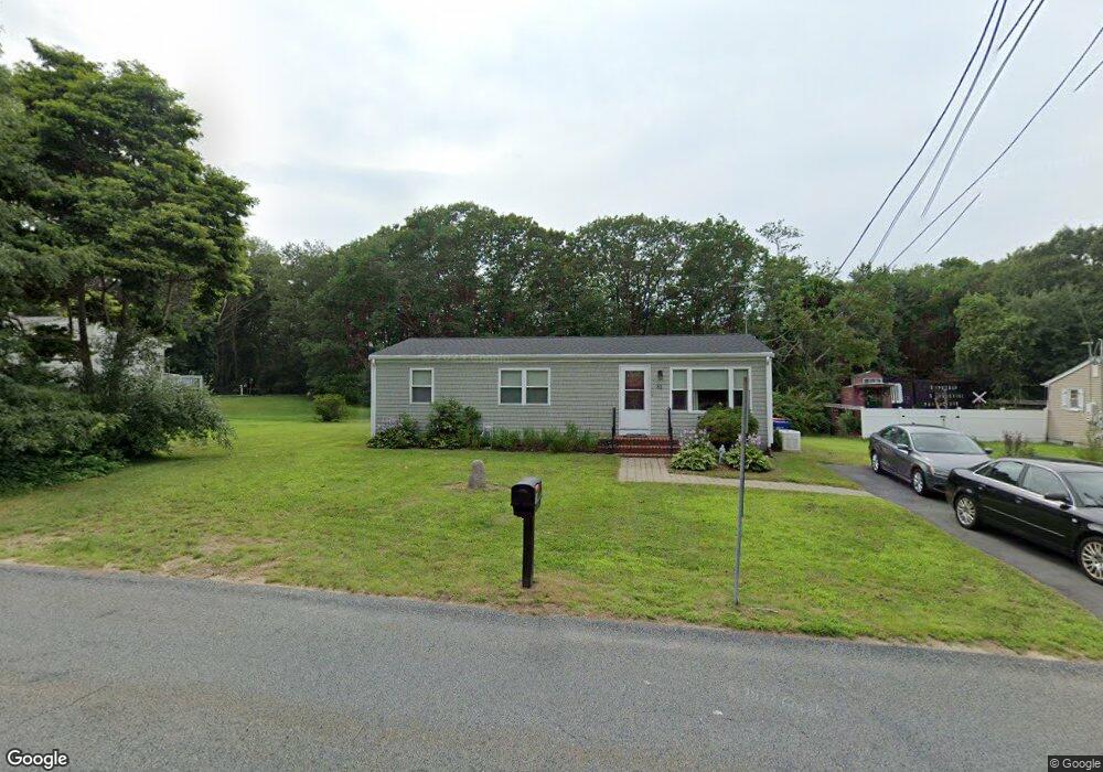
81 Robert St Westport, MA 02790
Sawdy Pond/Woods Corner NeighborhoodEstimated Value: $403,196 - $482,000
3
Beds
1
Bath
1,056
Sq Ft
$432/Sq Ft
Est. Value
About This Home
This home is located at 81 Robert St, Westport, MA 02790 and is currently estimated at $456,299, approximately $432 per square foot. 81 Robert St is a home located in Bristol County with nearby schools including Alice A. Macomber Primary School, Westport Elementary School, and Westport Middle-High School.
Ownership History
Date
Name
Owned For
Owner Type
Purchase Details
Closed on
Oct 26, 2015
Sold by
Lepage Deolinda M
Bought by
Lepage Ft
Current Estimated Value
Purchase Details
Closed on
Jan 18, 1979
Bought by
Lepage Ft
Create a Home Valuation Report for This Property
The Home Valuation Report is an in-depth analysis detailing your home's value as well as a comparison with similar homes in the area
Home Values in the Area
Average Home Value in this Area
Purchase History
| Date | Buyer | Sale Price | Title Company |
|---|---|---|---|
| Lepage Ft | -- | -- | |
| Lepage Ft | -- | -- |
Source: Public Records
Mortgage History
| Date | Status | Borrower | Loan Amount |
|---|---|---|---|
| Previous Owner | Lepage Ft | $50,000 |
Source: Public Records
Tax History
| Year | Tax Paid | Tax Assessment Tax Assessment Total Assessment is a certain percentage of the fair market value that is determined by local assessors to be the total taxable value of land and additions on the property. | Land | Improvement |
|---|---|---|---|---|
| 2025 | $2,385 | $320,100 | $154,800 | $165,300 |
| 2024 | $2,368 | $306,400 | $143,400 | $163,000 |
| 2023 | $2,324 | $284,800 | $136,600 | $148,200 |
| 2022 | $2,226 | $262,500 | $136,600 | $125,900 |
| 2021 | $2,171 | $251,900 | $124,200 | $127,700 |
| 2020 | $2,081 | $246,900 | $119,200 | $127,700 |
| 2019 | $3,407 | $233,700 | $108,400 | $125,300 |
| 2018 | $2,964 | $209,500 | $116,600 | $92,900 |
| 2017 | $3,168 | $206,900 | $116,600 | $90,300 |
| 2016 | $1,598 | $202,000 | $116,600 | $85,400 |
| 2015 | $1,526 | $192,400 | $116,600 | $75,800 |
Source: Public Records
Map
Nearby Homes
- 179 Robert St
- 40 Sycamore Ln
- 47 Robert St
- 33 Moniz Dr
- 2 Magnolia Ln
- 218 American Legion Hwy
- 329 Tickle Rd
- 8 Campion Ave
- 24 Greenfield Rd
- 45 Greenfield Rd
- 259 Tickle Rd
- 24 Cala Ave
- 214 Sawdy Dr
- 6 Angel Ct
- 374 Crandall Rd
- 47 Devol Ave
- 10 Elise Michelle Way
- 1023 Old Stafford Rd
- 0 Tickle Rd Unit 73453134
- 105 Florence St
Your Personal Tour Guide
Ask me questions while you tour the home.