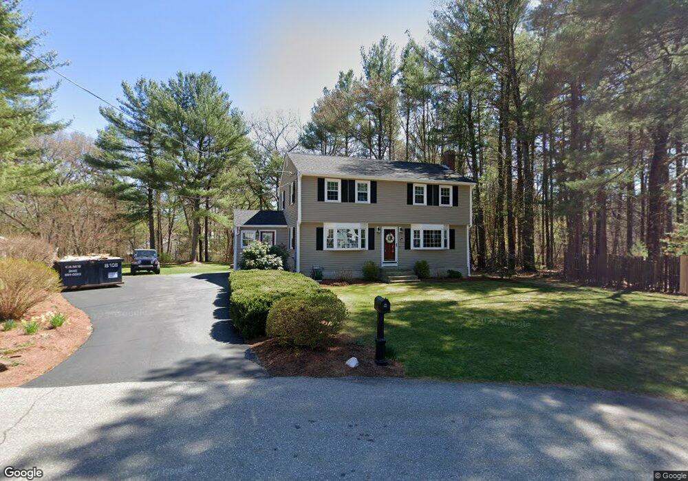
81 Ronald Dr Tewksbury, MA 01876
Estimated Value: $657,599 - $838,000
4
Beds
2
Baths
1,715
Sq Ft
$426/Sq Ft
Est. Value
About This Home
This home is located at 81 Ronald Dr, Tewksbury, MA 01876 and is currently estimated at $730,400, approximately $425 per square foot. 81 Ronald Dr is a home located in Middlesex County with nearby schools including Heath-Brook Elementary School, John W. Wynn Middle School, and John F. Ryan Elementary School.
Ownership History
Date
Name
Owned For
Owner Type
Purchase Details
Closed on
Apr 29, 1994
Sold by
Lauria John S and Lauria Joanne
Bought by
Cooke Thomas M and Cooke Susan L
Current Estimated Value
Home Financials for this Owner
Home Financials are based on the most recent Mortgage that was taken out on this home.
Original Mortgage
$152,900
Interest Rate
7.7%
Mortgage Type
Purchase Money Mortgage
Create a Home Valuation Report for This Property
The Home Valuation Report is an in-depth analysis detailing your home's value as well as a comparison with similar homes in the area
Home Values in the Area
Average Home Value in this Area
Purchase History
| Date | Buyer | Sale Price | Title Company |
|---|---|---|---|
| Cooke Thomas M | $170,000 | -- |
Source: Public Records
Mortgage History
| Date | Status | Borrower | Loan Amount |
|---|---|---|---|
| Open | Cooke Thomas M | $23,000 | |
| Closed | Cooke Thomas M | $152,900 | |
| Previous Owner | Cooke Thomas M | $125,000 |
Source: Public Records
Tax History Compared to Growth
Tax History
| Year | Tax Paid | Tax Assessment Tax Assessment Total Assessment is a certain percentage of the fair market value that is determined by local assessors to be the total taxable value of land and additions on the property. | Land | Improvement |
|---|---|---|---|---|
| 2025 | $7,625 | $576,800 | $321,100 | $255,700 |
| 2024 | $7,543 | $563,300 | $305,900 | $257,400 |
| 2023 | $7,298 | $517,600 | $278,000 | $239,600 |
| 2022 | $6,861 | $451,400 | $241,800 | $209,600 |
| 2021 | $6,626 | $421,500 | $220,000 | $201,500 |
| 2020 | $6,390 | $400,100 | $209,600 | $190,500 |
| 2019 | $5,495 | $362,200 | $199,600 | $162,600 |
| 2018 | $9,079 | $340,600 | $199,600 | $141,000 |
| 2017 | $5,457 | $334,600 | $199,600 | $135,000 |
| 2016 | $5,291 | $323,600 | $199,600 | $124,000 |
| 2015 | $5,062 | $309,200 | $190,000 | $119,200 |
| 2014 | $4,926 | $305,800 | $190,000 | $115,800 |
Source: Public Records
Map
Nearby Homes
- 70 Ronald Dr
- 14 Hinckley Rd
- 31 Marie St
- 6 Stonebury Way Unit 6
- 1501 Whipple Rd
- 16 Eagle Dr
- 48 Whipple Rd
- 51 Whipple Rd
- 43 Palm Dr
- 77 Whipple Rd
- 1455 Main St Unit 8
- 1455 Main St Unit 4
- 1455 Main St Unit 10
- 31 Harjean Rd
- 29 Oregon Rd
- 93 Fairway Dr
- 127 Caddy Ct
- 1418 Main St Unit 201
- 142 Patrick Rd
- 8 Boisvert Rd