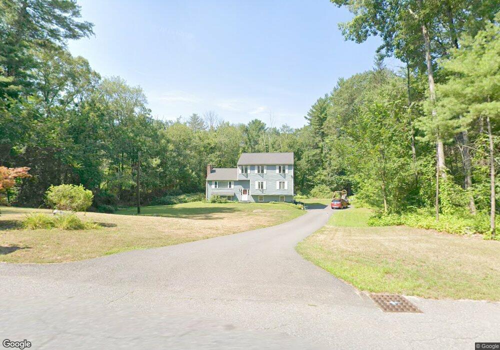
81 Virginia Farme Ln Carlisle, MA 01741
Estimated Value: $1,109,000 - $1,163,000
3
Beds
3
Baths
2,673
Sq Ft
$427/Sq Ft
Est. Value
About This Home
This home is located at 81 Virginia Farme Ln, Carlisle, MA 01741 and is currently estimated at $1,140,219, approximately $426 per square foot. 81 Virginia Farme Ln is a home located in Middlesex County with nearby schools including Carlisle School and Middlesex School.
Ownership History
Date
Name
Owned For
Owner Type
Purchase Details
Closed on
Jun 18, 2025
Sold by
Meldonian Ronald C and Meldonian Eugenia L
Bought by
Meldonian Ft and Meldonian
Current Estimated Value
Purchase Details
Closed on
Sep 17, 1984
Bought by
Meldonian Ronald C and Meldonian Eugenia L
Create a Home Valuation Report for This Property
The Home Valuation Report is an in-depth analysis detailing your home's value as well as a comparison with similar homes in the area
Home Values in the Area
Average Home Value in this Area
Purchase History
| Date | Buyer | Sale Price | Title Company |
|---|---|---|---|
| Meldonian Ft | -- | None Available | |
| Meldonian Ft | -- | None Available | |
| Meldonian Ronald C | -- | -- |
Source: Public Records
Mortgage History
| Date | Status | Borrower | Loan Amount |
|---|---|---|---|
| Previous Owner | Meldonian Ronald C | $190,000 | |
| Previous Owner | Meldonian Ronald C | $35,000 | |
| Previous Owner | Meldonian Ronald C | $115,000 | |
| Previous Owner | Meldonian Ronald C | $30,000 |
Source: Public Records
Tax History Compared to Growth
Tax History
| Year | Tax Paid | Tax Assessment Tax Assessment Total Assessment is a certain percentage of the fair market value that is determined by local assessors to be the total taxable value of land and additions on the property. | Land | Improvement |
|---|---|---|---|---|
| 2025 | $12,833 | $973,700 | $588,700 | $385,000 |
| 2024 | $12,565 | $942,600 | $522,700 | $419,900 |
| 2023 | $12,127 | $857,000 | $500,900 | $356,100 |
| 2022 | $12,212 | $740,100 | $435,600 | $304,500 |
| 2021 | $12,049 | $740,100 | $435,600 | $304,500 |
| 2020 | $12,527 | $682,300 | $370,300 | $312,000 |
| 2019 | $12,320 | $673,600 | $370,300 | $303,300 |
| 2018 | $12,239 | $673,600 | $370,300 | $303,300 |
| 2017 | $11,786 | $668,900 | $370,300 | $298,600 |
| 2016 | $11,505 | $668,900 | $370,300 | $298,600 |
| 2015 | $11,225 | $590,800 | $352,800 | $238,000 |
| 2014 | $11,013 | $590,800 | $352,800 | $238,000 |
Source: Public Records
Map
Nearby Homes
- 1420 Curve St
- 225 Lowell St
- 1056 Curve St
- 1 Garrison Way Unit 1
- 8 Kay's Walk Unit 13
- 14 Kay's Walk
- 6 Kay's Walk Unit 6
- 6 Kay's Walk
- 2 Kay's Walk Unit 18
- 4 Kay's Walk Unit 15
- 3 Kay's Walk
- 15 Kay's Walk
- 1 Kay's Walk Unit 1
- 1 Kay's Walk
- 13 Kay's Walk
- 15 Kay's Walk Unit 4
- 3 Kay's Walk Unit 3
- 12 Martin St
- 875 Acton St
- 232 Baldwin Rd
- 105 Virginia Farme Ln
- 45 Virginia Farme Ln
- 88 Virginia Farme Ln
- 68 Virginia Farme Ln
- 19 Virginia Farme Ln
- 108 Virginia Farme Ln
- 46 Virginia Farme Ln
- 131 Virginia Farme Ln
- 30 Virginia Farme Ln
- 514 Westford St
- 136 Virginia Farme Ln
- 85 Munroe Hill Rd
- 546 Westford St
- 151 Munroe Hill Rd
- 153 Virginia Farme Ln
- 32 Johnson Rd
- 178 Virginia Farme Ln
- 468 Westford St
- 117 Munroe Hill Rd
- 181 Munroe Hill Rd