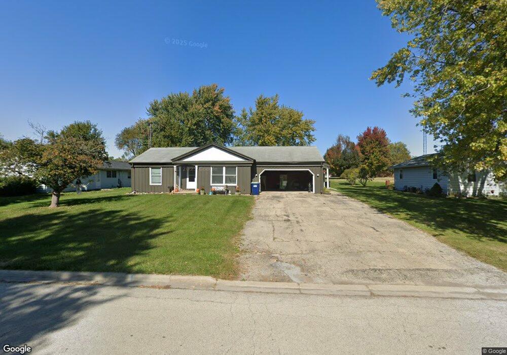
81 W George Ave Cortland, IL 60112
Estimated Value: $228,000 - $261,479
1
Bed
2
Baths
2,104
Sq Ft
$118/Sq Ft
Est. Value
About This Home
This home is located at 81 W George Ave, Cortland, IL 60112 and is currently estimated at $248,870, approximately $118 per square foot. 81 W George Ave is a home located in DeKalb County with nearby schools including Cortland Elementary School, Huntley Middle School, and De Kalb High School.
Ownership History
Date
Name
Owned For
Owner Type
Purchase Details
Closed on
Apr 4, 2018
Sold by
Sawyer Mark
Bought by
Sawyer Mark and Mark Sawyer Living Trust
Current Estimated Value
Purchase Details
Closed on
Oct 26, 2017
Sold by
First National Bank Of Omaha
Bought by
Sawyer Mark
Purchase Details
Closed on
Aug 2, 2010
Sold by
Weinmann Denise
Bought by
Castle Bank Na
Purchase Details
Closed on
Apr 3, 2009
Sold by
American National Bank
Bought by
Suppeland Denise L
Purchase Details
Closed on
Mar 30, 2009
Sold by
American National Bank
Bought by
Suppeland Denise L
Create a Home Valuation Report for This Property
The Home Valuation Report is an in-depth analysis detailing your home's value as well as a comparison with similar homes in the area
Home Values in the Area
Average Home Value in this Area
Purchase History
| Date | Buyer | Sale Price | Title Company |
|---|---|---|---|
| Sawyer Mark | -- | None Available | |
| Sawyer Mark | -- | None Available | |
| Castle Bank Na | -- | -- | |
| Suppeland Denise L | $145,000 | -- | |
| Suppeland Denise L | $145,000 | -- |
Source: Public Records
Tax History Compared to Growth
Tax History
| Year | Tax Paid | Tax Assessment Tax Assessment Total Assessment is a certain percentage of the fair market value that is determined by local assessors to be the total taxable value of land and additions on the property. | Land | Improvement |
|---|---|---|---|---|
| 2024 | $5,668 | $64,468 | $16,315 | $48,153 |
| 2023 | $5,668 | $60,312 | $15,263 | $45,049 |
| 2022 | $5,736 | $57,561 | $14,567 | $42,994 |
| 2021 | $5,806 | $54,804 | $13,869 | $40,935 |
| 2020 | $5,818 | $53,094 | $13,436 | $39,658 |
| 2019 | $5,656 | $50,866 | $12,872 | $37,994 |
| 2018 | $5,506 | $48,105 | $12,173 | $35,932 |
| 2017 | $5,451 | $45,797 | $11,589 | $34,208 |
| 2016 | $5,256 | $43,042 | $10,892 | $32,150 |
| 2015 | -- | $40,419 | $10,228 | $30,191 |
| 2014 | -- | $38,902 | $9,844 | $29,058 |
| 2013 | -- | $40,313 | $10,201 | $30,112 |
Source: Public Records
Map
Nearby Homes
- 269 S Somonauk Rd
- 231 S Walnut St
- 67 S Somonauk Rd
- Townes Plan at Robinson Farms - Townes
- The Anderson Plan at Robinson Farms
- 67 E Robinson Ave
- 154 S Llanos St
- 152 S Llanos St
- 154 Llanos St
- 152 Llanos St
- Lot B16 Llanos St
- Lot A16 Llanos St
- 167 W Carol Ave
- 241 N Somonauk Rd
- 95 Lots Chestnut Grove
- Lot B5 W Paw Ave
- Lot B6 W Paw Ave
- 300 N Aspen Dr
- 467 Preston St
- Berquist Plan at Richland Trails
- 89 W George Ave
- 71 W George Ave
- 89 W George Ave
- 61 W George Ave
- 89 & 91 W George Ave
- 97 W George Ave
- 82 W George Ave
- 74 W George Ave
- 111 W George Ave
- 109 W George Ave
- 98 W George Ave
- 190 S Joslyn St Unit 19
- 193 S King St
- 195 S King St
- 93 W Benson Ave
- 192 S Joslyn St
- 99 W Benson Ave
- 207 S King St
- 200 S Joslyn St
- 181 S Joslyn St