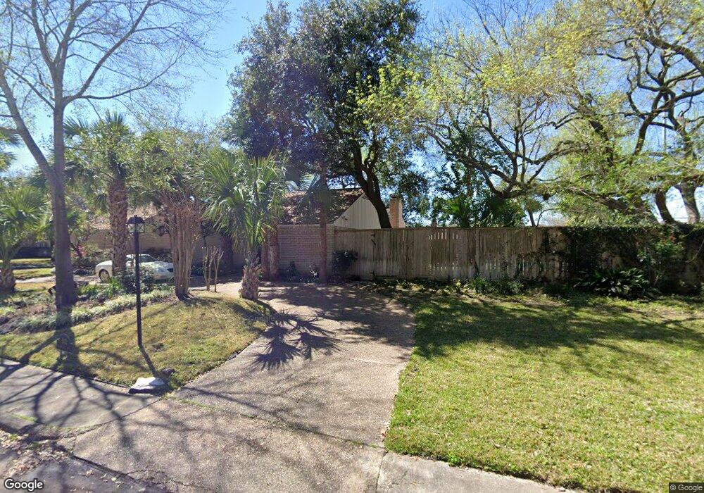
810 Briar Hill Dr Houston, TX 77042
Briar Forest NeighborhoodEstimated Value: $794,000 - $928,000
4
Beds
3
Baths
2,811
Sq Ft
$299/Sq Ft
Est. Value
About This Home
This home is located at 810 Briar Hill Dr, Houston, TX 77042 and is currently estimated at $841,155, approximately $299 per square foot. 810 Briar Hill Dr is a home located in Harris County with nearby schools including Walnut Bend Elementary School, Paul Revere Middle School, and Westside High School.
Ownership History
Date
Name
Owned For
Owner Type
Purchase Details
Closed on
Jul 27, 1998
Sold by
Purdy Steven S and Purdy Gina Y
Bought by
Able Gary N and Able Barbara J
Current Estimated Value
Home Financials for this Owner
Home Financials are based on the most recent Mortgage that was taken out on this home.
Original Mortgage
$225,000
Outstanding Balance
$47,021
Interest Rate
6.94%
Estimated Equity
$794,134
Purchase Details
Closed on
May 31, 1995
Sold by
Kennedy James W and Kennedy Sherry
Bought by
Purdy Steven S and Purdy Gina Y
Home Financials for this Owner
Home Financials are based on the most recent Mortgage that was taken out on this home.
Original Mortgage
$176,000
Interest Rate
8.18%
Create a Home Valuation Report for This Property
The Home Valuation Report is an in-depth analysis detailing your home's value as well as a comparison with similar homes in the area
Home Values in the Area
Average Home Value in this Area
Purchase History
| Date | Buyer | Sale Price | Title Company |
|---|---|---|---|
| Able Gary N | -- | Texas American Title Company | |
| Purdy Steven S | -- | Stewart Title |
Source: Public Records
Mortgage History
| Date | Status | Borrower | Loan Amount |
|---|---|---|---|
| Open | Able Gary N | $225,000 | |
| Previous Owner | Purdy Steven S | $176,000 | |
| Closed | Purdy Steven S | $22,000 |
Source: Public Records
Tax History Compared to Growth
Tax History
| Year | Tax Paid | Tax Assessment Tax Assessment Total Assessment is a certain percentage of the fair market value that is determined by local assessors to be the total taxable value of land and additions on the property. | Land | Improvement |
|---|---|---|---|---|
| 2025 | $6,034 | $667,467 | $359,100 | $308,367 |
| 2024 | $6,034 | $667,467 | $359,100 | $308,367 |
| 2023 | $6,034 | $667,467 | $359,100 | $308,367 |
| 2022 | $13,976 | $634,738 | $359,100 | $275,638 |
| 2021 | $15,082 | $647,113 | $359,100 | $288,013 |
| 2020 | $15,450 | $638,011 | $359,100 | $278,911 |
| 2019 | $16,145 | $638,011 | $359,100 | $278,911 |
| 2018 | $9,540 | $610,610 | $287,280 | $323,330 |
| 2017 | $14,598 | $610,610 | $287,280 | $323,330 |
| 2016 | $13,271 | $610,610 | $287,280 | $323,330 |
| 2015 | $8,787 | $610,610 | $287,280 | $323,330 |
| 2014 | $8,787 | $433,754 | $215,460 | $218,294 |
Source: Public Records
Map
Nearby Homes
- 10212 Longmont Dr Unit 44/7
- 10323 Pine Forest Rd
- 10378 Briar Forest Dr Unit 32/5
- 10324 Briar Forest Dr Unit 28
- 10276 Briar Forest Dr Unit 25
- 10121 Valley Forge Dr
- 1003 Blue Willow Dr
- 10317 Briar Forest Dr Unit 214
- 10034 Bordley Dr
- 10614 Lynbrook Dr
- 1537 W Sam Houston Pkwy S
- 10118 Briar Rose Dr
- 10010 Bordley Dr
- 10607 Cranbrook Rd
- 10042 Briar Forest Dr
- 10034 Briar Forest Dr
- 10623 Longmont Dr
- 1691 W Sam Houston Pkwy S
- 10607 Riverview Dr
- 10710 Candlewood Dr
- 806 Briar Hill Dr
- 10334 Lynbrook Hollow St
- 802 Briar Hill Dr
- 10407 Lynbrook Hollow St
- 10403 Lynbrook Hollow St
- 10323 Sugar Hill Dr
- 10335 Lynbrook Hollow St
- 10330 Lynbrook Hollow St
- 10331 Lynbrook Hollow St
- 10319 Sugar Hill Dr
- 714 Briar Hill Dr Unit 98
- 10326 Lynbrook Hollow St
- 10327 Lynbrook Hollow St
- 10392 Longmont Dr Unit 51
- 10390 Longmont Dr Unit 51
- 10394 Longmont Dr Unit 51
- 10388 Longmont Dr Unit 51
- 10396 Longmont Dr Unit 51
- 10386 Longmont Dr Unit 51
- 10386 Longmont Dr Unit 51/8