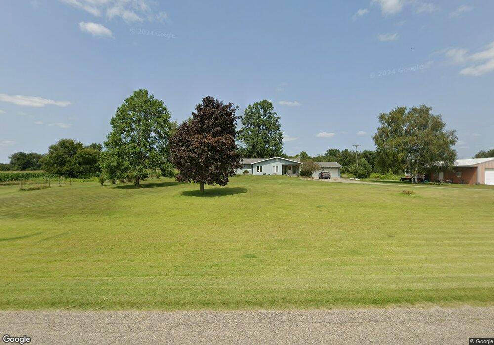
810 Campbell Rd Quincy, MI 49082
Estimated Value: $226,000 - $515,000
3
Beds
1
Bath
1,722
Sq Ft
$204/Sq Ft
Est. Value
About This Home
This home is located at 810 Campbell Rd, Quincy, MI 49082 and is currently estimated at $352,043, approximately $204 per square foot. 810 Campbell Rd is a home located in Branch County with nearby schools including Jennings Elementary School, Quincy Middle School, and Quincy High School.
Ownership History
Date
Name
Owned For
Owner Type
Purchase Details
Closed on
Sep 28, 2022
Sold by
Semmelroth Joanna
Bought by
David And Joanna Semmelroth Family Trust and Semmelroth
Current Estimated Value
Purchase Details
Closed on
Sep 27, 2017
Sold by
Harbaugh Arthur Grant
Bought by
Harbaugh Joanna Kay
Purchase Details
Closed on
Sep 11, 2013
Sold by
Hampton Terry
Bought by
Hampton Trevor L
Purchase Details
Closed on
Sep 10, 2003
Bought by
Harbaugh Arthur Grant and Joanna Kay
Create a Home Valuation Report for This Property
The Home Valuation Report is an in-depth analysis detailing your home's value as well as a comparison with similar homes in the area
Purchase History
| Date | Buyer | Sale Price | Title Company |
|---|---|---|---|
| David And Joanna Semmelroth Family Trust | -- | None Listed On Document | |
| Harbaugh Joanna Kay | -- | None Available | |
| Hampton Trevor L | -- | Branch County Abstract & Tit | |
| Harbaugh Arthur Grant | $140,000 | -- |
Source: Public Records
Tax History
| Year | Tax Paid | Tax Assessment Tax Assessment Total Assessment is a certain percentage of the fair market value that is determined by local assessors to be the total taxable value of land and additions on the property. | Land | Improvement |
|---|---|---|---|---|
| 2025 | $3,021 | $160,606 | $0 | $0 |
| 2024 | $31 | $147,048 | $0 | $0 |
| 2023 | $1,049 | $132,814 | $0 | $0 |
| 2022 | $3,079 | $126,016 | $0 | $0 |
| 2020 | -- | $111,448 | $0 | $0 |
| 2019 | -- | $117,531 | $0 | $0 |
| 2018 | -- | $113,799 | $0 | $0 |
| 2017 | -- | $107,070 | $0 | $0 |
| 2016 | -- | $98,877 | $0 | $0 |
| 2015 | -- | $86,086 | $0 | $0 |
| 2014 | -- | $88,891 | $0 | $0 |
| 2013 | -- | $88,122 | $0 | $0 |
Source: Public Records
Map
Nearby Homes
- 0 Brocklebank Rd
- 242 Bickford Dr
- 727 Skipper Ln
- 481 Quimby Rd
- 204 Crockett Dr
- 382 W Russell Dr
- 0 Warren Rd
- 204 Dons Dr
- 202 Dons Dr
- 181 Dons Dr
- 585 Berrynoll Ct
- 211 S Ray Quincy Rd
- 536 Hickory Ln
- 534 Hickory Ln
- 564 Lake Dr
- 566 Lake Dr Unit A
- 944 Lukesport Rd
- 808 Rolling Meadows Dr
- 716 Bayside Ln
- 981 Generic Dr
- 397 Brocklebank Rd
- 807 Hall Rd
- 803 Hall Rd
- 811 Hall Rd
- 798 Hall Rd
- 373 Brocklebank Rd
- 433 Brocklebank Rd
- 367 Brocklebank Rd
- 776 Hall Rd
- 845 Hall Rd
- 401 S Fremont Rd
- 407 S Fremont Rd
- 409 S Fremont Rd
- 0 S Fremont Rd
- 759 Hall Rd
- 416 S Fremont Rd
- 349 Brocklebank Rd
- 368 S Fremont Rd
- 455 Brocklebank Rd
- 862 Hall Rd
Your Personal Tour Guide
Ask me questions while you tour the home.