Estimated Value: $339,710 - $458,000
--
Bed
2
Baths
2,159
Sq Ft
$185/Sq Ft
Est. Value
About This Home
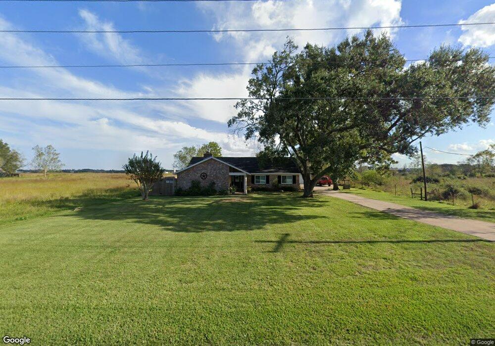
This home is located at 810 County Road 129, Alvin, TX 77511 and is currently estimated at $398,928, approximately $184 per square foot. 810 County Road 129 is a home located in Brazoria County with nearby schools including Mark Twain Elementary School, G.W. Harby Junior High School, and Alvin High School.
Ownership History
Date
Name
Owned For
Owner Type
Purchase Details
Closed on
Jun 6, 2023
Sold by
Wolfe Winifred Anne
Bought by
Cook Tracy and Cook Wendell
Current Estimated Value
Home Financials for this Owner
Home Financials are based on the most recent Mortgage that was taken out on this home.
Original Mortgage
$353,479
Outstanding Balance
$344,096
Interest Rate
6.43%
Mortgage Type
FHA
Estimated Equity
$54,832
Purchase Details
Closed on
Oct 17, 1996
Sold by
Federal National Mortgage Association
Bought by
Wolfe Dale Robert and Wolfe Winifred A
Home Financials for this Owner
Home Financials are based on the most recent Mortgage that was taken out on this home.
Original Mortgage
$78,350
Interest Rate
8.31%
Create a Home Valuation Report for This Property
The Home Valuation Report is an in-depth analysis detailing your home's value as well as a comparison with similar homes in the area
Home Values in the Area
Average Home Value in this Area
Purchase History
| Date | Buyer | Sale Price | Title Company |
|---|---|---|---|
| Cook Tracy | -- | Chicago Title | |
| Wolfe Winifred Anne | -- | Chicago Title | |
| Wolfe Dale Robert | -- | -- |
Source: Public Records
Mortgage History
| Date | Status | Borrower | Loan Amount |
|---|---|---|---|
| Open | Cook Tracy | $353,479 | |
| Previous Owner | Wolfe Dale Robert | $78,350 |
Source: Public Records
Tax History Compared to Growth
Tax History
| Year | Tax Paid | Tax Assessment Tax Assessment Total Assessment is a certain percentage of the fair market value that is determined by local assessors to be the total taxable value of land and additions on the property. | Land | Improvement |
|---|---|---|---|---|
| 2025 | $5,868 | $314,750 | $8,710 | $306,040 |
| 2023 | $5,868 | $171,358 | $8,710 | $305,140 |
| 2022 | $3,304 | $155,780 | $7,620 | $211,250 |
| 2021 | $3,143 | $173,150 | $5,450 | $167,700 |
| 2020 | $2,761 | $175,340 | $5,450 | $169,890 |
| 2019 | $2,589 | $117,040 | $5,450 | $111,590 |
| 2018 | $2,559 | $115,440 | $5,450 | $109,990 |
| 2017 | $2,668 | $118,840 | $5,450 | $113,390 |
| 2016 | $2,668 | $118,840 | $5,450 | $113,390 |
| 2014 | $2,030 | $104,670 | $5,450 | $99,220 |
Source: Public Records
Map
Nearby Homes
- 5350 N Highway 35
- 0000 N Highway 35
- 2082 Wilderness Trail
- 902 Longleaf Ct
- 1914 Quinn Rd
- 2243 County Road 130
- 0 County Road 130
- 18120 County Road 127
- 19701 Highway 35
- 153 Mooney Rd
- 8835 Escondido St
- 158 Mooney Rd
- 205 Del Monte Dr
- 18118 County Road 125
- 1208 Cowards Creek Dr
- 251 Saint Cloud Dr
- 1412 Cambridge Dr
- 1501 W Castlewood Ave
- 1404 Blueberry Ln
- 644 E Castle Harbour Dr
- 906 County Road 129
- 906 County Road 129
- 911 County Road 129
- 918 County Road 129
- 938 County Road 129
- 938 Cr 129
- 939 County Road 129
- 706 County Road 129
- 1010 County Road 129
- 702 County Road 129
- 527 County Road 129d
- 607 County Road 129d
- 607 Cr129 D
- 607 Cr 129 D
- 511 County Road 129d
- 517 County Road 129d
- 1020 County Road 129
- 503 County Road 129d
- 435 County Road 129d
- 516 County Road 129d