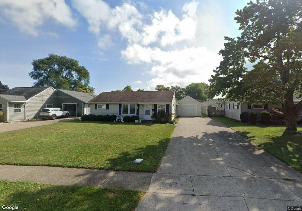
810 Dorn Dr Sandusky, OH 44870
Estimated Value: $185,477 - $224,000
3
Beds
1
Bath
1,370
Sq Ft
$145/Sq Ft
Est. Value
About This Home
This home is located at 810 Dorn Dr, Sandusky, OH 44870 and is currently estimated at $198,869, approximately $145 per square foot. 810 Dorn Dr is a home located in Erie County with nearby schools including Sandusky High School and Sandusky Central Catholic School.
Ownership History
Date
Name
Owned For
Owner Type
Purchase Details
Closed on
Dec 5, 2016
Sold by
Mulvane Wendell I
Bought by
Mulvane Wendell I and Ruiz Wendy A
Current Estimated Value
Home Financials for this Owner
Home Financials are based on the most recent Mortgage that was taken out on this home.
Original Mortgage
$92,500
Outstanding Balance
$41,392
Interest Rate
3.57%
Mortgage Type
New Conventional
Estimated Equity
$157,477
Purchase Details
Closed on
Mar 31, 2000
Sold by
Anna L Flourony Trst
Bought by
Mulvane Wendell I
Home Financials for this Owner
Home Financials are based on the most recent Mortgage that was taken out on this home.
Original Mortgage
$84,456
Interest Rate
8.39%
Mortgage Type
FHA
Create a Home Valuation Report for This Property
The Home Valuation Report is an in-depth analysis detailing your home's value as well as a comparison with similar homes in the area
Home Values in the Area
Average Home Value in this Area
Purchase History
We collect this data history from publicly available records. To have your information removed, we recommend requesting removal directly through your county’s website.
| Date | Buyer | Sale Price | Title Company |
|---|---|---|---|
| Mulvane Wendell I | $4,492,000 | Document Processing Solution | |
| Mulvane Wendell I | $84,500 | -- |
Source: Public Records
Mortgage History
We collect this data history from publicly available records. To have your information removed, we recommend requesting removal directly through your county’s website.
| Date | Status | Borrower | Loan Amount |
|---|---|---|---|
| Open | Mulvane Wendell I | $92,500 | |
| Previous Owner | Mulvane Wendell I | $84,456 |
Source: Public Records
Tax History
| Year | Tax Paid | Tax Assessment Tax Assessment Total Assessment is a certain percentage of the fair market value that is determined by local assessors to be the total taxable value of land and additions on the property. | Land | Improvement |
|---|---|---|---|---|
| 2025 | $1,698 | $45,646 | $8,039 | $37,607 |
| 2024 | $1,698 | $45,646 | $8,039 | $37,607 |
| 2023 | $1,756 | $37,478 | $6,349 | $31,129 |
| 2022 | $1,854 | $37,478 | $6,349 | $31,129 |
| 2021 | $1,871 | $37,480 | $6,350 | $31,130 |
| 2020 | $1,607 | $29,600 | $6,350 | $23,250 |
| 2019 | $1,654 | $29,600 | $6,350 | $23,250 |
| 2018 | $1,655 | $29,600 | $6,350 | $23,250 |
| 2017 | $1,765 | $31,450 | $7,410 | $24,040 |
| 2016 | $1,273 | $31,450 | $7,410 | $24,040 |
| 2015 | $1,149 | $31,450 | $7,410 | $24,040 |
| 2014 | $1,142 | $31,450 | $7,410 | $24,040 |
| 2013 | $1,130 | $31,450 | $7,410 | $24,040 |
Source: Public Records
Map
Nearby Homes
- S/L 85 S Meadow Dr
- 801 S Meadow Dr
- 63 Old Mill Place
- 4215 Cold Creek Blvd
- S/L 46 Walnut Ridge Ln
- 510 Cold Creek Blvd
- 4701 Venice Heights Blvd Unit 141
- S/L 3 Cold Creek Blvd
- 4708 Venice Heights Blvd Unit 204
- 455 Mill Pond Dr
- 0 Venice Rd
- 1 Venice Rd
- 3711 W Monroe St
- 5414 Homegardner Rd
- 5508 Mccartney Rd
- 2614 Tiffin Ave
- 2614 Tiffin Ave Unit 103
- 3313 W Monroe St
- 603 Carroll Ave
- 5804 Mccartney Rd
Your Personal Tour Guide
Ask me questions while you tour the home.