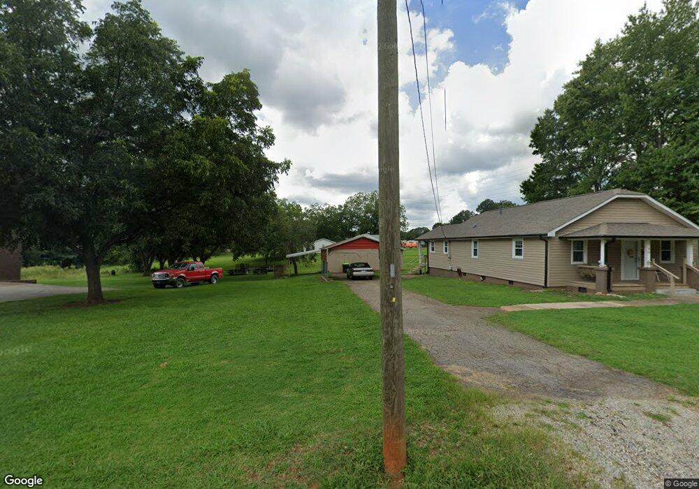
810 Grove St China Grove, NC 28023
Estimated Value: $184,000 - $282,000
--
Bed
1
Bath
1,330
Sq Ft
$175/Sq Ft
Est. Value
About This Home
This home is located at 810 Grove St, China Grove, NC 28023 and is currently estimated at $233,381, approximately $175 per square foot. 810 Grove St is a home located in Rowan County with nearby schools including China Grove Elementary School, China Grove Middle School, and Jesse C Carson High School.
Ownership History
Date
Name
Owned For
Owner Type
Purchase Details
Closed on
Aug 14, 2015
Sold by
Vinson Virginia Ruth
Bought by
Albright Kathy and Albright Daryl
Current Estimated Value
Purchase Details
Closed on
Jan 28, 2014
Sold by
Henley Sherry Barrow and Henley William J
Bought by
Vinson Virginia Ruth
Purchase Details
Closed on
May 17, 2012
Sold by
Ritchie Karen E
Bought by
Ritchie Darlene Barrow
Purchase Details
Closed on
Feb 14, 2005
Sold by
Menius Jimmy Mcfadden and Menius Joyce R
Bought by
Jones Bruce D and Jones Rebecca A
Create a Home Valuation Report for This Property
The Home Valuation Report is an in-depth analysis detailing your home's value as well as a comparison with similar homes in the area
Home Values in the Area
Average Home Value in this Area
Purchase History
| Date | Buyer | Sale Price | Title Company |
|---|---|---|---|
| Albright Kathy | -- | None Available | |
| Vinson Virginia Ruth | $125 | None Available | |
| Ritchie Darlene Barrow | $46,000 | None Available | |
| Jones Bruce D | $65,000 | -- |
Source: Public Records
Tax History Compared to Growth
Tax History
| Year | Tax Paid | Tax Assessment Tax Assessment Total Assessment is a certain percentage of the fair market value that is determined by local assessors to be the total taxable value of land and additions on the property. | Land | Improvement |
|---|---|---|---|---|
| 2025 | $1,656 | $153,318 | $31,500 | $121,818 |
| 2024 | $1,656 | $153,318 | $31,500 | $121,818 |
| 2023 | $828 | $153,318 | $31,500 | $121,818 |
| 2022 | $594 | $97,526 | $26,250 | $71,276 |
| 2021 | $1,168 | $97,526 | $26,250 | $71,276 |
| 2020 | $584 | $97,526 | $26,250 | $71,276 |
| 2019 | $584 | $97,526 | $26,250 | $71,276 |
| 2018 | $519 | $84,875 | $26,250 | $58,625 |
| 2017 | $1,039 | $84,875 | $26,250 | $58,625 |
| 2016 | $1,039 | $84,875 | $26,250 | $58,625 |
| 2015 | $1,055 | $84,875 | $26,250 | $58,625 |
| 2014 | $1,013 | $83,712 | $23,100 | $60,612 |
Source: Public Records
Map
Nearby Homes
- 0 Heglar St
- 0 E Liberty St
- 1213 Elm Forest Ln
- Fairview Plan at Liberty Grove - Single Family Homes
- Woodford Plan at Liberty Grove - Single Family Homes
- Poplar Plan at Liberty Grove - Single Family Homes
- Lily Plan at Liberty Grove - Single Family Homes
- Dogwood Plan at Liberty Grove - Single Family Homes
- Marigold Plan at Liberty Grove - Single Family Homes
- Iris Plan at Liberty Grove - Single Family Homes
- Rosewood Plan at Liberty Grove - Single Family Homes
- 1813 Millstream Dr
- 1819 Millstream Dr
- 1202 Elm Forest Ln
- 1231 Elm Forest Ln
- 175 Ketchie Estates Rd
- 215 Ketchie Estates Rd
- 145 Ketchie Estates Rd
- 1280 Elm Forest Ln
- 1307 Elm Forest Ln
- 900 Grove St
- 800 Grove St
- 902 Power St
- 902 Grove St
- 821 Grove St
- 812 Power St
- 0000 Railroad Ave Unit Lot 3 & 4
- 0000 Railroad Ave Unit Lot 1 & 2
- 906 Grove St
- 811 Ridge Ave
- 810 Power St
- 795 Highway 29 N
- 903 Grove St
- 525 Ridge St
- 1011 Heglar St
- 912 Railroad Ave
- 813 Ridge Ave
- 511 Ridge St
- 1008 Heglar St
- 1006 Heglar St