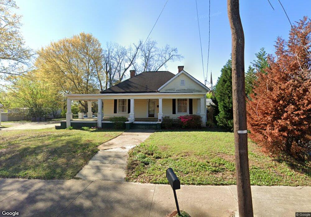
810 Hill St Lagrange, GA 30241
Estimated Value: $102,000 - $137,765
4
Beds
1
Bath
1,974
Sq Ft
$58/Sq Ft
Est. Value
About This Home
This home is located at 810 Hill St, Lagrange, GA 30241 and is currently estimated at $115,441, approximately $58 per square foot. 810 Hill St is a home with nearby schools including Franklin Forest Elementary School, Hollis Hand Elementary School, and Ethel W. Kight Elementary School.
Ownership History
Date
Name
Owned For
Owner Type
Purchase Details
Closed on
Dec 12, 2013
Sold by
Stone Cynthia Faye Roberts
Bought by
Cammon Robert B
Current Estimated Value
Home Financials for this Owner
Home Financials are based on the most recent Mortgage that was taken out on this home.
Original Mortgage
$21,206
Outstanding Balance
$15,812
Interest Rate
4.38%
Mortgage Type
New Conventional
Estimated Equity
$99,629
Purchase Details
Closed on
Aug 14, 1989
Sold by
James A Roberts
Bought by
Joe E Roberts
Purchase Details
Closed on
Mar 1, 1987
Sold by
Summerlin W L
Bought by
James A Roberts
Purchase Details
Closed on
Jan 1, 1925
Bought by
Summerlin W L
Create a Home Valuation Report for This Property
The Home Valuation Report is an in-depth analysis detailing your home's value as well as a comparison with similar homes in the area
Purchase History
| Date | Buyer | Sale Price | Title Company |
|---|---|---|---|
| Cammon Robert B | $35,000 | -- | |
| Joe E Roberts | -- | -- | |
| James A Roberts | -- | -- | |
| Summerlin W L | -- | -- |
Source: Public Records
Mortgage History
| Date | Status | Borrower | Loan Amount |
|---|---|---|---|
| Open | Cammon Robert B | $21,206 |
Source: Public Records
Tax History
| Year | Tax Paid | Tax Assessment Tax Assessment Total Assessment is a certain percentage of the fair market value that is determined by local assessors to be the total taxable value of land and additions on the property. | Land | Improvement |
|---|---|---|---|---|
| 2025 | $1,352 | $49,556 | $3,560 | $45,996 |
| 2024 | $1,251 | $45,876 | $3,560 | $42,316 |
| 2023 | $1,114 | $40,836 | $3,560 | $37,276 |
| 2022 | $1,059 | $37,956 | $3,560 | $34,396 |
| 2021 | $734 | $24,320 | $3,560 | $20,760 |
| 2020 | $733 | $24,320 | $3,560 | $20,760 |
| 2019 | $694 | $23,016 | $3,500 | $19,516 |
| 2018 | $694 | $23,016 | $3,500 | $19,516 |
| 2017 | $694 | $23,016 | $3,500 | $19,516 |
| 2016 | $690 | $22,888 | $3,500 | $19,388 |
| 2015 | $694 | $22,972 | $3,584 | $19,388 |
| 2014 | $424 | $14,000 | $1,815 | $12,185 |
| 2013 | -- | $35,200 | $2,940 | $32,260 |
Source: Public Records
Map
Nearby Homes
Your Personal Tour Guide
Ask me questions while you tour the home.