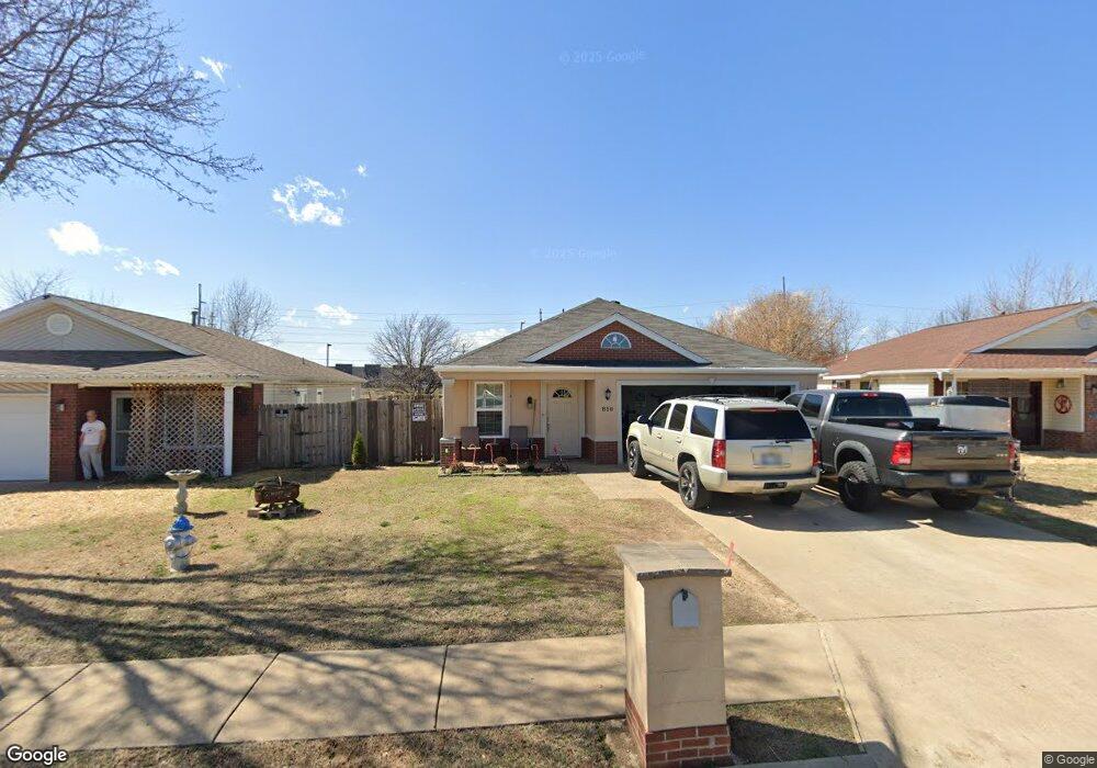
810 Locust St Springdale, AR 72762
Estimated Value: $234,000 - $252,000
3
Beds
2
Baths
1,132
Sq Ft
$211/Sq Ft
Est. Value
About This Home
This home is located at 810 Locust St, Springdale, AR 72762 and is currently estimated at $239,313, approximately $211 per square foot. 810 Locust St is a home located in Washington County with nearby schools including Elmdale Elementary School, Southwest Junior High School, and Helen Tyson Middle School.
Ownership History
Date
Name
Owned For
Owner Type
Purchase Details
Closed on
Oct 6, 2006
Sold by
Netzel Raymond G and Netzel Teresa A
Bought by
Fuentes Alex I Franco and Lovo Marina E Bonilla
Current Estimated Value
Home Financials for this Owner
Home Financials are based on the most recent Mortgage that was taken out on this home.
Original Mortgage
$117,000
Outstanding Balance
$69,378
Interest Rate
6.44%
Mortgage Type
Purchase Money Mortgage
Estimated Equity
$169,935
Purchase Details
Closed on
Jan 28, 1998
Bought by
Netzel Raymond G and Netzel Teresa A
Purchase Details
Closed on
Aug 4, 1997
Bought by
Riggins Properties Inc An Ar and Corp
Purchase Details
Closed on
Jun 9, 1997
Bought by
Riggins Darin
Purchase Details
Closed on
Sep 19, 1996
Bought by
Central Village Inc An
Create a Home Valuation Report for This Property
The Home Valuation Report is an in-depth analysis detailing your home's value as well as a comparison with similar homes in the area
Purchase History
| Date | Buyer | Sale Price | Title Company |
|---|---|---|---|
| Fuentes Alex I Franco | $117,000 | Rt | |
| Netzel Raymond G | $78,000 | -- | |
| Riggins Properties Inc An Ar | -- | -- | |
| Riggins Darin | $16,000 | -- | |
| Birddog Development Llc | $683,000 | -- | |
| Central Village Inc An | -- | -- |
Source: Public Records
Mortgage History
| Date | Status | Borrower | Loan Amount |
|---|---|---|---|
| Open | Fuentes Alex I Franco | $117,000 |
Source: Public Records
Tax History
| Year | Tax Paid | Tax Assessment Tax Assessment Total Assessment is a certain percentage of the fair market value that is determined by local assessors to be the total taxable value of land and additions on the property. | Land | Improvement |
|---|---|---|---|---|
| 2025 | $413 | $36,540 | $12,600 | $23,940 |
| 2024 | $469 | $36,540 | $12,600 | $23,940 |
| 2023 | $518 | $36,540 | $12,600 | $23,940 |
| 2022 | $523 | $24,140 | $6,000 | $18,140 |
| 2021 | $484 | $24,140 | $6,000 | $18,140 |
| 2020 | $445 | $24,140 | $6,000 | $18,140 |
| 2019 | $405 | $14,810 | $5,000 | $9,810 |
| 2018 | $430 | $14,810 | $5,000 | $9,810 |
| 2017 | $423 | $14,810 | $5,000 | $9,810 |
| 2016 | $423 | $14,810 | $5,000 | $9,810 |
| 2015 | $423 | $14,810 | $5,000 | $9,810 |
| 2014 | $475 | $15,810 | $5,000 | $10,810 |
Source: Public Records
Map
Nearby Homes
- 5498 Little Field Ave
- 659 Westbury St
- 803 N Gutensohn Rd
- TBD W Huntsville Ave
- 2700 Mcmillan Dr
- 1107 White Rd
- 2704 Mcmillan Dr
- 548 Westford St
- 605 Betty St
- 524 Westford St
- 1004 Daline St
- 805 Andy St
- 2403 Trudi Place
- 2007 W Huntsville Ave
- 603 Thomas Blvd
- 1101 Karena St
- 1309 Jennifer St
- 3776 Colburn Ln
- 3602 W Emma Ave
- 710 Hinshaw Dr
Your Personal Tour Guide
Ask me questions while you tour the home.