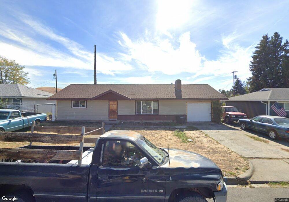
810 Maple Dr Goldendale, WA 98620
Estimated Value: $294,000 - $327,757
4
Beds
2
Baths
2,112
Sq Ft
$149/Sq Ft
Est. Value
About This Home
This home is located at 810 Maple Dr, Goldendale, WA 98620 and is currently estimated at $315,689, approximately $149 per square foot. 810 Maple Dr is a home located in Klickitat County with nearby schools including Goldendale Primary School, Goldendale Middle School, and Goldendale High School.
Ownership History
Date
Name
Owned For
Owner Type
Purchase Details
Closed on
Jan 11, 2019
Sold by
Olson Daryel G and Olson Mary Jo
Bought by
Cooper Robert and Cooper Ashley
Current Estimated Value
Home Financials for this Owner
Home Financials are based on the most recent Mortgage that was taken out on this home.
Original Mortgage
$166,920
Outstanding Balance
$148,628
Interest Rate
5.25%
Mortgage Type
FHA
Estimated Equity
$167,061
Create a Home Valuation Report for This Property
The Home Valuation Report is an in-depth analysis detailing your home's value as well as a comparison with similar homes in the area
Home Values in the Area
Average Home Value in this Area
Purchase History
| Date | Buyer | Sale Price | Title Company |
|---|---|---|---|
| Cooper Robert | $146,124 | None Available |
Source: Public Records
Mortgage History
| Date | Status | Borrower | Loan Amount |
|---|---|---|---|
| Open | Cooper Robert | $166,920 |
Source: Public Records
Tax History
| Year | Tax Paid | Tax Assessment Tax Assessment Total Assessment is a certain percentage of the fair market value that is determined by local assessors to be the total taxable value of land and additions on the property. | Land | Improvement |
|---|---|---|---|---|
| 2025 | $2,482 | $263,600 | $44,300 | $219,300 |
| 2023 | $2,482 | $227,400 | $39,800 | $187,600 |
| 2022 | $2,082 | $190,520 | $22,120 | $168,400 |
| 2021 | $1,756 | $160,030 | $17,030 | $143,000 |
| 2020 | $1,859 | $160,030 | $17,030 | $143,000 |
| 2018 | $1,454 | $126,730 | $17,030 | $109,700 |
| 2017 | $1,318 | $122,430 | $16,030 | $106,400 |
| 2016 | $1,296 | $122,430 | $16,030 | $106,400 |
| 2015 | $1,178 | $122,430 | $16,030 | $106,400 |
| 2013 | $1,178 | $154,530 | $15,730 | $138,800 |
Source: Public Records
Map
Nearby Homes
- 702 Elm Dr
- 1102 S Roosevelt St
- 1102 S Roosevelt Ave
- 308 S King Ave
- 328 Allison Way
- 305 Allison Way
- 2692 U S 97
- 501 E Collins St
- 0 E SiMcOe Dr Unit 24221905
- 0 E SiMcOe Dr Unit 24081586
- 000 U S 97
- 820 S Roosevelt Ave
- 511 E Collins St
- 0 E Broadway St Unit 241103943
- 417 E Court St
- 336 12th Street Ct
- 0 04181100000700 Unit NWM2414634
- 1500 S Columbus Ave Unit 18
- 1500 S Columbus Ave Unit 38
- 1500 S Columbus Ave Unit 16
Your Personal Tour Guide
Ask me questions while you tour the home.