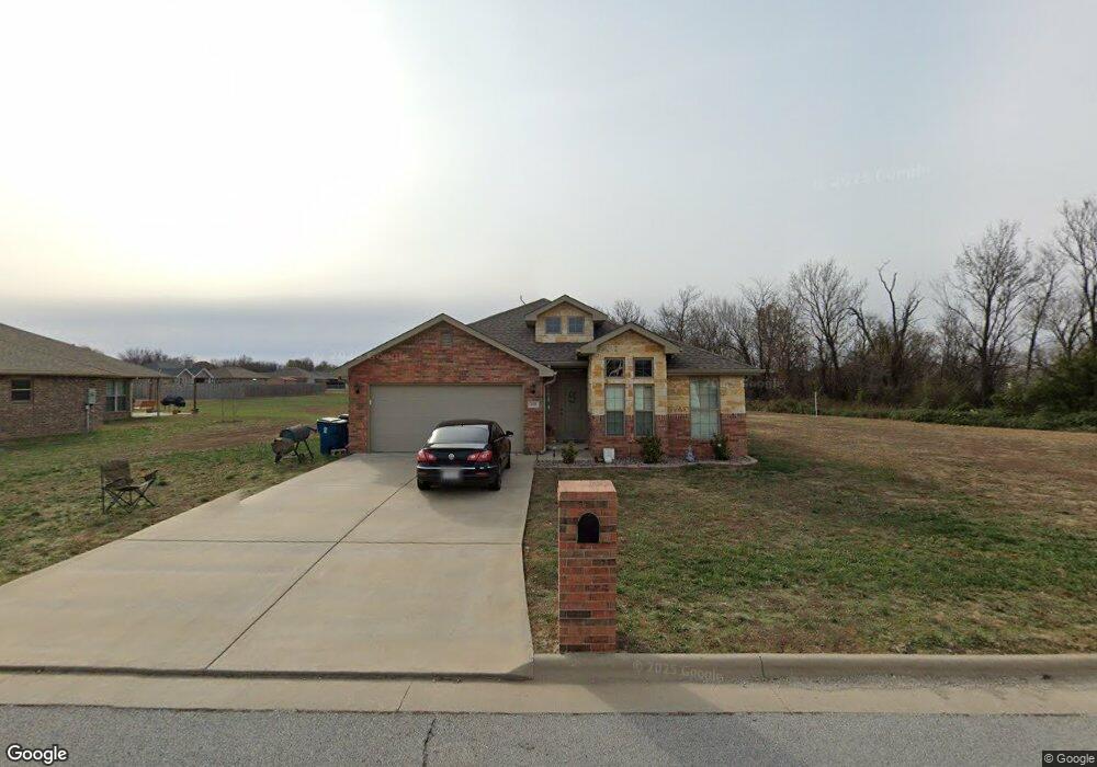
810 Nicholas Ln Carl Junction, MO 64834
Estimated Value: $265,000 - $286,000
3
Beds
2
Baths
1,812
Sq Ft
$153/Sq Ft
Est. Value
About This Home
This home is located at 810 Nicholas Ln, Carl Junction, MO 64834 and is currently estimated at $277,571, approximately $153 per square foot. 810 Nicholas Ln is a home located in Jasper County with nearby schools including Carl Junction Primary School (K-1), Carl Junction Intermediate School, and Carl Junction Primary School (2-3).
Ownership History
Date
Name
Owned For
Owner Type
Purchase Details
Closed on
Sep 11, 2024
Sold by
Isbell Derek A and Isbell Janae M
Bought by
Brown Wesley M and Brown Guyla R
Current Estimated Value
Purchase Details
Closed on
Sep 6, 2017
Sold by
Schuber Mitchell Homes Llc
Bought by
Isbell Derek A and Isbell Janae M
Home Financials for this Owner
Home Financials are based on the most recent Mortgage that was taken out on this home.
Original Mortgage
$168,853
Interest Rate
3.75%
Mortgage Type
FHA
Create a Home Valuation Report for This Property
The Home Valuation Report is an in-depth analysis detailing your home's value as well as a comparison with similar homes in the area
Purchase History
| Date | Buyer | Sale Price | Title Company |
|---|---|---|---|
| Brown Wesley M | -- | None Listed On Document | |
| Isbell Derek A | -- | None Available |
Source: Public Records
Mortgage History
| Date | Status | Borrower | Loan Amount |
|---|---|---|---|
| Previous Owner | Isbell Derek A | $168,853 |
Source: Public Records
Tax History
| Year | Tax Paid | Tax Assessment Tax Assessment Total Assessment is a certain percentage of the fair market value that is determined by local assessors to be the total taxable value of land and additions on the property. | Land | Improvement |
|---|---|---|---|---|
| 2025 | $2,006 | $37,950 | $4,180 | $33,770 |
| 2024 | $2,019 | $34,290 | $4,180 | $30,110 |
| 2023 | $2,019 | $34,290 | $4,180 | $30,110 |
| 2022 | $2,058 | $34,870 | $4,180 | $30,690 |
| 2021 | $1,766 | $34,870 | $4,180 | $30,690 |
| 2020 | $1,656 | $32,140 | $4,180 | $27,960 |
| 2019 | $1,572 | $32,140 | $4,180 | $27,960 |
| 2018 | $1,582 | $32,420 | $0 | $0 |
| 2017 | $350 | $7,150 | $0 | $0 |
Source: Public Records
Map
Nearby Homes
- 904 Larson St
- 505 N Broadway Ave
- TBD Route Yy
- 29320 State Highway Yy
- 29250 State Highway Yy
- 817 Delaney Dr
- 9129 Cr-290
- 809 Aberdeen Ave
- 901 Aberdeen Ave
- Tract 3 Prairie Ln
- Tract 2 Prairie Ln
- Tract 1 Prairie Ln
- Tract 4 Prairie Ln
- 711 Prairie Ln
- 304 Belgian Blue Blvd
- 804 Aberdeen Ave
- 806 Aberdeen Ave
- 808 Aberdeen Ave
- 902 Aberdeen Ave
- 904 Aberdeen Ave
Your Personal Tour Guide
Ask me questions while you tour the home.