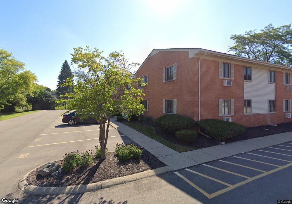
810 Plate St Rochester, MI 48307
Estimated Value: $121,000 - $135,000
1
Bed
1
Bath
627
Sq Ft
$201/Sq Ft
Est. Value
About This Home
This home is located at 810 Plate St, Rochester, MI 48307 and is currently estimated at $125,889, approximately $200 per square foot. 810 Plate St is a home located in Oakland County with nearby schools including North Hill Elementary School, Hart Middle School, and Stoney Creek High School.
Ownership History
Date
Name
Owned For
Owner Type
Purchase Details
Closed on
Jul 29, 2016
Sold by
Czerwinski Thomas F and Czerwinski Julie A
Bought by
Czerwinski Thomas F and Czerwinski Julie A
Current Estimated Value
Purchase Details
Closed on
May 27, 2010
Sold by
Citimortgage Inc
Bought by
Federal National Mortgage Association
Purchase Details
Closed on
Apr 27, 2010
Sold by
Mcmillan Patterson Julie A and Mcmillan Patterson R
Bought by
Citimortgage Inc
Purchase Details
Closed on
Mar 5, 2004
Sold by
Mcmillan Patterson Julie
Bought by
Patterson Raymond and Patterson Julie Mcmillan
Purchase Details
Closed on
Feb 12, 1998
Sold by
Wendt Kerry L
Bought by
Palmer James J
Create a Home Valuation Report for This Property
The Home Valuation Report is an in-depth analysis detailing your home's value as well as a comparison with similar homes in the area
Home Values in the Area
Average Home Value in this Area
Purchase History
| Date | Buyer | Sale Price | Title Company |
|---|---|---|---|
| Czerwinski Thomas F | -- | None Available | |
| Federal National Mortgage Association | -- | None Available | |
| Citimortgage Inc | $50,770 | None Available | |
| Patterson Raymond | -- | -- | |
| Palmer James J | $46,000 | -- |
Source: Public Records
Tax History Compared to Growth
Tax History
| Year | Tax Paid | Tax Assessment Tax Assessment Total Assessment is a certain percentage of the fair market value that is determined by local assessors to be the total taxable value of land and additions on the property. | Land | Improvement |
|---|---|---|---|---|
| 2024 | $586 | $47,200 | $0 | $0 |
| 2023 | $561 | $43,210 | $0 | $0 |
| 2022 | $708 | $41,430 | $0 | $0 |
| 2021 | $673 | $38,920 | $0 | $0 |
| 2020 | $523 | $35,400 | $0 | $0 |
| 2019 | $679 | $33,030 | $0 | $0 |
| 2018 | $673 | $30,100 | $0 | $0 |
| 2017 | $660 | $25,830 | $0 | $0 |
| 2016 | $644 | $21,410 | $0 | $0 |
| 2015 | -- | $17,850 | $0 | $0 |
| 2014 | -- | $13,840 | $0 | $0 |
| 2011 | -- | $19,310 | $0 | $0 |
Source: Public Records
Map
Nearby Homes
- 801 Plate St Unit 201
- 500 Romeo Rd Unit 122
- 761 Lounsbury Ave
- 417 Parkdale Ave Unit 13
- 334 Romeo Rd
- 536 Rewold Dr
- 1022 Pointe Place Blvd
- 509 E University Dr Unit 508
- 433 Miller Ave Unit 204
- 804 N Main St Unit 2H
- 804 N Main St Unit 2A
- 804 N Main St Unit 2C
- 714 N Main St
- 1228 N Main St
- 420 Baldwin Ave Unit 79
- 1219 N Main St
- 1223 N Main St
- 1217 N Main St
- 428 East St
- 164 Albertson St
- 810 Plate St
- 810 Plate St Unit 105
- 810 Plate St
- 810 Plate St
- 810 Plate St
- 810 Plate St
- 810 Plate St
- 810 Plate St
- 810 Plate St
- 810 Plate St
- 810 Plate St Unit 63
- 810 Plate St
- 810 Plate St
- 810 Plate St
- 810 Plate St
- 810 Plate St
- 810 Plate St
- 810 Plate St Unit 206
- 810 Plate St Unit 108
- 810 Plate St Unit 203