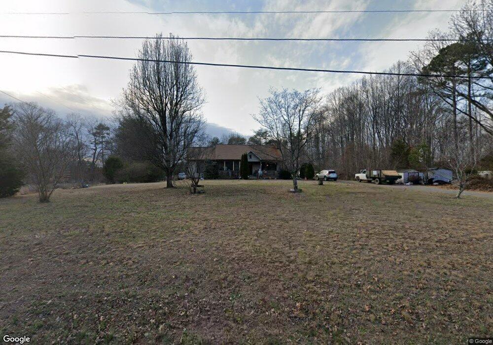
810 Walkertown Guthrie Rd Winston Salem, NC 27101
Estimated Value: $257,489 - $311,000
3
Beds
2
Baths
1,530
Sq Ft
$188/Sq Ft
Est. Value
About This Home
This home is located at 810 Walkertown Guthrie Rd, Winston Salem, NC 27101 and is currently estimated at $288,372, approximately $188 per square foot. 810 Walkertown Guthrie Rd is a home located in Forsyth County with nearby schools including Cash Elementary, East Forsyth Middle, and East Forsyth High School.
Ownership History
Date
Name
Owned For
Owner Type
Purchase Details
Closed on
Feb 16, 2007
Sold by
Family Heritage Foundation Inc
Bought by
Dillon Robert J and Dillon Ilena B
Current Estimated Value
Home Financials for this Owner
Home Financials are based on the most recent Mortgage that was taken out on this home.
Original Mortgage
$132,000
Outstanding Balance
$90,925
Interest Rate
9.05%
Mortgage Type
Purchase Money Mortgage
Estimated Equity
$197,447
Purchase Details
Closed on
Dec 29, 2004
Sold by
Gullion David M and Gullion Loretta
Bought by
Family Heritage Foundation Inc
Create a Home Valuation Report for This Property
The Home Valuation Report is an in-depth analysis detailing your home's value as well as a comparison with similar homes in the area
Home Values in the Area
Average Home Value in this Area
Purchase History
| Date | Buyer | Sale Price | Title Company |
|---|---|---|---|
| Dillon Robert J | $150,000 | None Available | |
| Family Heritage Foundation Inc | -- | -- |
Source: Public Records
Mortgage History
| Date | Status | Borrower | Loan Amount |
|---|---|---|---|
| Open | Dillon Robert J | $132,000 |
Source: Public Records
Tax History Compared to Growth
Tax History
| Year | Tax Paid | Tax Assessment Tax Assessment Total Assessment is a certain percentage of the fair market value that is determined by local assessors to be the total taxable value of land and additions on the property. | Land | Improvement |
|---|---|---|---|---|
| 2025 | $1,326 | $239,000 | $48,500 | $190,500 |
| 2024 | $1,326 | $151,100 | $41,500 | $109,600 |
| 2023 | $1,326 | $151,100 | $41,500 | $109,600 |
| 2022 | $1,326 | $151,100 | $41,500 | $109,600 |
| 2021 | $1,326 | $151,100 | $41,500 | $109,600 |
| 2020 | $1,280 | $135,700 | $33,000 | $102,700 |
| 2019 | $1,294 | $135,700 | $33,000 | $102,700 |
| 2018 | $1,253 | $135,700 | $33,000 | $102,700 |
| 2016 | $1,181 | $126,808 | $24,292 | $102,516 |
| 2015 | $1,181 | $126,808 | $24,292 | $102,516 |
| 2014 | $1,163 | $126,808 | $24,292 | $102,516 |
Source: Public Records
Map
Nearby Homes
- 769 Morris Rd
- 751 Morris Rd
- 4211 Gracewood Farm Dr
- 0 Morris Rd Rd
- 851 Morris Rd
- 4212 Gracewood Farm Dr
- 4217 Gracewood Farm Dr
- 4218 Gracewood Farm Dr
- 4722 Acron Hills Dr
- 4223 Gracewood Farm Dr
- 620 Walkertown Guthrie Rd
- 4224 Gracewood Farm Dr
- 4791 Weston Brooke Trail
- 4761 Weston Brooke Trail
- 0 Weston Brooke Trail
- 2165 Castle Stone Ct
- 4721 Weston Brooke Trail
- 2171 Castle Stone Ct
- 5226 Shaddowfax Dr
- 924 Star Gate Dr
- 820 Walkertown Guthrie Rd
- 780 Walkertown Guthrie Rd
- 801 Walkertown Guthrie Rd
- 4180 Rocky Ford Ln
- 4154 Rocky Ford Ln
- 796 Conestoga Trail
- 822 Walkertown Guthrie Rd
- 4140 Rocky Ford Ln
- 829 Walkertown Guthrie Rd
- 788 Conestoga Trail
- 5001 Carbine Ct
- 4848 Stovall Dr
- 4420 Ramseur Dr
- 4412 Ramseur Dr
- 4403 Ramseur Dr
- 4428 Ramseur Dr
- 4404 Ramseur Dr
- 4411 Ramseur Dr
- 4427 Ramseur Dr
- 4419 Ramseur Dr