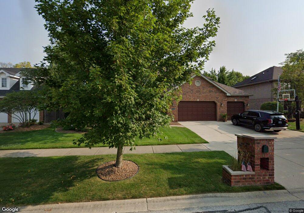
8100 Blarney Rd Tinley Park, IL 60477
Central Tinley Park NeighborhoodEstimated Value: $569,365 - $638,000
4
Beds
3
Baths
3,392
Sq Ft
$178/Sq Ft
Est. Value
About This Home
This home is located at 8100 Blarney Rd, Tinley Park, IL 60477 and is currently estimated at $604,591, approximately $178 per square foot. 8100 Blarney Rd is a home located in Cook County with nearby schools including Millennium Elementary School, Virgil I Grissom Middle School, and Victor J Andrew High School.
Ownership History
Date
Name
Owned For
Owner Type
Purchase Details
Closed on
Jul 17, 2018
Sold by
Sanfilippo Dino M and Sanfilippo Maria L
Bought by
Sanfilippo Dino M and Sanfilippo Maria L
Current Estimated Value
Purchase Details
Closed on
Sep 3, 1999
Sold by
State Bank Of Countryside
Bought by
Sanfilippo Dino M and Sanfilippo Maria L
Home Financials for this Owner
Home Financials are based on the most recent Mortgage that was taken out on this home.
Original Mortgage
$215,000
Outstanding Balance
$64,132
Interest Rate
7.9%
Estimated Equity
$540,459
Create a Home Valuation Report for This Property
The Home Valuation Report is an in-depth analysis detailing your home's value as well as a comparison with similar homes in the area
Home Values in the Area
Average Home Value in this Area
Purchase History
| Date | Buyer | Sale Price | Title Company |
|---|---|---|---|
| Sanfilippo Dino M | -- | Attorney | |
| Sanfilippo Dino M | $326,500 | -- |
Source: Public Records
Mortgage History
| Date | Status | Borrower | Loan Amount |
|---|---|---|---|
| Open | Sanfilippo Dino M | $215,000 |
Source: Public Records
Tax History Compared to Growth
Tax History
| Year | Tax Paid | Tax Assessment Tax Assessment Total Assessment is a certain percentage of the fair market value that is determined by local assessors to be the total taxable value of land and additions on the property. | Land | Improvement |
|---|---|---|---|---|
| 2024 | $11,309 | $44,049 | $13,005 | $31,044 |
| 2023 | $11,812 | $44,049 | $13,005 | $31,044 |
| 2022 | $11,812 | $36,554 | $5,610 | $30,944 |
| 2021 | $11,463 | $36,553 | $5,610 | $30,943 |
| 2020 | $11,242 | $36,553 | $5,610 | $30,943 |
| 2019 | $12,336 | $41,465 | $5,100 | $36,365 |
| 2018 | $12,889 | $44,046 | $5,100 | $38,946 |
| 2017 | $12,564 | $44,046 | $5,100 | $38,946 |
| 2016 | $11,020 | $35,677 | $4,590 | $31,087 |
| 2015 | $11,499 | $37,619 | $4,590 | $33,029 |
| 2014 | $11,418 | $37,619 | $4,590 | $33,029 |
| 2013 | $11,650 | $41,204 | $4,590 | $36,614 |
Source: Public Records
Map
Nearby Homes
- 8036 Blarney Rd
- 17908 Iroquois Trace
- 7783 Bristol Park Dr Unit 1-SW
- 8416 Stratford Dr Unit 8416
- 8423 Stratford Dr Unit 8423
- 7767 Bristol Park Dr Unit 7767
- 18261 Kirby Dr Unit 2918261
- 7755 Bristol Park Dr Unit 1NE
- 8313 Aster Ln
- 7925 Belle Rive Ct
- 7727 Bristol Park Dr
- 8030 Valley View Dr
- 17631 Dover Ct
- Fremont Plan at Radcliffe Place
- Calysta Plan at Radcliffe Place
- Danbury Plan at Radcliffe Place
- Briarcliffe Plan at Radcliffe Place
- Eden Plan at Radcliffe Place
- Amberwood Plan at Radcliffe Place
- 7517 175th St Unit 331
- 8106 Blarney Rd
- 8101 Mallow Dr
- 8037 Mallow Dr
- 8107 Mallow Dr
- 8030 Blarney Rd
- 8112 Blarney Rd
- 8101 Blarney Rd
- 8107 Blarney Rd
- 8031 Mallow Dr
- 8037 Blarney Rd
- 8031 Blarney Rd
- 8113 Mallow Dr
- 8024 Blarney Rd
- 8113 Blarney Rd
- 8118 Blarney Rd
- 8025 Mallow Dr
- 8119 Mallow Dr
- 8025 Blarney Rd
- 8100 Mallow Dr
- 8036 Mallow Dr