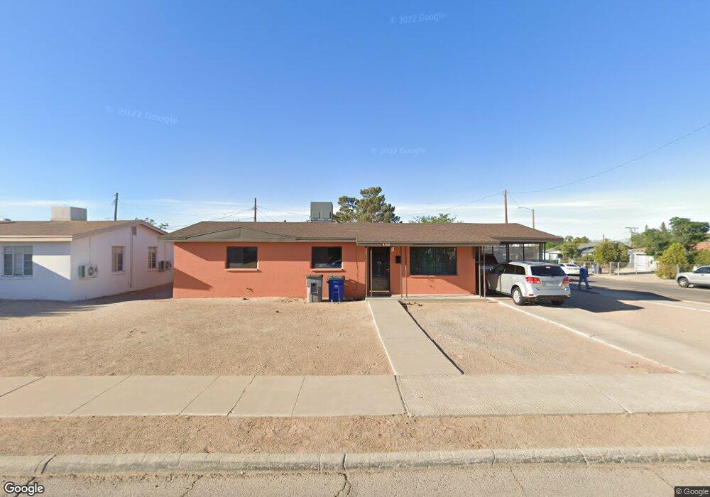
8100 Rolland Ct El Paso, TX 79907
Mesa Vista NeighborhoodEstimated Value: $156,000 - $176,000
--
Bed
2
Baths
1,347
Sq Ft
$123/Sq Ft
Est. Value
About This Home
This home is located at 8100 Rolland Ct, El Paso, TX 79907 and is currently estimated at $166,240, approximately $123 per square foot. 8100 Rolland Ct is a home located in El Paso County with nearby schools including Loma Terrace Elementary School, Bel Air Middle, and Bel Air High School.
Ownership History
Date
Name
Owned For
Owner Type
Purchase Details
Closed on
Aug 20, 2012
Sold by
Maldonado Gloria Torres
Bought by
Robles Juan and Robles Irene
Current Estimated Value
Home Financials for this Owner
Home Financials are based on the most recent Mortgage that was taken out on this home.
Original Mortgage
$20,000
Interest Rate
3.57%
Mortgage Type
Seller Take Back
Purchase Details
Closed on
Dec 1, 1995
Sold by
Mccarter Nancy Merrill
Bought by
Macias Irene M
Create a Home Valuation Report for This Property
The Home Valuation Report is an in-depth analysis detailing your home's value as well as a comparison with similar homes in the area
Home Values in the Area
Average Home Value in this Area
Purchase History
| Date | Buyer | Sale Price | Title Company |
|---|---|---|---|
| Robles Juan | -- | None Available | |
| Macias Irene M | $77,000 | -- |
Source: Public Records
Mortgage History
| Date | Status | Borrower | Loan Amount |
|---|---|---|---|
| Previous Owner | Robles Juan | $20,000 |
Source: Public Records
Tax History Compared to Growth
Tax History
| Year | Tax Paid | Tax Assessment Tax Assessment Total Assessment is a certain percentage of the fair market value that is determined by local assessors to be the total taxable value of land and additions on the property. | Land | Improvement |
|---|---|---|---|---|
| 2025 | $1,491 | $143,011 | -- | -- |
| 2024 | $1,491 | $130,010 | -- | -- |
| 2023 | $1,410 | $118,191 | $0 | $0 |
| 2022 | $3,337 | $107,446 | $0 | $0 |
| 2021 | $3,175 | $97,678 | $14,577 | $83,101 |
| 2020 | $2,852 | $90,285 | $14,577 | $75,708 |
| 2018 | $2,786 | $89,585 | $14,577 | $75,008 |
| 2017 | $2,546 | $83,308 | $14,577 | $68,731 |
| 2016 | $2,546 | $83,308 | $14,577 | $68,731 |
| 2015 | $1,488 | $83,308 | $14,577 | $68,731 |
| 2014 | $1,488 | $84,905 | $14,577 | $70,328 |
Source: Public Records
Map
Nearby Homes
- 1004 Atwood Dr
- 1121 Stanley St
- 8241 Williamette Ave
- TBD Burnham Dr
- 956 Duskin Dr
- 8341 Loma Terrace Rd
- 8181 Staghorn Dr
- 8004 Gilbert Dr
- TBD Yermoland Dr
- 7937 San Paulo Dr
- 7975 Esther Rd
- 7928 Hermosillo Dr
- 740 Draco Place
- 525 Lafayette Dr
- 8280 N Loop Dr
- 810 Silvestre Rd
- 491 Borrett St
- 8350 Lynn Haven Ave
- 859 Destello Rd
- 7922 Parral Dr
- 8104 Rolland Ct
- 8105 Newland Ct
- 1021 Stanley St
- 8108 Rolland Ct
- 8101 Rolland Ct
- 1017 Stanley St
- 1025 Stanley St
- 8105 Rolland Ct
- 8109 Rolland Ct
- 1013 Stanley St
- 1029 Stanley St
- 8109 Newland Ct
- 8112 Rolland Ct
- 8113 Rolland Ct
- 1028 Gloria St
- 1024 Gloria St
- 8100 Newland Ct
- 8100 Sandland Dr
- 1009 Stanley St
- 1032 Gloria St