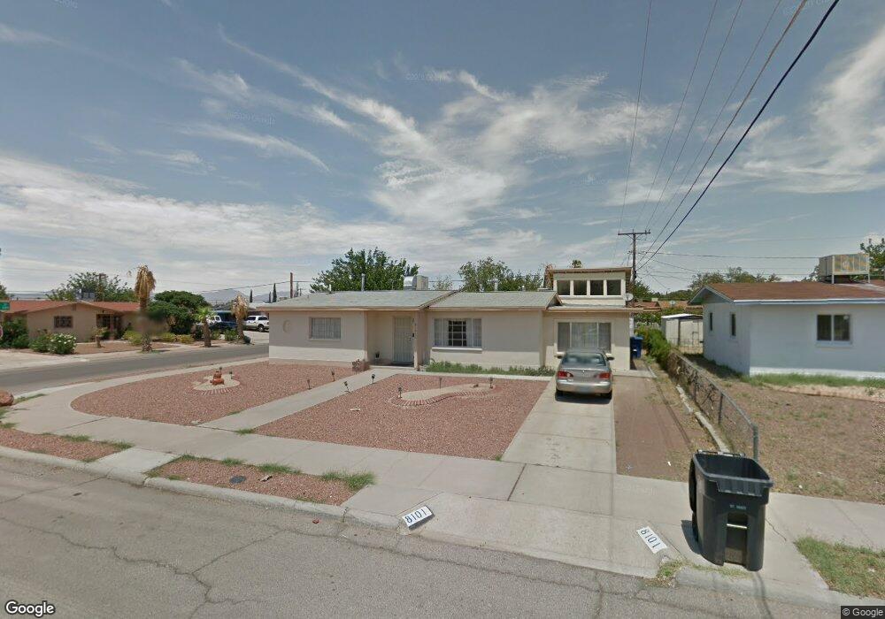
8101 Sandland Dr El Paso, TX 79907
Mesa Vista NeighborhoodEstimated Value: $154,000 - $197,000
--
Bed
2
Baths
1,718
Sq Ft
$105/Sq Ft
Est. Value
About This Home
This home is located at 8101 Sandland Dr, El Paso, TX 79907 and is currently estimated at $180,127, approximately $104 per square foot. 8101 Sandland Dr is a home located in El Paso County with nearby schools including Loma Terrace Elementary School, Bel Air Middle, and Bel Air High School.
Ownership History
Date
Name
Owned For
Owner Type
Purchase Details
Closed on
Jun 29, 2018
Sold by
Bustillos Ignacio M and Bustillos Carlos
Bought by
Zaragoza Jose and Zaragoza Graciela Marie
Current Estimated Value
Home Financials for this Owner
Home Financials are based on the most recent Mortgage that was taken out on this home.
Original Mortgage
$70,920
Outstanding Balance
$61,463
Interest Rate
4.5%
Mortgage Type
Purchase Money Mortgage
Estimated Equity
$118,664
Purchase Details
Closed on
Aug 9, 2011
Sold by
Bustillos Francisca M
Bought by
Bustillos Ignacio M and Bustillos Carlos
Create a Home Valuation Report for This Property
The Home Valuation Report is an in-depth analysis detailing your home's value as well as a comparison with similar homes in the area
Home Values in the Area
Average Home Value in this Area
Purchase History
| Date | Buyer | Sale Price | Title Company |
|---|---|---|---|
| Zaragoza Jose | -- | None Available | |
| Bustillos Ignacio M | -- | None Available |
Source: Public Records
Mortgage History
| Date | Status | Borrower | Loan Amount |
|---|---|---|---|
| Open | Zaragoza Jose | $70,920 |
Source: Public Records
Tax History Compared to Growth
Tax History
| Year | Tax Paid | Tax Assessment Tax Assessment Total Assessment is a certain percentage of the fair market value that is determined by local assessors to be the total taxable value of land and additions on the property. | Land | Improvement |
|---|---|---|---|---|
| 2025 | $1,607 | $164,640 | -- | -- |
| 2024 | $1,607 | $149,673 | -- | -- |
| 2023 | $1,506 | $136,066 | $0 | $0 |
| 2022 | $3,841 | $123,696 | $0 | $0 |
| 2021 | $3,655 | $117,465 | $15,358 | $102,107 |
| 2020 | $3,229 | $102,228 | $15,358 | $86,870 |
| 2018 | $2,464 | $79,220 | $15,358 | $63,862 |
| 2017 | $2,422 | $79,220 | $15,358 | $63,862 |
| 2016 | $2,852 | $93,306 | $15,358 | $77,948 |
| 2015 | $2,703 | $93,306 | $15,358 | $77,948 |
| 2014 | $2,703 | $94,458 | $15,358 | $79,100 |
Source: Public Records
Map
Nearby Homes
- 1004 Atwood Dr
- 1121 Stanley St
- 8241 Williamette Ave
- TBD Burnham Dr
- 956 Duskin Dr
- 8341 Loma Terrace Rd
- 8181 Staghorn Dr
- 8004 Gilbert Dr
- TBD Yermoland Dr
- 7937 San Paulo Dr
- 7975 Esther Rd
- 7928 Hermosillo Dr
- 740 Draco Place
- 525 Lafayette Dr
- 8280 N Loop Dr
- 810 Silvestre Rd
- 491 Borrett St
- 8350 Lynn Haven Ave
- 859 Destello Rd
- 7922 Parral Dr
- 8105 Sandland Dr
- 8100 Wonderland Ln
- 8104 Wonderland Ln
- 1045 Stanley St
- 1041 Stanley St
- 8109 Sandland Dr
- 8100 Sandland Dr
- 1049 Stanley St
- 8108 Wonderland Ln
- 8104 Sandland Dr
- 1037 Stanley St
- 8112 Wonderland Ln
- 1053 Stanley St
- 8113 Sandland Dr
- 8108 Sandland Dr
- 8108 Sandland Dr
- 1033 Stanley St
- 1060 Gloria St
- 1056 Gloria St
- 1064 Gloria St