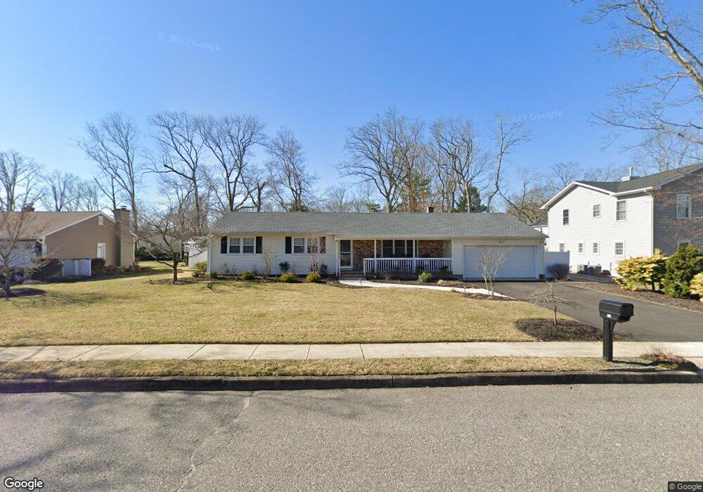
811 Derry Dr Toms River, NJ 08753
Estimated Value: $478,950 - $600,000
3
Beds
2
Baths
1,638
Sq Ft
$339/Sq Ft
Est. Value
About This Home
This home is located at 811 Derry Dr, Toms River, NJ 08753 and is currently estimated at $554,488, approximately $338 per square foot. 811 Derry Dr is a home located in Ocean County.
Ownership History
Date
Name
Owned For
Owner Type
Purchase Details
Closed on
Apr 29, 2020
Sold by
Morejon J J and Morejon Julie I
Bought by
Frake Lindsay Ann
Current Estimated Value
Home Financials for this Owner
Home Financials are based on the most recent Mortgage that was taken out on this home.
Original Mortgage
$260,000
Outstanding Balance
$228,367
Interest Rate
3.3%
Mortgage Type
New Conventional
Estimated Equity
$326,121
Purchase Details
Closed on
May 13, 1985
Bought by
Lewandowski Jean
Create a Home Valuation Report for This Property
The Home Valuation Report is an in-depth analysis detailing your home's value as well as a comparison with similar homes in the area
Home Values in the Area
Average Home Value in this Area
Purchase History
| Date | Buyer | Sale Price | Title Company |
|---|---|---|---|
| Frake Lindsay Ann | $325,000 | Foundation Title Llc | |
| Lewandowski Jean | -- | -- | |
| Lewandowski Jean | -- | -- |
Source: Public Records
Mortgage History
| Date | Status | Borrower | Loan Amount |
|---|---|---|---|
| Open | Frake Lindsay Ann | $260,000 |
Source: Public Records
Tax History
| Year | Tax Paid | Tax Assessment Tax Assessment Total Assessment is a certain percentage of the fair market value that is determined by local assessors to be the total taxable value of land and additions on the property. | Land | Improvement |
|---|---|---|---|---|
| 2025 | $7,378 | $377,600 | $126,000 | $251,600 |
| 2024 | $6,536 | $377,600 | $126,000 | $251,600 |
| 2023 | $6,302 | $377,600 | $126,000 | $251,600 |
| 2022 | $6,302 | $377,600 | $126,000 | $251,600 |
| 2021 | $5,746 | $229,400 | $100,000 | $129,400 |
| 2020 | $5,721 | $229,400 | $100,000 | $129,400 |
| 2019 | $5,473 | $229,400 | $100,000 | $129,400 |
| 2018 | $5,400 | $229,400 | $100,000 | $129,400 |
| 2017 | $5,354 | $229,400 | $100,000 | $129,400 |
| 2016 | $4,964 | $229,400 | $100,000 | $129,400 |
| 2015 | $4,767 | $229,400 | $100,000 | $129,400 |
| 2014 | $4,526 | $229,400 | $100,000 | $129,400 |
Source: Public Records
Map
Nearby Homes
- 348 Cedar Grove Rd
- 103 Ridge Dr
- 349 Kildare Dr
- 867 Derry Dr
- 927 Indian Hill Rd
- 862 Bay Ave
- 782 Bay Ave
- 400 Killarney Dr
- 1012 Sheila Dr
- 815 Gilmores Island Rd
- 230 Carol Dr
- 975 Indian Hill Rd
- 899 Molde Ct
- 731 Bay Ave
- 128 Oak Glen Rd
- 7 Apache Dr
- 830 Brookside Dr
- 834 Brookside Dr
- 621 Buenaventura Ct
- 864 Breezy Oaks Dr
Your Personal Tour Guide
Ask me questions while you tour the home.