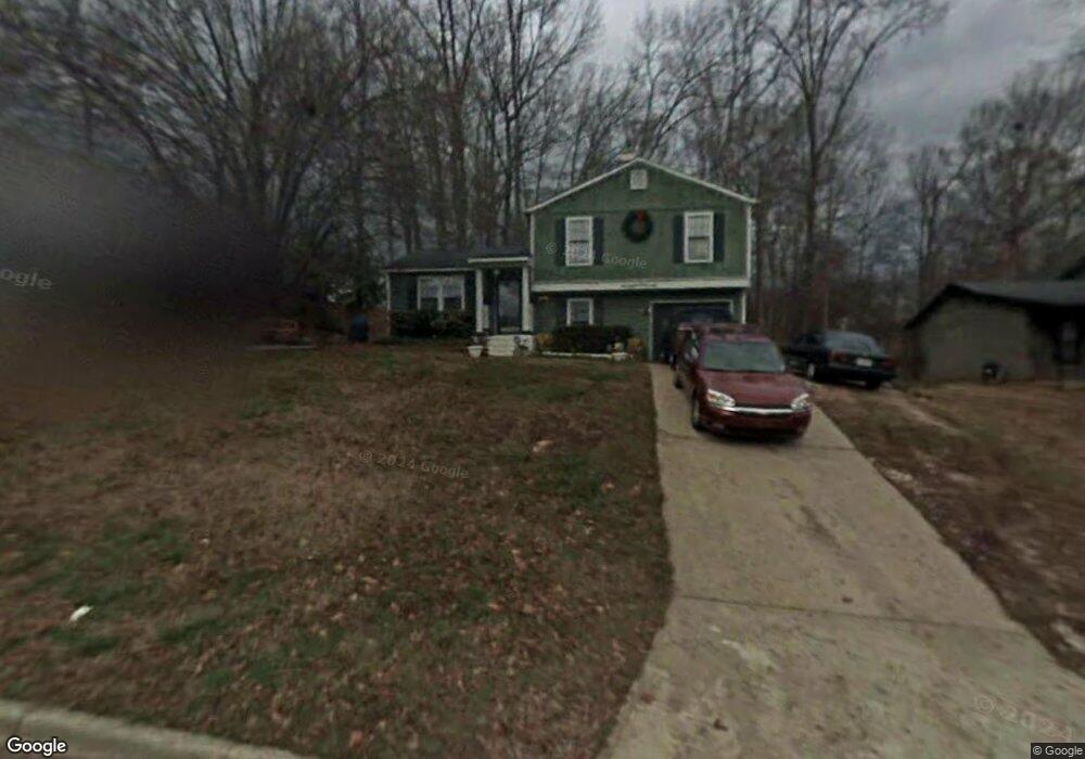
811 Forest Path Stone Mountain, GA 30088
Estimated Value: $211,774 - $255,000
3
Beds
2
Baths
1,368
Sq Ft
$168/Sq Ft
Est. Value
About This Home
This home is located at 811 Forest Path, Stone Mountain, GA 30088 and is currently estimated at $229,194, approximately $167 per square foot. 811 Forest Path is a home located in DeKalb County with nearby schools including Shadow Rock Elementary School, Redan Middle School, and Redan High School.
Ownership History
Date
Name
Owned For
Owner Type
Purchase Details
Closed on
Jan 27, 2004
Sold by
Lumpkin Jerry
Bought by
Lumpkin Jerry and Lumpkin Sandra
Current Estimated Value
Home Financials for this Owner
Home Financials are based on the most recent Mortgage that was taken out on this home.
Original Mortgage
$106,250
Outstanding Balance
$49,517
Interest Rate
5.85%
Mortgage Type
New Conventional
Estimated Equity
$179,677
Create a Home Valuation Report for This Property
The Home Valuation Report is an in-depth analysis detailing your home's value as well as a comparison with similar homes in the area
Home Values in the Area
Average Home Value in this Area
Purchase History
| Date | Buyer | Sale Price | Title Company |
|---|---|---|---|
| Lumpkin Jerry | -- | -- |
Source: Public Records
Mortgage History
| Date | Status | Borrower | Loan Amount |
|---|---|---|---|
| Open | Lumpkin Jerry | $106,250 |
Source: Public Records
Tax History
| Year | Tax Paid | Tax Assessment Tax Assessment Total Assessment is a certain percentage of the fair market value that is determined by local assessors to be the total taxable value of land and additions on the property. | Land | Improvement |
|---|---|---|---|---|
| 2025 | $2,354 | $83,680 | $20,000 | $63,680 |
| 2024 | $2,536 | $89,440 | $20,000 | $69,440 |
| 2023 | $2,536 | $85,800 | $20,000 | $65,800 |
| 2022 | $2,101 | $73,960 | $7,200 | $66,760 |
| 2021 | $1,503 | $48,040 | $7,200 | $40,840 |
| 2020 | $1,344 | $41,360 | $7,200 | $34,160 |
| 2019 | $980 | $31,040 | $4,800 | $26,240 |
| 2018 | $956 | $33,680 | $4,800 | $28,880 |
| 2017 | $1,095 | $33,480 | $4,800 | $28,680 |
| 2016 | $868 | $27,640 | $4,800 | $22,840 |
| 2014 | $720 | $23,200 | $3,080 | $20,120 |
Source: Public Records
Map
Nearby Homes
- 5175 Walker Rd
- 5268 Fox Path
- 767 Forest Path
- 868 Greenhedge Dr Unit 2
- 854 Greenhedge Dr
- 884 Forest Path
- 5232 Mainstreet Park Dr
- 5257 Post Ridge Ct
- 5242 McCarter Station
- 958 Redan Crescent
- 922 Fox Valley Ct
- 961 Redan Trace
- 826 Greenhedge Way Unit 2
- 5215 Mainstreet Park Dr
- 5450 Hedgeflower Ct
- 5233 McCarter Station
- 5208 Mainstreet Park Dr
- 915 Fox Valley Ct
- 5397 Fox Valley Trace
- 937 Fox Valley Ct
- 817 Forest Path
- 803 Forest Path
- 825 Forest Path
- 5334 Greenhedge Trail
- 5185 Walker Rd
- 5338 Greenhedge Trail
- 5287 Fox Path Unit 1
- 5280 Fox Path
- 829 Forest Path
- 829 829 Forest Path
- 5333 Greenhedge Trail
- 5193 Walker Rd Unit 1
- 5342 Greenhedge Trail
- 820 Forest Path
- 5281 Fox Path Unit 1
- 837 Forest Path Unit 2007
- 4567 Walker Rd
- 5293 Mainstreet Park Dr Unit 1
- 828 Forest Path
- 5199 Walker Rd
Your Personal Tour Guide
Ask me questions while you tour the home.