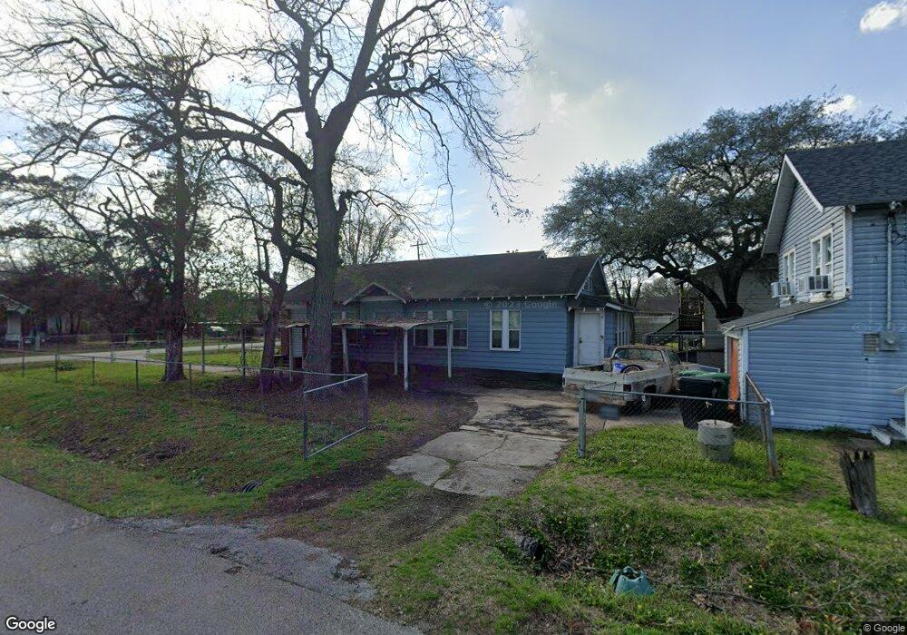
811 Lindale St Houston, TX 77022
Northside-Northline NeighborhoodEstimated Value: $230,598 - $325,000
4
Beds
2
Baths
1,887
Sq Ft
$157/Sq Ft
Est. Value
About This Home
This home is located at 811 Lindale St, Houston, TX 77022 and is currently estimated at $296,900, approximately $157 per square foot. 811 Lindale St is a home located in Harris County with nearby schools including Roosevelt Elementary School, Burbank Middle School, and Northside High School.
Ownership History
Date
Name
Owned For
Owner Type
Purchase Details
Closed on
Jan 1, 2008
Sold by
Vara Raymond Anthony
Bought by
Vara Lori Yvonne
Current Estimated Value
Purchase Details
Closed on
Nov 24, 1999
Sold by
Vara Roy
Bought by
Vara Lois Yvonne
Home Financials for this Owner
Home Financials are based on the most recent Mortgage that was taken out on this home.
Original Mortgage
$35,000
Interest Rate
7.95%
Mortgage Type
Seller Take Back
Create a Home Valuation Report for This Property
The Home Valuation Report is an in-depth analysis detailing your home's value as well as a comparison with similar homes in the area
Home Values in the Area
Average Home Value in this Area
Purchase History
| Date | Buyer | Sale Price | Title Company |
|---|---|---|---|
| Vara Lori Yvonne | -- | None Available | |
| Vara Lori Yvonne | -- | None Available | |
| Vara Lori Yvonne | -- | None Available | |
| Vara Lois Yvonne | -- | -- |
Source: Public Records
Mortgage History
| Date | Status | Borrower | Loan Amount |
|---|---|---|---|
| Previous Owner | Vara Lois Yvonne | $35,000 |
Source: Public Records
Tax History Compared to Growth
Tax History
| Year | Tax Paid | Tax Assessment Tax Assessment Total Assessment is a certain percentage of the fair market value that is determined by local assessors to be the total taxable value of land and additions on the property. | Land | Improvement |
|---|---|---|---|---|
| 2025 | $2,094 | $273,897 | $132,000 | $141,897 |
| 2024 | $2,094 | $240,000 | $66,000 | $174,000 |
| 2023 | $2,094 | $269,644 | $66,000 | $203,644 |
| 2022 | $3,215 | $216,691 | $66,000 | $150,691 |
| 2021 | $3,094 | $132,744 | $66,000 | $66,744 |
| 2020 | $3,215 | $132,744 | $66,000 | $66,744 |
| 2019 | $3,359 | $132,744 | $66,000 | $66,744 |
| 2018 | $2,399 | $144,154 | $66,000 | $78,154 |
| 2017 | $3,051 | $144,154 | $66,000 | $78,154 |
| 2016 | $2,774 | $144,154 | $66,000 | $78,154 |
| 2015 | $1,695 | $115,586 | $34,650 | $80,936 |
| 2014 | $1,695 | $90,668 | $34,650 | $56,018 |
Source: Public Records
Map
Nearby Homes
- 6515 Lloyd St
- 613 Melbourne St
- 702 Caplin St
- 6505 Frisco St
- 6501 Frisco St
- 522 Caplin St
- 931 Bennington St
- 513 Reid St
- 605 Kelley St
- 906 Eleanor St
- 809 Dorchester St
- 408 Frisco St
- 614 Eleanor St
- 616 Eleanor St
- 0 Avenue of Oaks St
- 516 Eleanor St
- 319 Melbourne St
- 5705 Cochran St
- 317 Kelley St
- 5709 Gano St
- 809 Lindale St
- 6602 Trumbull St
- 903 Lindale St
- 803 Lindale St
- 902 Frisco St
- 812 Lindale St
- 812 Frisco St
- 905 Lindale St
- 808 Lindale St
- 711 Lindale St
- 808 Frisco St
- 904 Frisco St
- 902 Lindale St
- 909 Lindale St
- 806 Lindale St
- 906 Frisco St
- 911 Lindale St
- 712 Lindale St
- 906 Lindale St
- 6606 Irvington Blvd