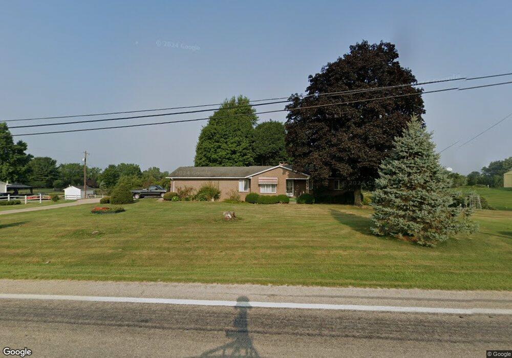
811 N State Route 61 Sunbury, OH 43074
Estimated Value: $393,553 - $436,000
3
Beds
4
Baths
1,614
Sq Ft
$261/Sq Ft
Est. Value
About This Home
This home is located at 811 N State Route 61, Sunbury, OH 43074 and is currently estimated at $421,138, approximately $260 per square foot. 811 N State Route 61 is a home located in Delaware County with nearby schools including General Rosecrans Elementary School, Big Walnut Intermediate School, and Big Walnut Middle School.
Ownership History
Date
Name
Owned For
Owner Type
Purchase Details
Closed on
Aug 11, 2023
Sold by
Tornes Lawrence A
Bought by
Lawrence A Tornes Revocable Trust and Tornes
Current Estimated Value
Purchase Details
Closed on
Apr 8, 2011
Sold by
Tornes Lawrence A and Tornes Anna V
Bought by
Tornes Anna V and Anna V Tornes Revocable Trust
Create a Home Valuation Report for This Property
The Home Valuation Report is an in-depth analysis detailing your home's value as well as a comparison with similar homes in the area
Home Values in the Area
Average Home Value in this Area
Purchase History
| Date | Buyer | Sale Price | Title Company |
|---|---|---|---|
| Lawrence A Tornes Revocable Trust | -- | None Listed On Document | |
| Tornes Anna V | -- | None Available | |
| Tornes Lawrence A | -- | None Available |
Source: Public Records
Tax History Compared to Growth
Tax History
| Year | Tax Paid | Tax Assessment Tax Assessment Total Assessment is a certain percentage of the fair market value that is determined by local assessors to be the total taxable value of land and additions on the property. | Land | Improvement |
|---|---|---|---|---|
| 2024 | $3,964 | $109,550 | $23,100 | $86,450 |
| 2023 | $3,890 | $109,550 | $23,100 | $86,450 |
| 2022 | $3,342 | $83,620 | $16,630 | $66,990 |
| 2021 | $3,358 | $83,620 | $16,630 | $66,990 |
| 2020 | $3,372 | $83,620 | $16,630 | $66,990 |
| 2019 | $2,756 | $67,630 | $14,460 | $53,170 |
| 2018 | $2,593 | $67,630 | $14,460 | $53,170 |
| 2017 | $986 | $58,240 | $11,200 | $47,040 |
| 2016 | $1,960 | $58,240 | $11,200 | $47,040 |
| 2015 | $1,972 | $58,240 | $11,200 | $47,040 |
| 2014 | $2,045 | $58,240 | $11,200 | $47,040 |
| 2013 | $2,210 | $58,240 | $11,200 | $47,040 |
Source: Public Records
Map
Nearby Homes
- 732 N State Route 61
- 956 N State Route 61
- 202 N Columbus St
- 388 Millers Cove Ct
- 408 Village Ln
- 0 W Cherry St
- 0 Ohio 37 Unit 225026227
- 0 Hartford Rd Unit 8.17 acres 225016432
- 285 E Cherry St
- 320 E Cherry St
- 300 Fox Trail Dr
- 0 Kintner Pkwy
- 349 Laurel Ct
- 561 Fields Meadow Dr
- 761 Buckeye Cir Unit Lot 2392
- 239 Millpond Rd Unit 239
- 12433 Ohio 37
- 285 E Granville St
- 654 Fairland Dr Unit Lot 2398
- 2177 Common Bent Dr
- 901 N State Route 61
- 880 N State Route 61
- 761 N State Route 61
- 770 N State Route 61
- 927 N State Route 61
- 763 N State Route 61
- 963 N State Route 61
- 980 N State Route 61
- 3500 State Route 61
- 2290 State Route 61
- 3620 State Route 61
- 0-1 State Route 61
- 1020 N State Route 61
- 41 N State Route 61
- 19 N State Route 61
- 25 N State Route 61
- 81 N State Route 61
- 32 N State Route 61
- 38 N State Route 61
- 7556 Ohio 61