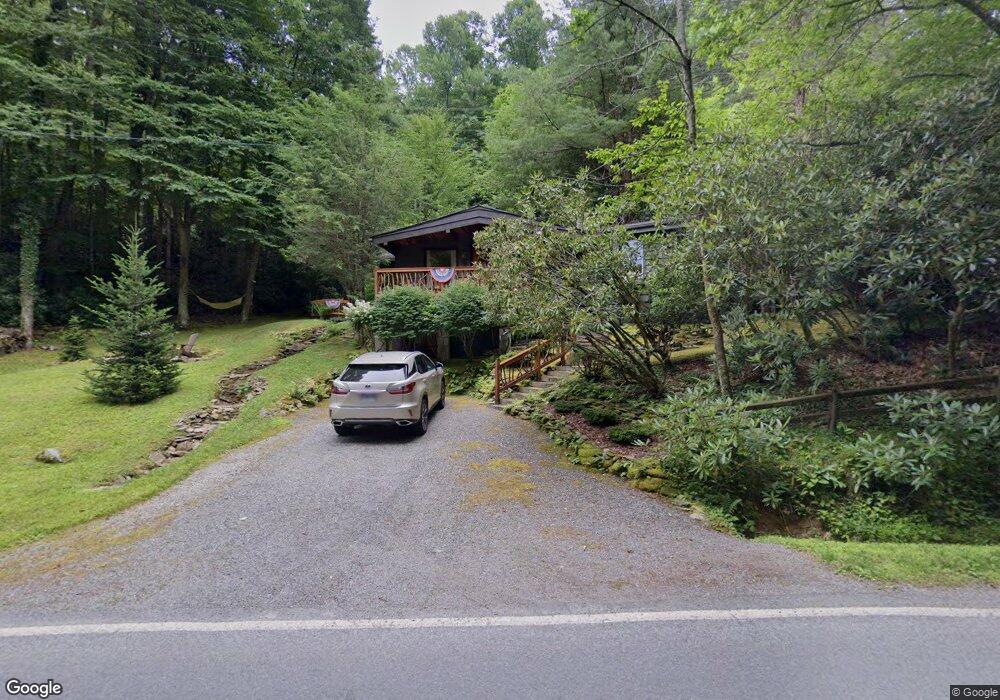
811 Payne Branch Rd Blowing Rock, NC 28605
Estimated Value: $395,895 - $483,000
2
Beds
3
Baths
872
Sq Ft
$516/Sq Ft
Est. Value
About This Home
This home is located at 811 Payne Branch Rd, Blowing Rock, NC 28605 and is currently estimated at $449,632, approximately $515 per square foot. 811 Payne Branch Rd is a home with nearby schools including Blowing Rock Elementary School and Watauga High School.
Ownership History
Date
Name
Owned For
Owner Type
Purchase Details
Closed on
Sep 26, 2011
Sold by
Pearsall Stuart K and Pearsall Dana R
Bought by
Denny Richard M and Denny Lisa Robi
Current Estimated Value
Home Financials for this Owner
Home Financials are based on the most recent Mortgage that was taken out on this home.
Original Mortgage
$100,000
Interest Rate
4.3%
Mortgage Type
New Conventional
Purchase Details
Closed on
Aug 31, 2005
Sold by
Owens Mark S and Owens Maria M
Bought by
Pearsall Stuart K and Pearsall Dana R
Home Financials for this Owner
Home Financials are based on the most recent Mortgage that was taken out on this home.
Original Mortgage
$203,200
Interest Rate
5.77%
Mortgage Type
New Conventional
Create a Home Valuation Report for This Property
The Home Valuation Report is an in-depth analysis detailing your home's value as well as a comparison with similar homes in the area
Home Values in the Area
Average Home Value in this Area
Purchase History
| Date | Buyer | Sale Price | Title Company |
|---|---|---|---|
| Denny Richard M | $200,000 | None Available | |
| Pearsall Stuart K | $254,000 | None Available |
Source: Public Records
Mortgage History
| Date | Status | Borrower | Loan Amount |
|---|---|---|---|
| Closed | Denny Richard M | $100,000 | |
| Previous Owner | Pearsall Stuart K | $203,200 |
Source: Public Records
Tax History Compared to Growth
Tax History
| Year | Tax Paid | Tax Assessment Tax Assessment Total Assessment is a certain percentage of the fair market value that is determined by local assessors to be the total taxable value of land and additions on the property. | Land | Improvement |
|---|---|---|---|---|
| 2025 | $894 | $209,400 | $37,500 | $171,900 |
| 2024 | $894 | $209,400 | $37,500 | $171,900 |
| 2023 | $872 | $209,400 | $37,500 | $171,900 |
| 2022 | $872 | $209,400 | $37,500 | $171,900 |
| 2021 | $0 | $155,300 | $22,100 | $133,200 |
| 2020 | $799 | $155,300 | $22,100 | $133,200 |
| 2019 | $799 | $155,300 | $22,100 | $133,200 |
| 2018 | $721 | $155,300 | $22,100 | $133,200 |
| 2017 | $721 | $155,300 | $22,100 | $133,200 |
| 2013 | -- | $141,500 | $30,200 | $111,300 |
Source: Public Records
Map
Nearby Homes
- 170 Mountain Laurel Ln
- 40 Silver Fox Dr
- 592 Galax Cir
- TBD Hews Cir
- 63 Galax Circle Extension
- TBD U S Highway 321 S
- 3453 Us Highway 321 S
- 193 Grovers Knob
- Lot 22 Ski Acres Dr
- 136 Deer Ridge Ln Unit 1
- 157 Twisted Laurel Ln
- TBD Leon Coffey Rd
- 111 Oxford Ln Unit 1
- 111 Oxford Ln
- 132 Carlton Cir
- TBD Us Highway 321 Hwy S
- TBD Niley Cook Rd
- Lot 11 Sunset Ridge Dr
- 32 S Creek Dr
- Lot 11 & 12 Sunset Ridge Dr
- 844 Payne Branch Rd
- 164 Fox Den Rd
- 104 Fox Den Rd
- 270 Fox Den Rd
- 250 Mountain Laurel Ln
- 742 Payne Branch Rd
- 729 Payne Branch Rd
- 230 Mountain Laurel Ln
- 229 Mountain Laurel Ln
- 285 Toni Ave
- 224 Mountain Laurel Ln
- 504 Galax Cir
- 185 Toni Ave
- 265 Toni Ave
- 389 Claudia St
- 526 Galax Cir
- 296 Toni Ave
- 592 Fox Den Rd
- 500 Galax Cir
- 377 Fox Den Rd