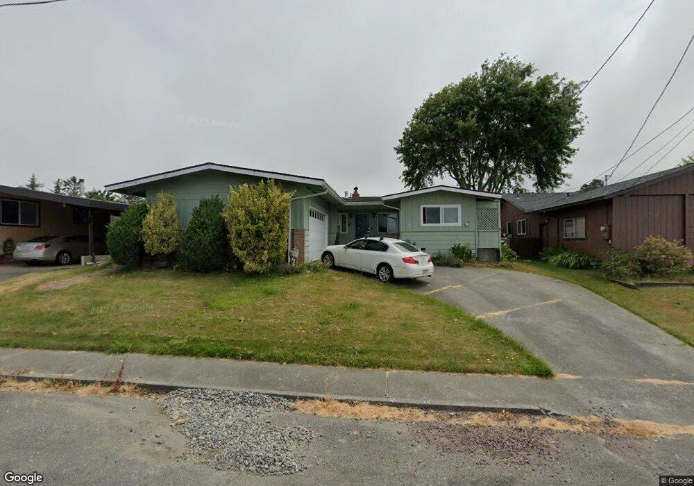
811 Perrott Ave Loleta, CA 95551
Loleta NeighborhoodEstimated Value: $331,000 - $402,000
3
Beds
2
Baths
1,528
Sq Ft
$244/Sq Ft
Est. Value
About This Home
This home is located at 811 Perrott Ave, Loleta, CA 95551 and is currently estimated at $372,160, approximately $243 per square foot. 811 Perrott Ave is a home located in Humboldt County with nearby schools including Loleta Elementary School, East High School, and Fortuna Union High School.
Ownership History
Date
Name
Owned For
Owner Type
Purchase Details
Closed on
Nov 6, 2015
Sold by
Merrill Thomas R and Merrill Denise R
Bought by
Merrill Thomas R
Current Estimated Value
Home Financials for this Owner
Home Financials are based on the most recent Mortgage that was taken out on this home.
Original Mortgage
$130,200
Interest Rate
3.8%
Mortgage Type
New Conventional
Purchase Details
Closed on
Mar 25, 2002
Sold by
Merrill Thomas R
Bought by
Merrill Thomas R and Merrill Denise R
Home Financials for this Owner
Home Financials are based on the most recent Mortgage that was taken out on this home.
Original Mortgage
$92,500
Interest Rate
6.85%
Purchase Details
Closed on
Mar 15, 2002
Sold by
Heap Larena J and Merrill Larena J
Bought by
Merrill Thomas R
Home Financials for this Owner
Home Financials are based on the most recent Mortgage that was taken out on this home.
Original Mortgage
$92,500
Interest Rate
6.85%
Create a Home Valuation Report for This Property
The Home Valuation Report is an in-depth analysis detailing your home's value as well as a comparison with similar homes in the area
Home Values in the Area
Average Home Value in this Area
Purchase History
| Date | Buyer | Sale Price | Title Company |
|---|---|---|---|
| Merrill Thomas R | -- | None Available | |
| Merrill Thomas R | -- | Fidelity National Title Co | |
| Merrill Thomas R | -- | Fidelity National Title Co |
Source: Public Records
Mortgage History
| Date | Status | Borrower | Loan Amount |
|---|---|---|---|
| Closed | Merrill Thomas R | $130,200 | |
| Closed | Merrill Thomas R | $92,500 |
Source: Public Records
Tax History
| Year | Tax Paid | Tax Assessment Tax Assessment Total Assessment is a certain percentage of the fair market value that is determined by local assessors to be the total taxable value of land and additions on the property. | Land | Improvement |
|---|---|---|---|---|
| 2025 | $3,315 | $185,063 | $66,734 | $118,329 |
| 2024 | $3,315 | $181,435 | $65,426 | $116,009 |
| 2023 | $3,104 | $177,879 | $64,144 | $113,735 |
| 2022 | $2,744 | $174,392 | $62,887 | $111,505 |
| 2021 | $2,707 | $170,973 | $61,654 | $109,319 |
| 2020 | $2,698 | $169,221 | $61,022 | $108,199 |
| 2019 | $2,365 | $165,904 | $59,826 | $106,078 |
| 2018 | $2,325 | $162,652 | $58,653 | $103,999 |
| 2017 | $2,299 | $159,463 | $57,503 | $101,960 |
| 2016 | $2,268 | $156,337 | $56,376 | $99,961 |
| 2015 | -- | $153,990 | $55,530 | $98,460 |
| 2014 | -- | $150,975 | $54,443 | $96,532 |
Source: Public Records
Map
Nearby Homes
- 849 Perrott Ave
- 386 Loleta Dr
- 275 Church St
- 2554 Eel River Dr
- 0 Church St Unit 326015012
- 0 Church St Unit 271562
- 255 Hillcrest Rd
- 135 Clough Rd
- 1770 Tompkins Hill Rd
- 887 Fernbridge Dr
- 32 Summit View Ln
- 781 Tompkins Hill Rd
- 500 Sage Rd
- 420 Valley Ave
- 105 Annahy Dr
- 630 Palmer Blvd
- 545 Garland Ave
- 370 Main St
- 0 Ambrosini Ln
- 645 7th St
- 793 Perrott Ave
- 831 Perrott Ave
- 60 Shadowbrook St
- 70 Shadowbrook St
- 777 Perrott Ave
- 50 Shadowbrook St
- 808 Perrott Ave
- 80 Shadowbrook St
- 830 Perrott Ave
- 40 Shadowbrook St
- 784 Perrott Ave
- 867 Perrott Ave
- 757 Perrott Ave
- 90 Shadowbrook St
- 854 Perrott Ave
- 30 Shadowbrook St
- 762 Perrott Ave
- 739 Perrott Ave
- 100 Shadowbrook St
- 75 Shadowbrook St
Your Personal Tour Guide
Ask me questions while you tour the home.