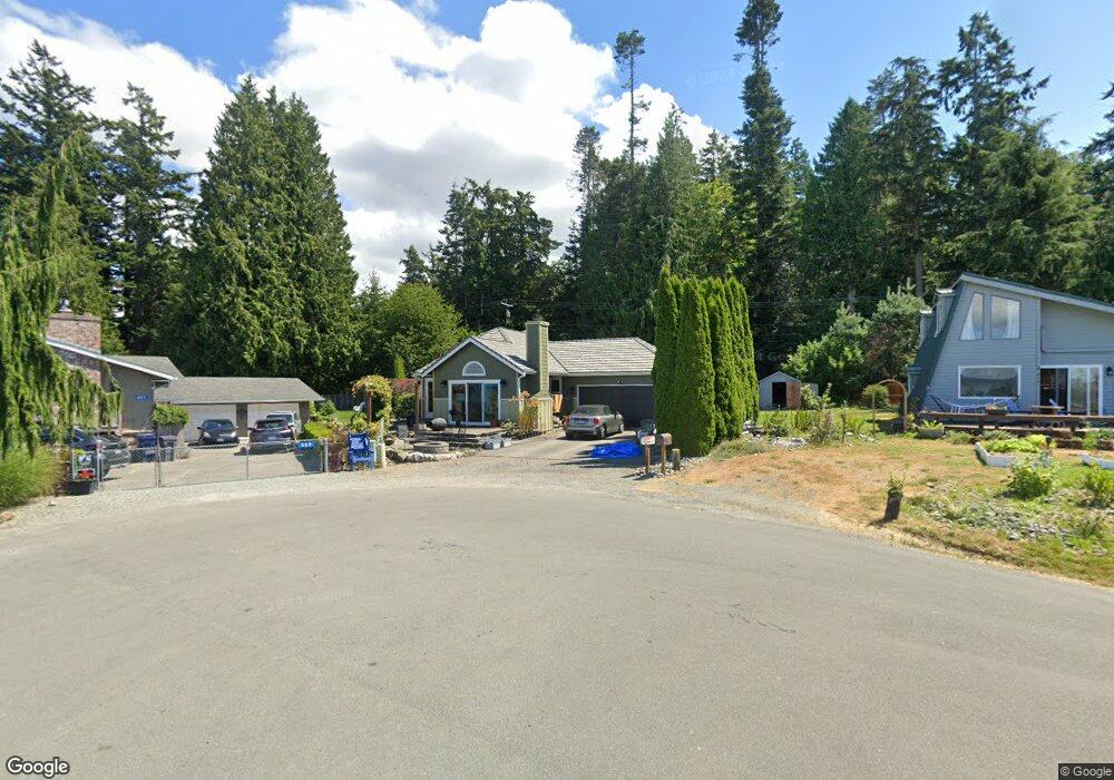
811 Rocky Point Dr Camano Island, WA 98282
Estimated Value: $627,000 - $692,000
2
Beds
2
Baths
1,203
Sq Ft
$546/Sq Ft
Est. Value
About This Home
This home is located at 811 Rocky Point Dr, Camano Island, WA 98282 and is currently estimated at $657,083, approximately $546 per square foot. 811 Rocky Point Dr is a home located in Island County with nearby schools including Utsalady Elementary School, Port Susan Middle School, and Stanwood High School.
Ownership History
Date
Name
Owned For
Owner Type
Purchase Details
Closed on
Sep 16, 2009
Sold by
Olson Vern and Olson Angela
Bought by
Stutesman Karen Lorraine
Current Estimated Value
Home Financials for this Owner
Home Financials are based on the most recent Mortgage that was taken out on this home.
Original Mortgage
$161,400
Outstanding Balance
$105,072
Interest Rate
5.18%
Mortgage Type
New Conventional
Estimated Equity
$552,011
Purchase Details
Closed on
Aug 26, 2004
Sold by
Bash Daniel R and Bash Elizabeth M
Bought by
Olson Vern and Olson Angela
Create a Home Valuation Report for This Property
The Home Valuation Report is an in-depth analysis detailing your home's value as well as a comparison with similar homes in the area
Home Values in the Area
Average Home Value in this Area
Purchase History
| Date | Buyer | Sale Price | Title Company |
|---|---|---|---|
| Stutesman Karen Lorraine | $269,000 | Land Title & Escrow Of Islan | |
| Olson Vern | $225,000 | Land Title Co Island Cnty |
Source: Public Records
Mortgage History
| Date | Status | Borrower | Loan Amount |
|---|---|---|---|
| Open | Stutesman Karen Lorraine | $161,400 |
Source: Public Records
Tax History Compared to Growth
Tax History
| Year | Tax Paid | Tax Assessment Tax Assessment Total Assessment is a certain percentage of the fair market value that is determined by local assessors to be the total taxable value of land and additions on the property. | Land | Improvement |
|---|---|---|---|---|
| 2025 | $4,209 | $578,782 | $340,000 | $238,782 |
| 2024 | $4,629 | $571,954 | $330,000 | $241,954 |
| 2023 | $4,629 | $605,128 | $360,000 | $245,128 |
| 2022 | $3,871 | $484,807 | $260,000 | $224,807 |
| 2021 | $3,661 | $417,981 | $220,000 | $197,981 |
| 2020 | $3,676 | $382,588 | $190,000 | $192,588 |
| 2019 | $3,384 | $379,517 | $230,000 | $149,517 |
| 2018 | $3,143 | $349,989 | $200,000 | $149,989 |
| 2017 | $2,370 | $300,909 | $150,000 | $150,909 |
| 2016 | $2,480 | $251,332 | $100,000 | $151,332 |
| 2015 | -- | $253,202 | $100,000 | $153,202 |
| 2013 | -- | $241,938 | $85,000 | $156,938 |
Source: Public Records
Map
Nearby Homes
- 688 Gladstone Dr
- 1042 Shorecrest Place
- 0 Maple Grove Rd Unit NWM2455478
- 628 N Sunset Dr
- 1048 Malvern Hills Dr
- 900 N Sunset Dr
- 366 Samanthia Ln
- 1048 Cassius Ct
- 345 Seaview Ct
- 350 N Sunset Dr
- 329 Melissa St
- 329 Burke Dr
- 325 Melissa St
- 941 Cambell Dr
- 0 Cambell Dr Unit NWM2331086
- 276 Melissa St
- 441 Windsun Way
- 243 Henning Dr
- 212 Grandview Ave
- 211 N Sunset Dr
- 815 Rocky Point Dr
- 957 N Sunset Dr
- 819 Rocky Point Dr
- 812 Rocky Point Dr
- 823 Rocky Point Dr
- 882 Rocky Point Dr
- 827 Rocky Point Dr
- 0 XXX Burbin Ln
- 0 L36 W Gladstone Dr
- 800 W Gladstone Dr
- 789 Burbin Ln
- 0 Gladstone Dr Unit 1114688
- 0 Gladstone Dr Unit 1260406
- 960 N Sunset Dr
- 800 Block W Gladstone Dr
- 828 Gladstone Dr
- 835 Rocky Point Dr
- 969 N Sunset Dr
- 790 Gladstone Dr
- 836 Rocky Point Dr