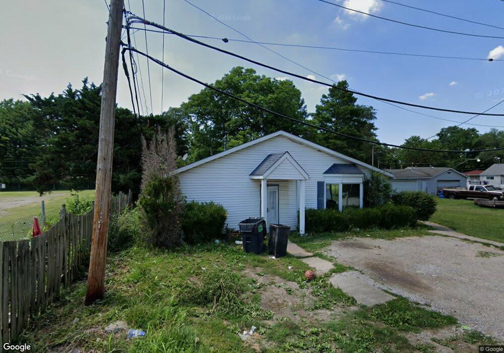
811 Rome Ave Cahokia, IL 62206
Estimated Value: $79,000 - $89,000
3
Beds
3
Baths
1,260
Sq Ft
$68/Sq Ft
Est. Value
About This Home
This home is located at 811 Rome Ave, Cahokia, IL 62206 and is currently estimated at $85,408, approximately $67 per square foot. 811 Rome Ave is a home located in St. Clair County.
Ownership History
Date
Name
Owned For
Owner Type
Purchase Details
Closed on
Dec 28, 2009
Sold by
Bank Of America National Association
Bought by
Bush Tamekia L
Current Estimated Value
Purchase Details
Closed on
Jun 15, 2009
Sold by
Newby Monica L
Bought by
Bank Of America National Association
Purchase Details
Closed on
Mar 10, 2006
Sold by
Sweeney John
Bought by
Newby Monica L
Home Financials for this Owner
Home Financials are based on the most recent Mortgage that was taken out on this home.
Original Mortgage
$74,100
Interest Rate
12.03%
Mortgage Type
Fannie Mae Freddie Mac
Purchase Details
Closed on
Aug 17, 2005
Sold by
The Cit Group/Consumer Finance Inc
Bought by
Sweeney John
Purchase Details
Closed on
Nov 30, 2004
Sold by
Lovelace Paul and Lovelace Rachel
Bought by
The Cit Group/Consumer Finance Inc
Create a Home Valuation Report for This Property
The Home Valuation Report is an in-depth analysis detailing your home's value as well as a comparison with similar homes in the area
Home Values in the Area
Average Home Value in this Area
Purchase History
| Date | Buyer | Sale Price | Title Company |
|---|---|---|---|
| Bush Tamekia L | $15,000 | First American Title Insuran | |
| Bank Of America National Association | -- | None Available | |
| Newby Monica L | $78,000 | Metro East Title Corporation | |
| Sweeney John | $26,000 | Fatic | |
| The Cit Group/Consumer Finance Inc | -- | -- |
Source: Public Records
Mortgage History
| Date | Status | Borrower | Loan Amount |
|---|---|---|---|
| Previous Owner | Newby Monica L | $74,100 |
Source: Public Records
Tax History Compared to Growth
Tax History
| Year | Tax Paid | Tax Assessment Tax Assessment Total Assessment is a certain percentage of the fair market value that is determined by local assessors to be the total taxable value of land and additions on the property. | Land | Improvement |
|---|---|---|---|---|
| 2024 | $2,282 | $11,997 | $1,561 | $10,436 |
| 2023 | $2,060 | $10,843 | $1,411 | $9,432 |
| 2022 | $1,886 | $9,503 | $1,237 | $8,266 |
| 2021 | $1,934 | $9,005 | $1,172 | $7,833 |
| 2020 | $2,086 | $8,955 | $1,227 | $7,728 |
| 2019 | $2,090 | $8,955 | $1,227 | $7,728 |
| 2018 | $2,080 | $9,086 | $1,245 | $7,841 |
| 2017 | $2,058 | $8,867 | $1,215 | $7,652 |
| 2016 | $2,151 | $8,767 | $1,210 | $7,557 |
| 2014 | $887 | $8,672 | $1,197 | $7,475 |
| 2013 | $2,239 | $8,135 | $1,123 | $7,012 |
Source: Public Records
Map
Nearby Homes
- 1713 Loretta Ave
- 2025 Sandy Ridge Rd
- 2014 Florence St
- 2005 Louise Ave
- 1997 Oak Tree Ln
- 1426 Richard Dr
- 2016 Lynn St
- 2 Margie Dr
- 1128 Saint Benedict Dr
- 1713 Theodore Ln
- 1326 Saint Zita Ln
- 1723 Theodore Ln
- 1106 Saint Boniface Dr
- 1700 Theodore Ln
- 913 Joliet Dr Unit 1
- 20 Leonard Dr
- 118 Saint Christopher Dr
- 111 Lazarcheff Dr
- 1505 Camp Jackson Rd
- 17 Hanover Ln
- 811 Rome St
- 817 Rome St
- 1852 Harvest Ave
- 1846 Harvest Ave
- 808 Rome St
- 1902 Harvest Ave
- 812 Rome St
- 1837 Loretta Ave
- 1906 Harvest Ave
- 1836 Harvest Ave
- 1908 Harvest Ave
- 1849 Harvest Ave
- 1840 Loretta Ave
- 1847 Harvest Ave
- 1843 Harvest Ave
- 1912 Harvest Ave
- 1828 Harvest Ave
- 1839 Harvest Ave
- 1836 Loretta Ave
- 1905 Harvest Ave