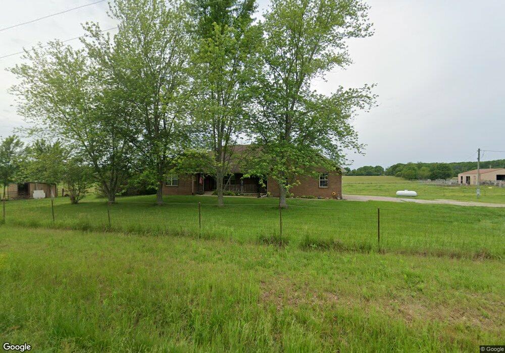
811 State Highway Vv Rogersville, MO 65742
Estimated Value: $396,434 - $503,000
3
Beds
1
Bath
1,788
Sq Ft
$244/Sq Ft
Est. Value
About This Home
This home is located at 811 State Highway Vv, Rogersville, MO 65742 and is currently estimated at $436,478, approximately $244 per square foot. 811 State Highway Vv is a home with nearby schools including Logan-Rogersville Primary School, Logan-Rogersville Upper Elementary School, and Logan-Rogersville Elementary School.
Ownership History
Date
Name
Owned For
Owner Type
Purchase Details
Closed on
Dec 1, 2020
Sold by
Calhoun Stephen G and Calhoun Gail A
Bought by
Calhoun Stephen G and Calhoun Gail A
Current Estimated Value
Home Financials for this Owner
Home Financials are based on the most recent Mortgage that was taken out on this home.
Original Mortgage
$111,100
Interest Rate
2.8%
Mortgage Type
New Conventional
Create a Home Valuation Report for This Property
The Home Valuation Report is an in-depth analysis detailing your home's value as well as a comparison with similar homes in the area
Home Values in the Area
Average Home Value in this Area
Purchase History
| Date | Buyer | Sale Price | Title Company |
|---|---|---|---|
| Calhoun Stephen G | -- | Title365 |
Source: Public Records
Mortgage History
| Date | Status | Borrower | Loan Amount |
|---|---|---|---|
| Closed | Calhoun Stephen G | $111,100 |
Source: Public Records
Tax History Compared to Growth
Tax History
| Year | Tax Paid | Tax Assessment Tax Assessment Total Assessment is a certain percentage of the fair market value that is determined by local assessors to be the total taxable value of land and additions on the property. | Land | Improvement |
|---|---|---|---|---|
| 2024 | $1,653 | $28,990 | -- | -- |
| 2023 | $1,653 | $28,990 | $0 | $0 |
| 2022 | $1,583 | $27,090 | $0 | $0 |
| 2021 | $1,583 | $27,090 | $0 | $0 |
| 2020 | $1,489 | $24,850 | $0 | $0 |
| 2019 | $1,489 | $24,850 | $0 | $0 |
| 2018 | $1,277 | $23,410 | $0 | $0 |
| 2017 | $1,277 | $23,410 | $0 | $0 |
| 2016 | $1,237 | $23,030 | $0 | $0 |
| 2015 | $1,259 | $23,030 | $23,030 | $0 |
| 2014 | $1,116 | $22,870 | $0 | $0 |
| 2013 | $1,116 | $22,870 | $0 | $0 |
| 2011 | -- | $45,740 | $0 | $0 |
Source: Public Records
Map
Nearby Homes
- 10193 E Beth Ln
- 000 Watts Rd
- 9966 E Farm Road 186
- 175 Deer Run
- 525 Woodland Hills Ave
- 270 Hickory Hills St
- 3440 Reed Rd
- 1030 Amherst Cir
- 363 Santa fe Rd
- 503 Patriot Place Dr
- 127 Finbrooke Rd
- 1065 Amherst Cir
- 5341 State Highway U
- 526 Bryan Ave Unit Lot 3
- 520 Bryan Ave Unit Lot 2
- 8559 Highway 60
- TBD Highway 60 Unit WP002
- 9404 Highway 60
- 000 Highway 60
- 230 S Newport Ave
- 812 S Vv Hwy
- 728 State Highway Vv
- 807 State Highway Vv
- 805 State Highway Vv
- 959 State Highway Vv
- 817 State Highway Vv
- 2171 Hedgpeth Rd
- 2111 Hedgpeth Rd
- 2135 Hedgpeth Rd
- 999 State Hwy Vv
- 585 State Highway Vv
- 2013 Hedgpeth Rd
- 999-1013 State Highway V V
- 1963 Hedgpeth Rd
- 000 State Highway Vv
- 1917 Hedgpeth Rd
- Lot 2 Hedgpeth Rd
- 6569 State Highway Vv
- 6569 State Highway Vv
- 6569 S State Highway Vv