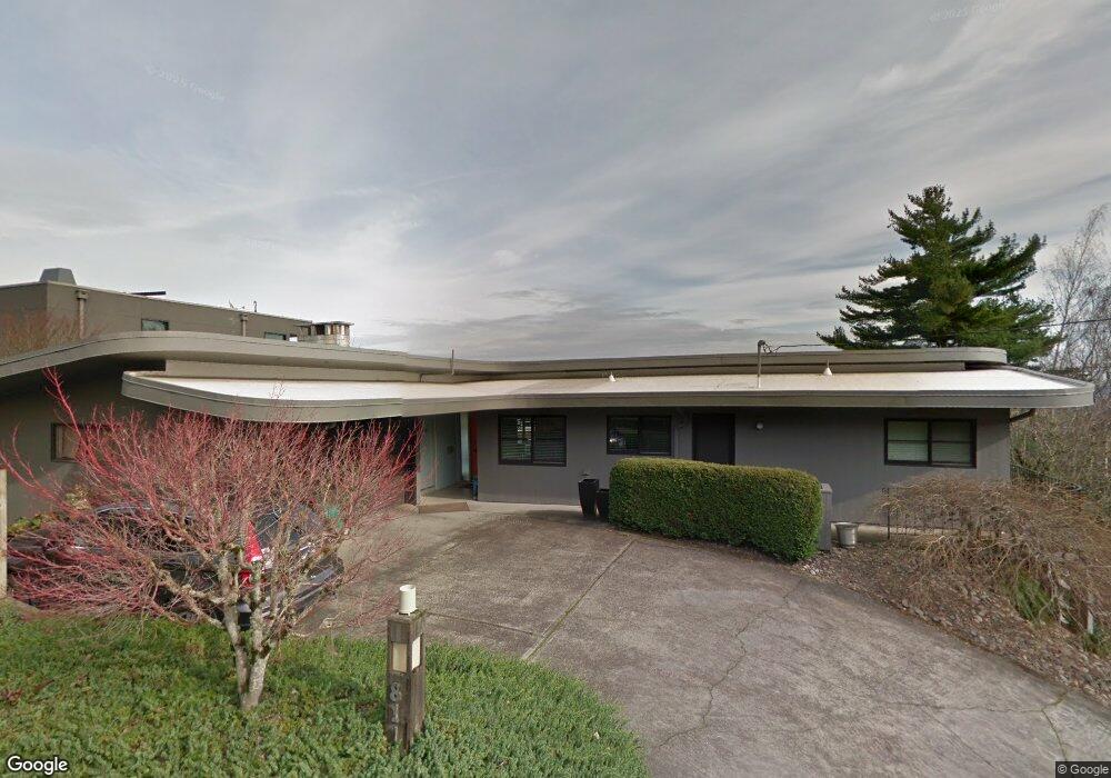
811 SW Davenport St Portland, OR 97201
Southwest Hills NeighborhoodEstimated Value: $1,301,883 - $1,886,000
5
Beds
3
Baths
3,798
Sq Ft
$407/Sq Ft
Est. Value
About This Home
This home is located at 811 SW Davenport St, Portland, OR 97201 and is currently estimated at $1,544,971, approximately $406 per square foot. 811 SW Davenport St is a home located in Multnomah County with nearby schools including Ainsworth Elementary School, West Sylvan Middle School, and Lincoln High School.
Ownership History
Date
Name
Owned For
Owner Type
Purchase Details
Closed on
Dec 8, 2021
Sold by
Nancy Craven
Bought by
Craven And Claypool Revocable Trust
Current Estimated Value
Purchase Details
Closed on
Apr 26, 2011
Sold by
Paxton Harold D
Bought by
Craven Nancy and Claypool James
Home Financials for this Owner
Home Financials are based on the most recent Mortgage that was taken out on this home.
Original Mortgage
$552,000
Interest Rate
3.5%
Mortgage Type
Adjustable Rate Mortgage/ARM
Create a Home Valuation Report for This Property
The Home Valuation Report is an in-depth analysis detailing your home's value as well as a comparison with similar homes in the area
Home Values in the Area
Average Home Value in this Area
Purchase History
| Date | Buyer | Sale Price | Title Company |
|---|---|---|---|
| Craven And Claypool Revocable Trust | $91,000 | None Listed On Document | |
| Craven Nancy | $690,000 | Lawyers Title |
Source: Public Records
Mortgage History
| Date | Status | Borrower | Loan Amount |
|---|---|---|---|
| Previous Owner | Craven Nancy | $552,000 |
Source: Public Records
Tax History Compared to Growth
Tax History
| Year | Tax Paid | Tax Assessment Tax Assessment Total Assessment is a certain percentage of the fair market value that is determined by local assessors to be the total taxable value of land and additions on the property. | Land | Improvement |
|---|---|---|---|---|
| 2024 | $23,874 | $1,013,010 | -- | -- |
| 2023 | $22,488 | $983,510 | $0 | $0 |
| 2022 | $22,779 | $954,870 | $0 | $0 |
| 2021 | $21,062 | $927,060 | $0 | $0 |
| 2020 | $18,894 | $900,060 | $0 | $0 |
| 2019 | $20,548 | $873,850 | $0 | $0 |
| 2018 | $20,430 | $848,400 | $0 | $0 |
| 2017 | $20,169 | $823,690 | $0 | $0 |
| 2016 | $17,524 | $799,700 | $0 | $0 |
| 2015 | $18,012 | $776,410 | $0 | $0 |
| 2014 | $15,841 | $753,800 | $0 | $0 |
Source: Public Records
Map
Nearby Homes
- 839 SW Broadway Dr Unit 74
- 847 SW Broadway Dr Unit 32
- 859 SW Broadway Dr Unit 41
- 843 SW Broadway Dr Unit 61
- 2440 SW Hoffman Ave
- 2590 SW Buckingham Ave
- 1136 SW Davenport St
- 2206 SW Hoffman Ave Unit 9
- 1040 SW Myrtle Dr
- 654 SW Grant St Unit 304
- 1120 SW Broadway Dr
- 1132 SW Broadway Dr
- 0 SW Cardinell Way
- 1274 SW Cardinell Way
- 1205 SW Myrtle Dr
- 1369 SW Broadway Dr
- 2047 SW 10th Ave
- 0 SW Rivington Dr Unit 24444940
- 3035 SW 11th Ave
- 1235 SW Myrtle Ct
- 821 SW Davenport St
- 840 SW Canning St
- 806 SW Davenport St
- 2684 SW Buckingham Ave
- 2690 SW Buckingham Ave
- 2658 SW Chelmsford Ave
- 0 SW Prince Blvd
- 925 SW Canning St
- 2666 SW Buckingham Ave
- 910 SW Canning St
- 908 SW Davenport St
- 2650 SW Chelmsford Ave
- 2681 SW Commonwealth Ave Unit 1
- 2681 SW Commonwealth Ave
- 934 SW Tangent St
- 2680 SW Cross Ave
- 0 SW Buckingham Ave
- 2700 SW Commonwealth Ave
- 2642 SW Chelmsford Ave
- 939 SW Tangent St
