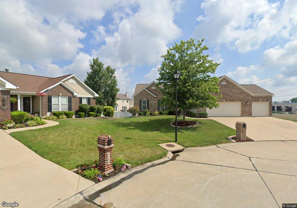
8111 Glen Arbor Dr Lake Saint Louis, MO 63367
Estimated Value: $390,515 - $472,000
3
Beds
2
Baths
1,652
Sq Ft
$265/Sq Ft
Est. Value
About This Home
This home is located at 8111 Glen Arbor Dr, Lake Saint Louis, MO 63367 and is currently estimated at $437,129, approximately $264 per square foot. 8111 Glen Arbor Dr is a home located in St. Charles County with nearby schools including Prairie View Elementary School, Frontier Middle School, and Liberty High School.
Ownership History
Date
Name
Owned For
Owner Type
Purchase Details
Closed on
Oct 22, 2004
Sold by
Rolwes Co Inc
Bought by
Hutchinson John R
Current Estimated Value
Home Financials for this Owner
Home Financials are based on the most recent Mortgage that was taken out on this home.
Original Mortgage
$125,000
Outstanding Balance
$62,114
Interest Rate
5.82%
Mortgage Type
Purchase Money Mortgage
Estimated Equity
$375,015
Create a Home Valuation Report for This Property
The Home Valuation Report is an in-depth analysis detailing your home's value as well as a comparison with similar homes in the area
Home Values in the Area
Average Home Value in this Area
Purchase History
| Date | Buyer | Sale Price | Title Company |
|---|---|---|---|
| Hutchinson John R | $223,490 | -- |
Source: Public Records
Mortgage History
| Date | Status | Borrower | Loan Amount |
|---|---|---|---|
| Open | Hutchinson John R | $125,000 |
Source: Public Records
Tax History Compared to Growth
Tax History
| Year | Tax Paid | Tax Assessment Tax Assessment Total Assessment is a certain percentage of the fair market value that is determined by local assessors to be the total taxable value of land and additions on the property. | Land | Improvement |
|---|---|---|---|---|
| 2025 | $4,084 | $70,443 | -- | -- |
| 2023 | $4,084 | $64,416 | $0 | $0 |
| 2022 | $3,554 | $52,328 | $0 | $0 |
| 2021 | $3,558 | $52,328 | $0 | $0 |
| 2020 | $3,464 | $48,869 | $0 | $0 |
| 2019 | $3,215 | $48,869 | $0 | $0 |
| 2018 | $2,886 | $41,803 | $0 | $0 |
| 2017 | $2,886 | $41,803 | $0 | $0 |
| 2016 | $2,644 | $36,695 | $0 | $0 |
| 2015 | $2,609 | $36,695 | $0 | $0 |
| 2014 | $2,373 | $35,824 | $0 | $0 |
Source: Public Records
Map
Nearby Homes
- LOT #1B Wies Industrial Dr
- LOT #1C Wies Industrial Dr
- 415 Filipp Ln
- Orf Road Orf Rd
- 339 Wyndemere Dr
- 235 Greengate Dr
- 396 Haycastle Dr
- 320 Briarchase Cir
- 103 Eckstein Ln
- 280 Osprey Ct
- 2 Hickory at Hawk Ridge Estate
- 126 Far Meadow Dr
- 286 Osprey Ct
- 2 Nottingham at Hawk Ridge
- 2 Pin Oak at Hawk Ridge Estate
- 288 Osprey Ct
- 113 Wyndcrest Ct
- 2 Sequoia at Hawk Ridge Estate
- 422 Parkgate Dr
- 1800 English Oak Dr
- 8109 Glen Arbor Dr
- 616 Glen Brook Ct
- 8107 Glen Arbor Dr
- 614 Glen Brook Ct
- 8110 Glen Arbor Dr
- 610 Glen Brook Ct
- 618 Glen Brook Ct
- 608 Glen Brook Ct
- 8105 Glen Arbor Dr
- 606 Glen Brook Ct
- 8108 Glen Arbor Dr
- 617 Glen Brook Ct
- 604 Glen Brook Ct
- 615 Glen Brook Ct
- 8106 Glen Arbor Dr
- 613 Glen Brook Ct
- 8103 Glen Arbor Dr
- 611 Glen Brook Ct
- 306 Wies Industrial Dr
- 609 Glen Brook Ct