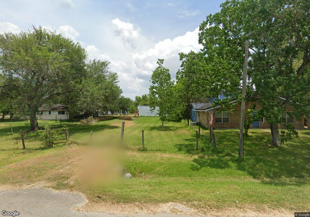
8111 Tye Ln Pearland, TX 77584
Estimated Value: $270,000 - $413,000
--
Bed
1
Bath
1,924
Sq Ft
$181/Sq Ft
Est. Value
About This Home
This home is located at 8111 Tye Ln, Pearland, TX 77584 and is currently estimated at $348,646, approximately $181 per square foot. 8111 Tye Ln is a home located in Brazoria County with nearby schools including Mark Twain Elementary School, G.W. Harby Junior High School, and Manvel High School.
Ownership History
Date
Name
Owned For
Owner Type
Purchase Details
Closed on
Nov 19, 2007
Sold by
Savage Jimmy Ray and Savage Kristi
Bought by
Morton Krissy and Mathena Michael
Current Estimated Value
Home Financials for this Owner
Home Financials are based on the most recent Mortgage that was taken out on this home.
Original Mortgage
$150,000
Outstanding Balance
$95,102
Interest Rate
6.42%
Mortgage Type
Seller Take Back
Estimated Equity
$253,544
Create a Home Valuation Report for This Property
The Home Valuation Report is an in-depth analysis detailing your home's value as well as a comparison with similar homes in the area
Home Values in the Area
Average Home Value in this Area
Purchase History
| Date | Buyer | Sale Price | Title Company |
|---|---|---|---|
| Morton Krissy | -- | Texas American Title Company |
Source: Public Records
Mortgage History
| Date | Status | Borrower | Loan Amount |
|---|---|---|---|
| Open | Morton Krissy | $150,000 |
Source: Public Records
Tax History Compared to Growth
Tax History
| Year | Tax Paid | Tax Assessment Tax Assessment Total Assessment is a certain percentage of the fair market value that is determined by local assessors to be the total taxable value of land and additions on the property. | Land | Improvement |
|---|---|---|---|---|
| 2025 | $3,825 | $293,650 | $102,600 | $244,280 |
| 2023 | $3,825 | $260,068 | $123,120 | $290,520 |
| 2022 | $4,903 | $231,176 | $107,740 | $195,390 |
| 2021 | $4,454 | $213,370 | $76,960 | $136,410 |
| 2020 | $3,976 | $213,370 | $76,960 | $136,410 |
| 2019 | $3,652 | $165,130 | $15,190 | $149,940 |
| 2018 | $3,584 | $161,650 | $18,230 | $143,420 |
| 2017 | $3,310 | $147,410 | $13,970 | $133,440 |
| 2016 | $3,199 | $143,370 | $14,580 | $128,790 |
| 2014 | $2,859 | $141,900 | $12,160 | $129,740 |
Source: Public Records
Map
Nearby Homes
- 8042 Over St
- 8030 Over St Unit C176A
- 18502 Wells Ct
- 00 Cr 175
- 18111 Roy Long Rd
- 17501 County Road 116
- 7506 Bluebonnet St
- 0 County Road 128
- 19168 County Road 669e Stoneforest
- 8835 Escondido St
- 7829 James St Unit CR117
- COUNTRY RD 143 County Road 112
- 3415 Herbert Dr
- 17827 N Highway 35
- 0000 N Highway 35
- 7225 Libby Ln
- 7223 Libby Ln
- 5350 N Highway 35
- 4016 Atago Tree Ln
- 7206 Williams Rd
- 8029 Tye Ln
- 0 Tye Ln
- 8028 Tye Ln
- 8010 Tye Ln
- 8107 Tye Ln
- 18701 Baughman Dr
- 8106 Tye Ln
- 18614 Baughman Dr
- 18614 Baughman Dr
- 18614 Baughman Dr Unit CR176
- 18614 Baughman Dr
- 18612 Baughman Dr
- 18604 Baughman Dr
- 8110 Tye Ln
- 8202 Tye Ln
- 18510 Frazier Dr
- 18503 Frazier Ln
- 18234 Doby Ln Unit 175E
- 18234 Doby Ln
- 8031 Over St