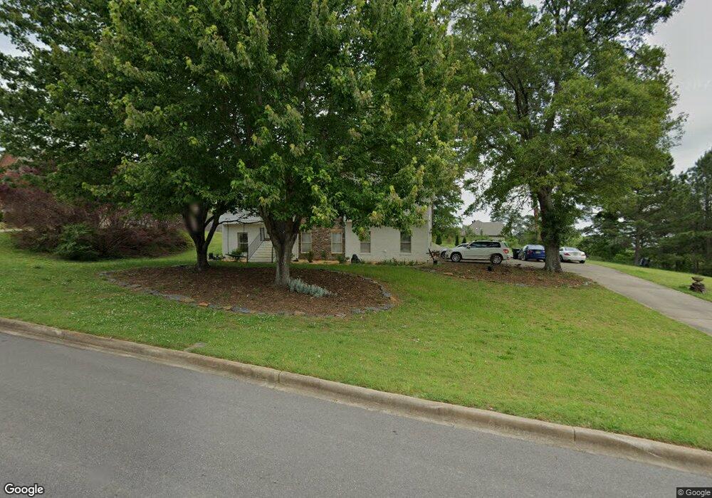
8112 Weatherstone Cir Bessemer, AL 35022
Estimated Value: $348,075 - $400,000
5
Beds
3
Baths
1,739
Sq Ft
$212/Sq Ft
Est. Value
About This Home
This home is located at 8112 Weatherstone Cir, Bessemer, AL 35022 and is currently estimated at $369,269, approximately $212 per square foot. 8112 Weatherstone Cir is a home located in Jefferson County with nearby schools including Mcadory Middle School and Mcadory High School.
Ownership History
Date
Name
Owned For
Owner Type
Purchase Details
Closed on
Dec 21, 2009
Sold by
Hsbc Mortgage Services Inc
Bought by
Trout Rhonda Lucas
Current Estimated Value
Home Financials for this Owner
Home Financials are based on the most recent Mortgage that was taken out on this home.
Original Mortgage
$161,990
Outstanding Balance
$105,448
Interest Rate
4.94%
Mortgage Type
New Conventional
Estimated Equity
$263,821
Purchase Details
Closed on
Jul 3, 2008
Sold by
Vines Edward J and Vines Brenda K
Bought by
Hsbc Mortgage Services Inc
Create a Home Valuation Report for This Property
The Home Valuation Report is an in-depth analysis detailing your home's value as well as a comparison with similar homes in the area
Home Values in the Area
Average Home Value in this Area
Purchase History
| Date | Buyer | Sale Price | Title Company |
|---|---|---|---|
| Trout Rhonda Lucas | $167,000 | None Available | |
| Hsbc Mortgage Services Inc | $236,383 | None Available |
Source: Public Records
Mortgage History
| Date | Status | Borrower | Loan Amount |
|---|---|---|---|
| Open | Trout Rhonda Lucas | $161,990 |
Source: Public Records
Tax History Compared to Growth
Tax History
| Year | Tax Paid | Tax Assessment Tax Assessment Total Assessment is a certain percentage of the fair market value that is determined by local assessors to be the total taxable value of land and additions on the property. | Land | Improvement |
|---|---|---|---|---|
| 2024 | $1,672 | $31,300 | -- | -- |
| 2022 | $1,342 | $28,010 | $4,700 | $23,310 |
| 2021 | $1,128 | $23,580 | $4,700 | $18,880 |
| 2020 | $1,366 | $21,710 | $4,700 | $17,010 |
| 2019 | $1,035 | $21,720 | $0 | $0 |
| 2018 | $1,100 | $23,020 | $0 | $0 |
| 2017 | $1,100 | $23,020 | $0 | $0 |
| 2016 | $1,100 | $23,020 | $0 | $0 |
| 2015 | $1,100 | $23,020 | $0 | $0 |
| 2014 | $1,316 | $22,700 | $0 | $0 |
| 2013 | $1,316 | $22,700 | $0 | $0 |
Source: Public Records
Map
Nearby Homes
- 3531 Lakefront Trail
- 7890 Saddlewood Dr Unit 1
- 7713 S Crest Trail
- 3588 Lakefront Trail
- 516 Sterling Lakes Way
- 524 Sterling Lakes Way
- 3623 Timber Way
- 860 Highway 277
- 3640 Timber Way
- 3603 Oakleaf Dr
- 669 Highway 277
- 131 Creekwater St
- 6089 Highway 13
- 513 Rock Terrace Way
- 3874 Black Hawk Dr
- 394 Rock Terrace Dr
- 386 Rock Terrace Dr
- 5365 S Shades Crest Rd
- 106 Orchard Ln
- 4110 Lee Roy Ln
- 8108 Weatherstone Cir
- 3815 Weatherstone Way
- 8111 Weatherstone Cir
- 1 Weatherstone Cir
- 0 Weatherstone Cir Unit 10 LOTS 611143
- 0 Weatherstone Cir Unit 510806
- 8104 Weatherstone Cir
- 8107 Weatherstone Cir
- 3811 Weatherstone Way
- 3811 Weatherstone Way Unit 29
- 8115 Weatherstone Cir
- 3814 Weatherstone Way
- 8100 Weatherstone Cir
- 8119 Weatherstone Cir
- 3807 Weatherstone Way
- 3807 Weatherstone Way Unit 28
- 8101 Weatherstone Cir
- 5075 S Shades Crest Rd
- 5049 S Shades Crest Rd
- 3803 Weatherstone Way