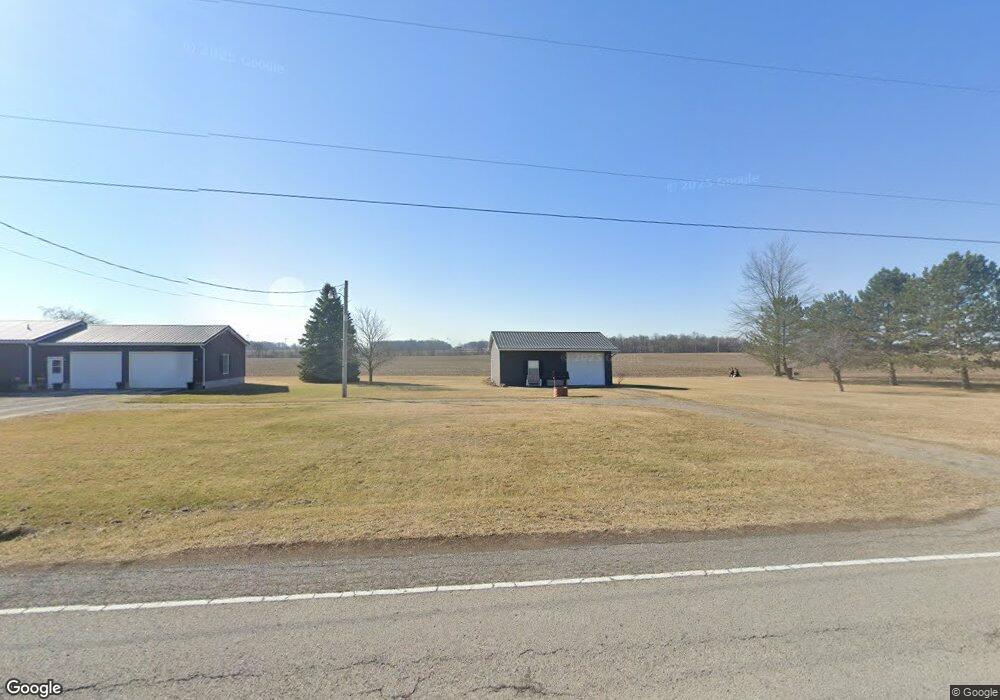
8113 C R 304 (Formerly Sr 30) Forest, OH 45843
Estimated Value: $231,000 - $303,000
3
Beds
3
Baths
1,660
Sq Ft
$168/Sq Ft
Est. Value
About This Home
This home is located at 8113 C R 304 (Formerly Sr 30), Forest, OH 45843 and is currently estimated at $279,314, approximately $168 per square foot. 8113 C R 304 (Formerly Sr 30) is a home located in Hancock County with nearby schools including Hardin Northern Elementary School and Hardin Northern High School.
Ownership History
Date
Name
Owned For
Owner Type
Purchase Details
Closed on
Jul 16, 2025
Sold by
Weyant Randall J and Weyant Lisa R
Bought by
Weyant Irrevocable Heritage Trust and Weyant
Current Estimated Value
Purchase Details
Closed on
May 27, 2009
Sold by
Vanderveer Michael D and Vanderveer Rose M
Bought by
Weyant Randall J and Weyant Lisa R
Home Financials for this Owner
Home Financials are based on the most recent Mortgage that was taken out on this home.
Original Mortgage
$134,290
Interest Rate
4.84%
Mortgage Type
VA
Purchase Details
Closed on
Oct 20, 1992
Bought by
Vanderveer Robert J
Purchase Details
Closed on
Mar 9, 1987
Bought by
Vanderveer Steven J
Create a Home Valuation Report for This Property
The Home Valuation Report is an in-depth analysis detailing your home's value as well as a comparison with similar homes in the area
Home Values in the Area
Average Home Value in this Area
Purchase History
| Date | Buyer | Sale Price | Title Company |
|---|---|---|---|
| Weyant Irrevocable Heritage Trust | -- | None Listed On Document | |
| Weyant Randall J | $130,000 | Whitman Title Security | |
| Vanderveer Robert J | -- | -- | |
| Vanderveer Steven J | $15,000 | -- |
Source: Public Records
Mortgage History
| Date | Status | Borrower | Loan Amount |
|---|---|---|---|
| Previous Owner | Weyant Randall J | $134,290 |
Source: Public Records
Tax History Compared to Growth
Tax History
| Year | Tax Paid | Tax Assessment Tax Assessment Total Assessment is a certain percentage of the fair market value that is determined by local assessors to be the total taxable value of land and additions on the property. | Land | Improvement |
|---|---|---|---|---|
| 2024 | $2,789 | $73,640 | $9,040 | $64,600 |
| 2023 | $2,816 | $73,640 | $9,040 | $64,600 |
| 2022 | $3,052 | $73,640 | $9,040 | $64,600 |
| 2021 | $2,676 | $61,530 | $9,000 | $52,530 |
| 2020 | $2,683 | $61,530 | $9,000 | $52,530 |
| 2019 | $2,486 | $61,530 | $9,000 | $52,530 |
| 2018 | $2,198 | $53,900 | $7,820 | $46,080 |
| 2017 | $2,096 | $53,900 | $7,820 | $46,080 |
| 2016 | $1,901 | $53,900 | $7,820 | $46,080 |
| 2015 | $1,679 | $47,540 | $7,820 | $39,720 |
| 2014 | $1,699 | $47,660 | $7,820 | $39,840 |
| 2012 | $1,767 | $47,660 | $7,820 | $39,840 |
Source: Public Records
Map
Nearby Homes
- 22707 Township Road 61
- 22294 Township Road 65
- 9224 County Road 14
- 22694 County Road 12
- 2375 Wayne St
- 3769 County Road 304
- 1482 Township Road 55
- 1482 Township Rd Unit 55
- 20265 U S 68
- 1568 State Route 68
- 395 Powell Dr
- 121 Hickory Grove Dr
- 0 W Main Cross St Unit 6119602
- 0 W Main Cross St Unit 6119597
- 0 W Main Cross St Unit 6119599
- 118 Wilch St
- 309 Alisa Ln
- 230 Union St
- 0 Township Rd Unit 77 207219
- 219 E Main Cross St
- 8113 County Road 304
- 22835 State Route 698
- 8347 County Road 304
- 7824 County Road 304
- 23403 Township Road 10
- 23460 Township Road 10
- 7752 County Rd
- 7757 County Road 304
- 8590 County Road 304
- 7547 County Road 304
- 22495 State Route 698
- 7514 County Road 304
- 7491 County Road 304
- 7492 County Road 304
- 8735 County Road 304
- 22908 Township Road 61
- 23066 Township Road 61
- 7460 County Road 304
- 7460 County Road 304