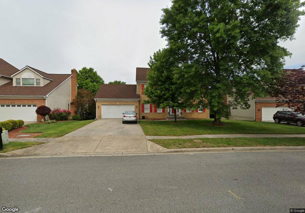
8113 Mike Shapiro Dr Clinton, MD 20735
Estimated Value: $506,589 - $614,000
4
Beds
4
Baths
3,400
Sq Ft
$165/Sq Ft
Est. Value
About This Home
This home is located at 8113 Mike Shapiro Dr, Clinton, MD 20735 and is currently estimated at $559,897, approximately $164 per square foot. 8113 Mike Shapiro Dr is a home located in Prince George's County with nearby schools including Francis T. Evans Elementary School, Stephen Decatur Middle School, and Dr. Henry A. Wise Jr. High School.
Ownership History
Date
Name
Owned For
Owner Type
Purchase Details
Closed on
Mar 4, 2016
Sold by
Hinton Glenda F and Hinton Michael W
Bought by
Hinton Justin W
Current Estimated Value
Home Financials for this Owner
Home Financials are based on the most recent Mortgage that was taken out on this home.
Original Mortgage
$249,600
Outstanding Balance
$197,478
Interest Rate
3.72%
Mortgage Type
New Conventional
Estimated Equity
$362,419
Purchase Details
Closed on
Nov 13, 1991
Sold by
Crestwood Homes
Bought by
Hinton Michael W and Hinton Glenda F
Create a Home Valuation Report for This Property
The Home Valuation Report is an in-depth analysis detailing your home's value as well as a comparison with similar homes in the area
Home Values in the Area
Average Home Value in this Area
Purchase History
| Date | Buyer | Sale Price | Title Company |
|---|---|---|---|
| Hinton Justin W | $312,000 | Old Republic National Title | |
| Hinton Michael W | $200,800 | -- |
Source: Public Records
Mortgage History
| Date | Status | Borrower | Loan Amount |
|---|---|---|---|
| Open | Hinton Justin W | $249,600 |
Source: Public Records
Tax History Compared to Growth
Tax History
| Year | Tax Paid | Tax Assessment Tax Assessment Total Assessment is a certain percentage of the fair market value that is determined by local assessors to be the total taxable value of land and additions on the property. | Land | Improvement |
|---|---|---|---|---|
| 2025 | $7,249 | $498,300 | $116,800 | $381,500 |
| 2024 | $7,249 | $461,000 | $0 | $0 |
| 2023 | $6,694 | $423,700 | $0 | $0 |
| 2022 | $8,778 | $386,400 | $101,800 | $284,600 |
| 2021 | $8,346 | $357,333 | $0 | $0 |
| 2020 | $5,276 | $328,267 | $0 | $0 |
| 2019 | $4,844 | $299,200 | $100,900 | $198,300 |
| 2018 | $4,685 | $288,533 | $0 | $0 |
| 2017 | $4,527 | $277,867 | $0 | $0 |
| 2016 | -- | $267,200 | $0 | $0 |
| 2015 | $4,670 | $267,200 | $0 | $0 |
| 2014 | $4,670 | $267,200 | $0 | $0 |
Source: Public Records
Map
Nearby Homes
- 7729 Castle Rock Dr
- 7904 Mike Shapiro Dr
- 7209 Mcmillen Dr
- 7205 Mcmillen Dr
- 7113 Branchwood Place
- 0 Clinton Vista Ln
- 0 Dangerfield Rd
- 6610 Bullrush Ct
- 6410 Woodley Rd
- 8817 Mimosa Ave
- 9003 Woodyard Rd
- 7804 New Ascot Ln
- 7807 Colonial Ln
- 6009 Sellner Ln
- 9302 Caldran Dr
- 6109 Kirby Rd
- 9409 Silver Fox Turn
- 8518 Cedar Chase Dr
- 5900 Arbroath Dr
- 6006 Runnymeade Ave
- 8201 Mike Shapiro Dr
- 8111 Mike Shapiro Dr
- 8203 Mike Shapiro Dr
- 8109 Mike Shapiro Dr
- 8110 Mike Shapiro Dr
- 8205 Mike Shapiro Dr
- 8107 Mike Shapiro Dr
- 8200 Mike Shapiro Dr
- 8108 Mike Shapiro Dr
- 7402 Castle Rock Dr
- 7205 Friendship Rd
- 7207 Friendship Rd
- 7203 Friendship Rd
- 8207 Mike Shapiro Dr
- 7403 Castle Rock Dr
- 7209 Friendship Rd
- 8105 Mike Shapiro Dr
- 8202 Mike Shapiro Dr
- 8106 Mike Shapiro Dr
- 7201 Friendship Rd