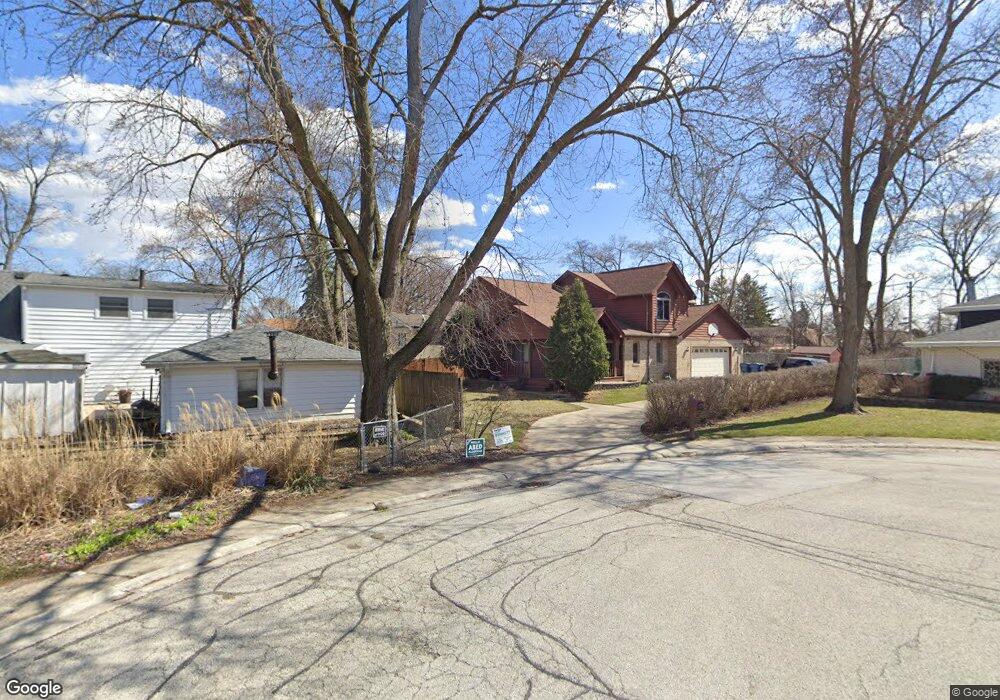
8115 W Erin Dr Palos Hills, IL 60465
Estimated Value: $404,000 - $540,000
4
Beds
2
Baths
2,380
Sq Ft
$201/Sq Ft
Est. Value
About This Home
This home is located at 8115 W Erin Dr, Palos Hills, IL 60465 and is currently estimated at $477,839, approximately $200 per square foot. 8115 W Erin Dr is a home located in Cook County with nearby schools including Sorrick Elementary School, Oak Ridge Elementary School, and H H Conrady Jr High School.
Ownership History
Date
Name
Owned For
Owner Type
Purchase Details
Closed on
Jun 17, 1999
Sold by
Sulo Donald J and Sulo Gail
Bought by
Sanders Marcus L and Sanders Paula C
Current Estimated Value
Home Financials for this Owner
Home Financials are based on the most recent Mortgage that was taken out on this home.
Original Mortgage
$212,800
Outstanding Balance
$56,169
Interest Rate
7.06%
Estimated Equity
$421,670
Create a Home Valuation Report for This Property
The Home Valuation Report is an in-depth analysis detailing your home's value as well as a comparison with similar homes in the area
Home Values in the Area
Average Home Value in this Area
Purchase History
| Date | Buyer | Sale Price | Title Company |
|---|---|---|---|
| Sanders Marcus L | $266,000 | -- |
Source: Public Records
Mortgage History
| Date | Status | Borrower | Loan Amount |
|---|---|---|---|
| Open | Sanders Marcus L | $212,800 | |
| Closed | Sanders Marcus L | $26,600 |
Source: Public Records
Tax History Compared to Growth
Tax History
| Year | Tax Paid | Tax Assessment Tax Assessment Total Assessment is a certain percentage of the fair market value that is determined by local assessors to be the total taxable value of land and additions on the property. | Land | Improvement |
|---|---|---|---|---|
| 2024 | $9,545 | $39,000 | $6,959 | $32,041 |
| 2023 | $8,254 | $39,000 | $6,959 | $32,041 |
| 2022 | $8,254 | $28,777 | $6,061 | $22,716 |
| 2021 | $8,998 | $28,776 | $6,060 | $22,716 |
| 2020 | $8,887 | $28,776 | $6,060 | $22,716 |
| 2019 | $9,493 | $30,964 | $5,611 | $25,353 |
| 2018 | $9,136 | $30,964 | $5,611 | $25,353 |
| 2017 | $8,831 | $30,964 | $5,611 | $25,353 |
| 2016 | $7,937 | $25,471 | $4,938 | $20,533 |
| 2015 | $7,782 | $25,471 | $4,938 | $20,533 |
| 2014 | $7,661 | $25,471 | $4,938 | $20,533 |
| 2013 | $7,472 | $26,472 | $4,938 | $21,534 |
Source: Public Records
Map
Nearby Homes
- 10125 S 81st Ct
- 10226 S 81st Ave
- 9940 S Wood Ln
- 10324 S 81st Ave
- 10221 S Eleanor Ave
- 7822 W 99th Place
- 8360 W 100th Place
- 7810 W 102nd St
- 9719 S 81st Ave
- 10230 S 83rd Ct
- 7826 W 98th Place
- 9950 S 84th Terrace Unit 215
- 9954 S 84th Terrace Unit 109
- 10409 Sheffield Dr Unit 13
- 8556 W 102nd Terrace Unit 5315
- 10300 S Kathy Ct
- 10441 S 83rd Ave
- 9645 S 78th Ct
- 10531 S Roberts Rd Unit 2D
- 10427 S Alta Dr
- 10086 S 81st Ave
- 8119 W Erin Dr
- 10060 S 81st Ave
- 8125 W Erin Dr
- 10090 S 81st Ave
- 8120 W Erin Dr
- 10101 S 81st Ct
- 10050 S 81st Ave
- 8131 W Erin Dr
- 8131 W Erin Dr
- 8126 W Erin Dr
- 10057 S 81st Ave
- 10031 S 81st Ave
- 10059 S 81st Ave
- 10100 S 81st Ave
- 8132 W Erin Dr
- 8132 W Erin Dr
- 8137 W Erin Dr
- 8137 W Erin Dr
- 10035 S 81st Ave