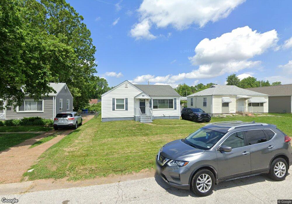
8119 Blanchard Dr Saint Louis, MO 63134
Estimated Value: $81,000 - $93,000
2
Beds
1
Bath
792
Sq Ft
$107/Sq Ft
Est. Value
About This Home
This home is located at 8119 Blanchard Dr, Saint Louis, MO 63134 and is currently estimated at $84,978, approximately $107 per square foot. 8119 Blanchard Dr is a home located in St. Louis County with nearby schools including Berkeley Elementary School, STEAM Academy at McCluer South-Berkeley High School, and Blessed Teresa of Calcutta Catholic School.
Ownership History
Date
Name
Owned For
Owner Type
Purchase Details
Closed on
Apr 30, 2001
Sold by
Pogue John and Pogue Charlene
Bought by
Wade Terunce C
Current Estimated Value
Purchase Details
Closed on
Jun 26, 1998
Sold by
Pogue John W & Charlene E Trs
Bought by
Burns Algernone
Home Financials for this Owner
Home Financials are based on the most recent Mortgage that was taken out on this home.
Original Mortgage
$34,000
Interest Rate
10.75%
Create a Home Valuation Report for This Property
The Home Valuation Report is an in-depth analysis detailing your home's value as well as a comparison with similar homes in the area
Home Values in the Area
Average Home Value in this Area
Purchase History
| Date | Buyer | Sale Price | Title Company |
|---|---|---|---|
| Wade Terunce C | -- | -- | |
| Burns Algernone | -- | -- |
Source: Public Records
Mortgage History
| Date | Status | Borrower | Loan Amount |
|---|---|---|---|
| Previous Owner | Burns Algernone | $34,000 | |
| Closed | Burns Algernone | $6,000 |
Source: Public Records
Tax History Compared to Growth
Tax History
| Year | Tax Paid | Tax Assessment Tax Assessment Total Assessment is a certain percentage of the fair market value that is determined by local assessors to be the total taxable value of land and additions on the property. | Land | Improvement |
|---|---|---|---|---|
| 2025 | $1,052 | $15,640 | $1,160 | $14,480 |
| 2024 | $1,052 | $13,630 | $1,560 | $12,070 |
| 2023 | $1,039 | $13,630 | $1,560 | $12,070 |
| 2022 | $770 | $8,740 | $1,160 | $7,580 |
| 2021 | $765 | $8,740 | $1,160 | $7,580 |
| 2020 | $754 | $8,020 | $1,180 | $6,840 |
| 2019 | $722 | $8,020 | $1,180 | $6,840 |
| 2018 | $621 | $6,180 | $1,200 | $4,980 |
| 2017 | $617 | $6,180 | $1,200 | $4,980 |
| 2016 | $959 | $9,410 | $1,580 | $7,830 |
| 2015 | $931 | $9,410 | $1,580 | $7,830 |
| 2014 | $977 | $9,870 | $1,030 | $8,840 |
Source: Public Records
Map
Nearby Homes
- 6135 Shillington Dr
- 6005 Shillington Dr
- 6016 Shillington Dr
- 8235 Zoe Dr
- 8042 Patterson Dr
- 117 Henquin Dr
- 8306 Whitewater Dr
- 116 Henquin Dr
- 213 Henquin Dr
- 8027 Aline Ave
- 324 Newell Dr
- 8219 Davenport Dr
- 53 N Dade Ave
- 6029 Washington Ave
- 6106 Jackson Ave
- 8140 Packard Ave
- 138 N Marguerite Ave
- 6029 Evergreen Blvd
- 218 N Marguerite Ave
- 6315 Washington Ave
- 8123 Blanchard Dr
- 8115 Blanchard Dr
- 8111 Blanchard Dr
- 8127 Blanchard Dr
- 8118 Myrick St
- 8114 Myrick St
- 8122 Myrick St
- 8131 Blanchard Dr
- 8107 Blanchard Dr
- 8110 Myrick St
- 8126 Myrick St
- 8118 Blanchard Dr
- 8122 Blanchard Dr
- 8114 Blanchard Dr
- 8106 Myrick St
- 8130 Myrick St
- 8110 Blanchard Dr
- 8126 Blanchard Dr
- 8135 Blanchard Dr
- 6023 Eaton Dr