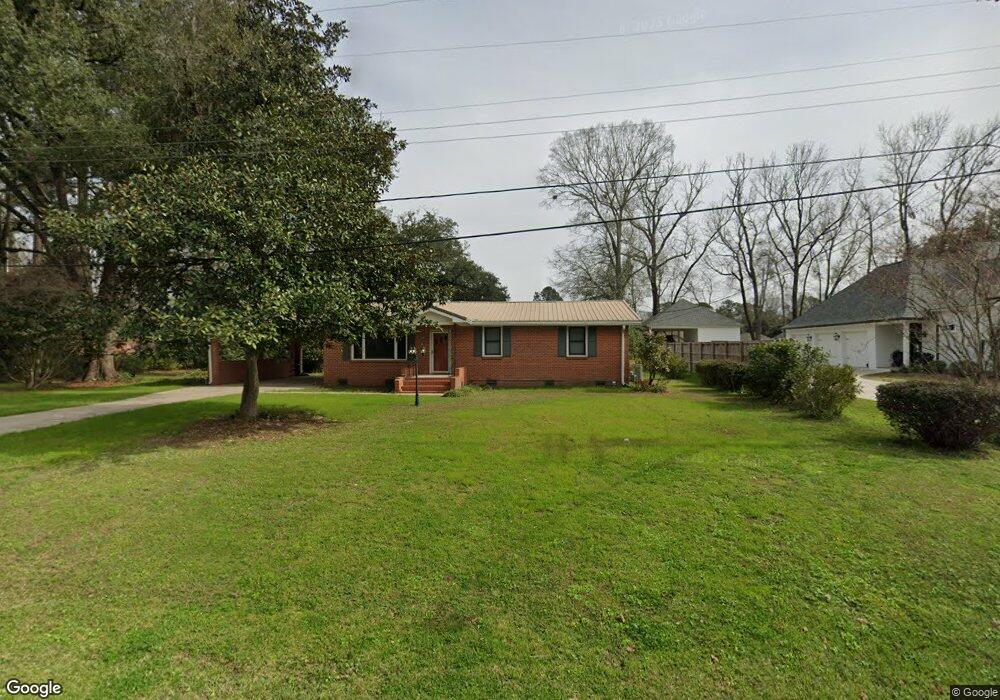
812 Albert Hart Dr Baton Rouge, LA 70808
Highlands/Perkins NeighborhoodEstimated Value: $208,573 - $252,000
--
Bed
--
Bath
1,421
Sq Ft
$164/Sq Ft
Est. Value
About This Home
This home is located at 812 Albert Hart Dr, Baton Rouge, LA 70808 and is currently estimated at $232,393, approximately $163 per square foot. 812 Albert Hart Dr is a home located in East Baton Rouge Parish with nearby schools including Magnolia Woods Elementary School, Glasgow Middle School, and Mckinley Senior High School.
Ownership History
Date
Name
Owned For
Owner Type
Purchase Details
Closed on
Aug 5, 2024
Sold by
Janssen J Kling And Or Jessie R Kling Re and Kling Jessie R
Bought by
Gay Robert and Gay Teresa
Current Estimated Value
Home Financials for this Owner
Home Financials are based on the most recent Mortgage that was taken out on this home.
Original Mortgage
$166,682
Outstanding Balance
$164,792
Interest Rate
6.86%
Mortgage Type
New Conventional
Estimated Equity
$67,601
Create a Home Valuation Report for This Property
The Home Valuation Report is an in-depth analysis detailing your home's value as well as a comparison with similar homes in the area
Home Values in the Area
Average Home Value in this Area
Purchase History
| Date | Buyer | Sale Price | Title Company |
|---|---|---|---|
| Gay Robert | $222,245 | Fidelity National Title |
Source: Public Records
Mortgage History
| Date | Status | Borrower | Loan Amount |
|---|---|---|---|
| Open | Gay Robert | $166,682 |
Source: Public Records
Tax History Compared to Growth
Tax History
| Year | Tax Paid | Tax Assessment Tax Assessment Total Assessment is a certain percentage of the fair market value that is determined by local assessors to be the total taxable value of land and additions on the property. | Land | Improvement |
|---|---|---|---|---|
| 2024 | $435 | $10,450 | $3,500 | $6,950 |
| 2023 | $435 | $10,450 | $3,500 | $6,950 |
| 2022 | $1,248 | $10,450 | $3,500 | $6,950 |
| 2021 | $1,219 | $10,450 | $3,500 | $6,950 |
| 2020 | $1,211 | $10,450 | $3,500 | $6,950 |
| 2019 | $1,266 | $10,450 | $3,500 | $6,950 |
| 2018 | $1,250 | $10,450 | $3,500 | $6,950 |
| 2017 | $1,250 | $10,450 | $3,500 | $6,950 |
| 2016 | $441 | $10,450 | $3,500 | $6,950 |
| 2015 | $443 | $10,450 | $3,500 | $6,950 |
| 2014 | $441 | $10,450 | $3,500 | $6,950 |
| 2013 | -- | $10,450 | $3,500 | $6,950 |
Source: Public Records
Map
Nearby Homes
- 640 Maxine Dr
- 1839 Applewood Rd
- 859 Maxine Dr
- 212 Magnolia Wood Ave
- 124 Magnolia Wood Ave
- 1758 Applewood Rd
- 578 Baird Dr
- 1605 Applewood Rd
- 935 Daventry Dr
- 7850 Boone Ave
- 550 Castle Kirk Dr
- 1431 Applewood Rd
- 408 Baird Dr
- 1342 Applewood Rd
- 8932 Southlawn Dr
- 456 Kimbro Dr
- 8929 Worthington Estates Ave
- 733 Chippenham Dr
- 548 Kenilworth Pkwy
- 9017 Stonecroft Ave
- 824 Albert Hart Dr
- 778 Albert Hart Dr
- 747 Maxine Dr
- 737 Maxine Dr
- 809 Maxine Dr
- 809 Maxine Dr
- 809 Maxine Dr
- 727 Maxine Dr
- 819 Maxine Dr
- 717 Maxine Dr
- 770 Albert Hart Dr
- 829 Maxine Dr
- 775 Albert Hart Dr
- 825 Albert Hart Dr
- 707 Maxine Dr
- 839 Maxine Dr
- 771 Albert Hart Dr
- 695 Maxine Dr
- 684 Albert Hart Dr
- 841 Albert Hart Dr