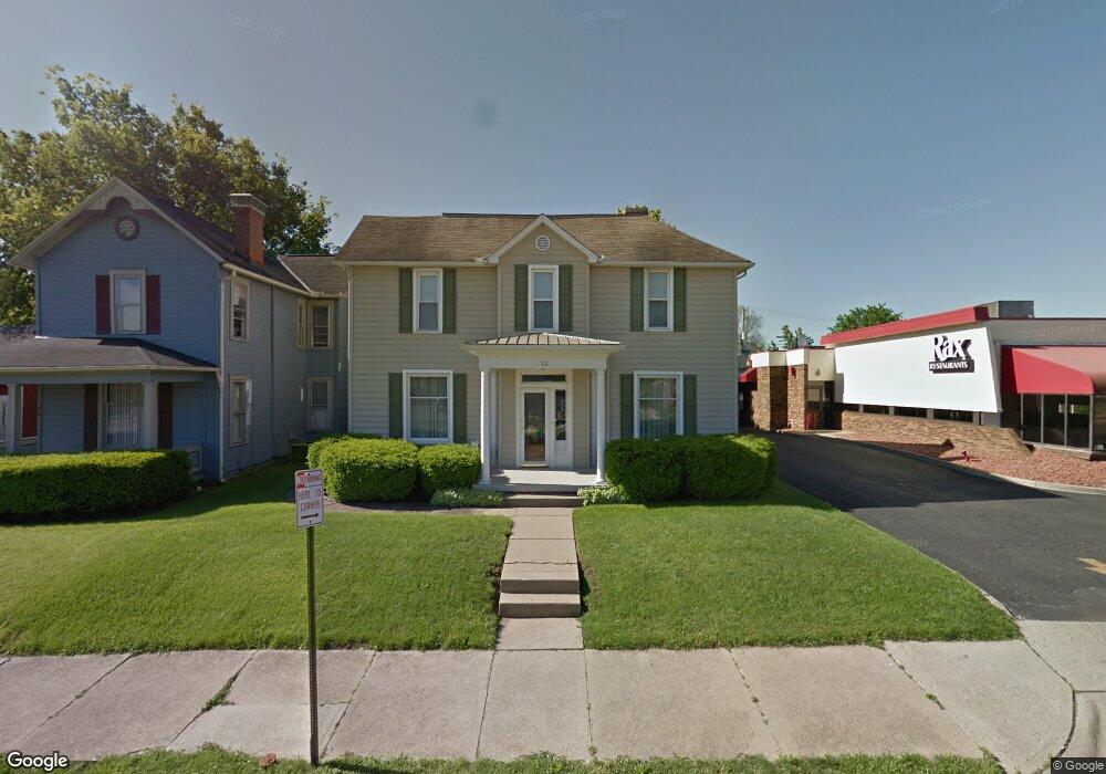
812 E Main St Lancaster, OH 43130
Estimated Value: $239,000 - $372,000
5
Beds
3
Baths
2,938
Sq Ft
$103/Sq Ft
Est. Value
About This Home
This home is located at 812 E Main St, Lancaster, OH 43130 and is currently estimated at $301,412, approximately $102 per square foot. 812 E Main St is a home located in Fairfield County with nearby schools including Thomas Ewing Junior High School, Lancaster High School, and St Mary Elementary School.
Ownership History
Date
Name
Owned For
Owner Type
Purchase Details
Closed on
Nov 4, 2025
Sold by
Joos Michael A
Bought by
Joos Michael A and Hollenbaugh Laura A
Current Estimated Value
Purchase Details
Closed on
Oct 30, 2023
Sold by
Joos Barbara Ann
Bought by
Joos Michael A
Purchase Details
Closed on
Sep 27, 2023
Sold by
Joos Barbara Ann
Bought by
Joos Michael A
Purchase Details
Closed on
Nov 11, 2004
Sold by
Joos Barbara Ann and Joos Barbara A
Bought by
Joos Michael A and Joos Barbara Ann
Purchase Details
Closed on
Jan 31, 1994
Sold by
Helwig Relva E
Bought by
Helwig Relva E
Purchase Details
Closed on
Jan 25, 1994
Sold by
Helwig Catherine M
Bought by
Helwig Relva E
Create a Home Valuation Report for This Property
The Home Valuation Report is an in-depth analysis detailing your home's value as well as a comparison with similar homes in the area
Home Values in the Area
Average Home Value in this Area
Purchase History
| Date | Buyer | Sale Price | Title Company |
|---|---|---|---|
| Joos Michael A | -- | None Listed On Document | |
| Joos Michael A | -- | None Listed On Document | |
| Joos Michael A | -- | None Listed On Document | |
| Joos Michael A | -- | -- | |
| Joos Barbara Ann | $20,000 | -- | |
| Helwig Relva E | $7,200 | -- | |
| Helwig Relva E | -- | -- |
Source: Public Records
Tax History
| Year | Tax Paid | Tax Assessment Tax Assessment Total Assessment is a certain percentage of the fair market value that is determined by local assessors to be the total taxable value of land and additions on the property. | Land | Improvement |
|---|---|---|---|---|
| 2025 | $5,735 | $82,040 | $19,240 | $62,800 |
| 2024 | $5,735 | $63,790 | $9,710 | $54,080 |
| 2023 | $1,987 | $63,790 | $9,710 | $54,080 |
| 2022 | $2,010 | $63,790 | $9,710 | $54,080 |
| 2021 | $1,652 | $51,140 | $9,710 | $41,430 |
| 2020 | $530 | $51,140 | $9,710 | $41,430 |
| 2019 | $1,505 | $51,140 | $9,710 | $41,430 |
| 2018 | $417 | $38,710 | $9,710 | $29,000 |
| 2017 | $1,392 | $45,970 | $16,970 | $29,000 |
| 2016 | $1,356 | $45,970 | $16,970 | $29,000 |
| 2015 | $1,350 | $44,730 | $16,970 | $27,760 |
| 2014 | $1,286 | $44,730 | $16,970 | $27,760 |
| 2013 | $1,286 | $44,730 | $16,970 | $27,760 |
Source: Public Records
Map
Nearby Homes
- 846 E Main St
- 844 E Wheeling St
- 869 E Mulberry St
- 859 E Mulberry St
- 1106 E Walnut St
- 1113 E Locust St
- 621 E Mulberry St
- 641 King St
- 545 E Main St
- 534 E Wheeling St
- 547 E Mulberry St
- 515 E Chestnut St
- 403 S Ewing St
- 736 E Allen St
- 632 N Eastwood Ave
- 627 Sheridan Dr
- 705 Madison Ave
- 641 Sheridan Dr
- 630 Sheridan Dr
- 414 E Walnut St
- 816 E Main St
- 820 E Main St
- 824 E Main St
- 817 E Chestnut St
- 817 E Chestnut St
- 807 E Chestnut St
- 832 E Main St
- 813 E Chestnut St
- 815 E Chestnut St
- 811 E Chestnut St
- 834 E Main St
- 819 E Chestnut St
- 801 E Chestnut St
- 831 E Chestnut St
- 838 E Main St
- 805 E Chestnut St
- 807 E Main St
- 840 E Main St
- 113 S Eastwood Ave
- 127 S Eastwood Ave
Your Personal Tour Guide
Ask me questions while you tour the home.