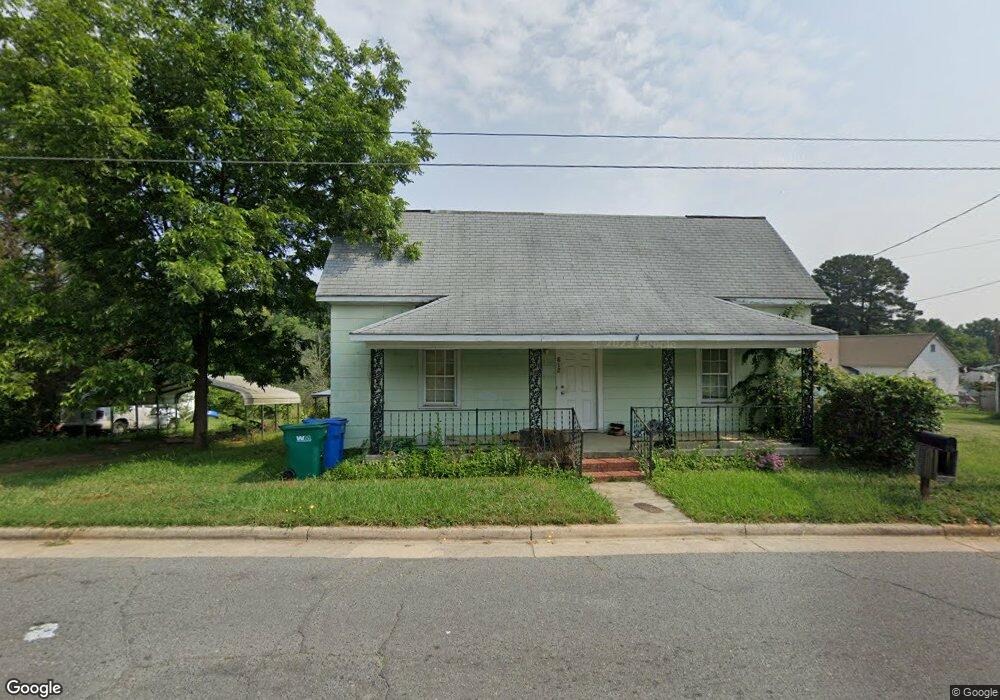
812 Efird St Albemarle, NC 28001
Estimated Value: $110,744 - $131,000
1
Bed
1
Bath
938
Sq Ft
$132/Sq Ft
Est. Value
About This Home
This home is located at 812 Efird St, Albemarle, NC 28001 and is currently estimated at $123,936, approximately $132 per square foot. 812 Efird St is a home located in Stanly County with nearby schools including Central Elementary School, Albemarle Middle School, and Albemarle High School.
Ownership History
Date
Name
Owned For
Owner Type
Purchase Details
Closed on
Jan 19, 2021
Sold by
Eudy Steven D and Eudy Misti Leigh
Bought by
Macanna Properties Llc
Current Estimated Value
Purchase Details
Closed on
Oct 12, 2007
Sold by
Whitley Jean R
Bought by
Eudy Steven Dwight
Home Financials for this Owner
Home Financials are based on the most recent Mortgage that was taken out on this home.
Original Mortgage
$18,000
Interest Rate
6.26%
Mortgage Type
New Conventional
Create a Home Valuation Report for This Property
The Home Valuation Report is an in-depth analysis detailing your home's value as well as a comparison with similar homes in the area
Home Values in the Area
Average Home Value in this Area
Purchase History
| Date | Buyer | Sale Price | Title Company |
|---|---|---|---|
| Macanna Properties Llc | -- | None Available | |
| Eudy Steven Dwight | $20,000 | None Available |
Source: Public Records
Mortgage History
| Date | Status | Borrower | Loan Amount |
|---|---|---|---|
| Previous Owner | Eudy Steven Dwight | $18,000 |
Source: Public Records
Tax History Compared to Growth
Tax History
| Year | Tax Paid | Tax Assessment Tax Assessment Total Assessment is a certain percentage of the fair market value that is determined by local assessors to be the total taxable value of land and additions on the property. | Land | Improvement |
|---|---|---|---|---|
| 2025 | $584 | $52,167 | $10,995 | $41,172 |
| 2024 | $366 | $30,006 | $5,597 | $24,409 |
| 2023 | $366 | $30,006 | $5,597 | $24,409 |
| 2022 | $366 | $30,006 | $5,597 | $24,409 |
| 2021 | $366 | $30,006 | $5,597 | $24,409 |
| 2020 | $310 | $23,866 | $4,798 | $19,068 |
| 2019 | $313 | $23,866 | $4,798 | $19,068 |
| 2018 | $313 | $23,866 | $4,798 | $19,068 |
| 2017 | $301 | $23,866 | $4,798 | $19,068 |
| 2016 | $313 | $24,828 | $4,598 | $20,230 |
| 2015 | $302 | $23,743 | $4,598 | $19,145 |
| 2014 | $337 | $23,743 | $4,598 | $19,145 |
Source: Public Records
Map
Nearby Homes
- 715 Wood St
- 406 Church St
- 710 Austin St Unit 124
- 203 N Broome St
- 1119 Poplar St
- 1600 Bluff St
- 1610 Lowder St
- 1724 Lowder St
- 1723 Lowder St
- 218 Wilson St Unit A&B
- 1806 Kingsley Dr
- 1316 Wiscassett St
- 1005 Lorrie Ln Unit 281
- 0 Pennington Rd Unit CAR4263058
- 610 Watts St
- 2311 Bulwarks Ct Unit 3
- 2309 Bulwarks Ct
- 2309 Bulwarks Ct Unit 4
- 724 N 2nd St
- 815 Sherwood Ave