Estimated Value: $365,502 - $394,000
3
Beds
2
Baths
2,004
Sq Ft
$191/Sq Ft
Est. Value
About This Home
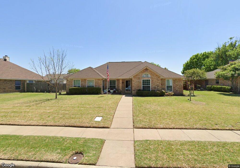
This home is located at 812 Heatherwood Dr, Wylie, TX 75098 and is currently estimated at $381,876, approximately $190 per square foot. 812 Heatherwood Dr is a home located in Collin County with nearby schools including P M Akin Elementary School, AB Harrison Intermediate School, and Grady Burnett J High School.
Ownership History
Date
Name
Owned For
Owner Type
Purchase Details
Closed on
Oct 11, 2012
Sold by
Knapp Matthew L and Knapp Elizabeth M
Bought by
Ingram Lonetta D and Ingram James M
Current Estimated Value
Purchase Details
Closed on
Apr 28, 2006
Sold by
Cooper Debra S and Cooper Christian A
Bought by
Knapp Matthew L and Knapp Elizabeth M
Purchase Details
Closed on
Dec 27, 1995
Sold by
Cooper Raymond B and Cooper Sue A
Bought by
Thurmond Debra S
Home Financials for this Owner
Home Financials are based on the most recent Mortgage that was taken out on this home.
Original Mortgage
$50,000
Interest Rate
7.33%
Mortgage Type
Seller Take Back
Purchase Details
Closed on
Dec 5, 1995
Sold by
Thurmond Robert Vance
Bought by
Thurmond Debra S
Home Financials for this Owner
Home Financials are based on the most recent Mortgage that was taken out on this home.
Original Mortgage
$50,000
Interest Rate
7.33%
Mortgage Type
Seller Take Back
Create a Home Valuation Report for This Property
The Home Valuation Report is an in-depth analysis detailing your home's value as well as a comparison with similar homes in the area
Home Values in the Area
Average Home Value in this Area
Purchase History
| Date | Buyer | Sale Price | Title Company |
|---|---|---|---|
| Ingram Lonetta D | -- | Fatco | |
| Knapp Matthew L | -- | Commonwealth Land Title | |
| Thurmond Debra S | -- | -- | |
| Thurmond Debra S | -- | -- |
Source: Public Records
Mortgage History
| Date | Status | Borrower | Loan Amount |
|---|---|---|---|
| Previous Owner | Thurmond Debra S | $50,000 | |
| Closed | Thurmond Debra S | $48,903 |
Source: Public Records
Tax History Compared to Growth
Tax History
| Year | Tax Paid | Tax Assessment Tax Assessment Total Assessment is a certain percentage of the fair market value that is determined by local assessors to be the total taxable value of land and additions on the property. | Land | Improvement |
|---|---|---|---|---|
| 2025 | $1,304 | $334,543 | $100,000 | $234,543 |
| 2024 | $1,304 | $326,351 | $100,000 | $267,330 |
| 2023 | $1,304 | $296,683 | $100,000 | $261,598 |
| 2022 | $5,917 | $269,712 | $80,000 | $224,846 |
| 2021 | $5,769 | $245,193 | $70,000 | $175,193 |
| 2020 | $5,752 | $231,647 | $55,000 | $176,647 |
| 2019 | $6,029 | $229,442 | $55,000 | $186,667 |
| 2018 | $5,617 | $208,584 | $55,000 | $183,169 |
| 2017 | $5,107 | $211,158 | $45,000 | $166,158 |
| 2016 | $4,790 | $172,384 | $35,000 | $137,384 |
| 2015 | $3,052 | $162,419 | $35,000 | $127,419 |
Source: Public Records
Map
Nearby Homes
- 811 Forest Edge Ln
- 820 Foxwood Ln
- 825 Forest Edge Ln
- 825 Foxwood Ln
- 216 Cedar Ridge St
- 104 Rushcreek Dr
- 409 Cedar Ridge Dr
- 416 Dogwood Dr
- 306 Woodhollow Ct
- 300 Woodhollow Ct
- 414 Briarwood Dr
- 327 S 4th St
- 306 Foxwood Ct
- 301 S 3rd St
- 114 Liberty Dr
- 1201 E Stone Rd
- 104 N 5th St
- 329 S 2nd St
- 207 Spence Dr
- 1209 Surrey Cir
- 810 Heatherwood Dr
- 814 Heatherwood Dr
- 813 Forest Edge Ln
- 808 Heatherwood Dr
- 816 Heatherwood Dr
- 815 Forest Edge Ln
- 813 Heatherwood Dr
- 811 Heatherwood Dr
- 815 Heatherwood Dr
- 815 Heatherwood Dr Unit S
- 809 Forest Edge Ln
- 817 Forest Edge Ln
- 806 Heatherwood Dr
- 809 Heatherwood Dr
- 817 Heatherwood Dr
- 807 Forest Edge Ln
- 807 Heatherwood Dr
- 819 Heatherwood Dr
- 818 Heatherwood Dr
- 804 Heatherwood Dr