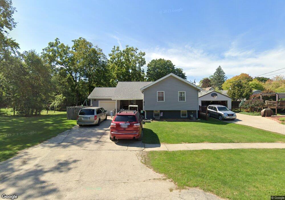
812 Muriel St Woodstock, IL 60098
Estimated Value: $244,000 - $294,093
3
Beds
2
Baths
1,466
Sq Ft
$186/Sq Ft
Est. Value
About This Home
This home is located at 812 Muriel St, Woodstock, IL 60098 and is currently estimated at $273,273, approximately $186 per square foot. 812 Muriel St is a home located in McHenry County with nearby schools including Dean Street Elementary School, Creekside Middle School, and Woodstock High School.
Ownership History
Date
Name
Owned For
Owner Type
Purchase Details
Closed on
Aug 30, 2004
Sold by
Fiedelman Eleanor J
Bought by
Torres Rudy
Current Estimated Value
Home Financials for this Owner
Home Financials are based on the most recent Mortgage that was taken out on this home.
Original Mortgage
$152,650
Outstanding Balance
$76,634
Interest Rate
6.08%
Mortgage Type
FHA
Estimated Equity
$196,639
Create a Home Valuation Report for This Property
The Home Valuation Report is an in-depth analysis detailing your home's value as well as a comparison with similar homes in the area
Home Values in the Area
Average Home Value in this Area
Purchase History
| Date | Buyer | Sale Price | Title Company |
|---|---|---|---|
| Torres Rudy | $160,000 | Universal Title Services Inc |
Source: Public Records
Mortgage History
| Date | Status | Borrower | Loan Amount |
|---|---|---|---|
| Open | Torres Rudy | $152,650 |
Source: Public Records
Tax History Compared to Growth
Tax History
| Year | Tax Paid | Tax Assessment Tax Assessment Total Assessment is a certain percentage of the fair market value that is determined by local assessors to be the total taxable value of land and additions on the property. | Land | Improvement |
|---|---|---|---|---|
| 2024 | $7,580 | $90,274 | $8,918 | $81,356 |
| 2023 | $7,204 | $81,637 | $8,065 | $73,572 |
| 2022 | $6,851 | $72,450 | $7,157 | $65,293 |
| 2021 | $6,510 | $67,691 | $6,687 | $61,004 |
| 2020 | $6,266 | $64,321 | $6,354 | $57,967 |
| 2019 | $6,077 | $61,398 | $6,065 | $55,333 |
| 2018 | $5,485 | $55,205 | $6,918 | $48,287 |
| 2017 | $5,375 | $51,958 | $6,511 | $45,447 |
| 2016 | $5,315 | $48,110 | $6,029 | $42,081 |
| 2013 | -- | $51,745 | $12,482 | $39,263 |
Source: Public Records
Map
Nearby Homes
- 421 W Kimball Ave
- 104 Stewart Ave
- 125 Forest Ave
- 155 Lee Ann Ln
- 908 Bunker St
- 415 Dean St
- 1004 Golden Ave
- 331 Chestnut St
- 601 S Jefferson St
- 1288 Prairie Ridge Trail
- 3848 Riverwoods Dr
- 3902 Riverwoods Dr
- 3842 Riverwoods Dr
- 3839 Riverwoods Dr
- Townsend Plan at Clublands of Antioch - Horizon Series
- Napa Plan at Clublands of Antioch - Andare Series
- 1249 Prairie Ridge Trail
- 3851 Riverwoods Dr
- 3827 Riverwoods Dr
- Meadowlark Plan at Clublands of Antioch - Horizon Series
- 501 Stewart Ave
- 506 Ridgeland Ave
- 509 Stewart Ave
- 508 Ridgeland Ave
- 502 Ridgeland Ave
- 817 Blakely St
- 523 Stewart Ave
- 518 Ridgeland Ave
- 803 Muriel St
- 424 Ridgeland Ave
- 815 Muriel St
- 529 Stewart Ave
- 421 Stewart Ave
- 422 Ridgeland Ave
- 417 Stewart Ave
- 418 Ridgeland Ave
- 506 Stewart Ave
- 790 Muriel St
- 512 Stewart Ave
- 507 Ridgeland Ave