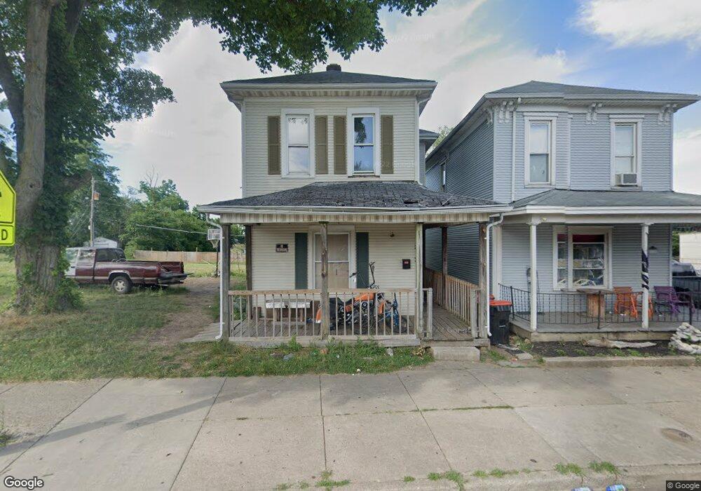
812 Selma Rd Springfield, OH 45505
Estimated Value: $52,000 - $116,000
2
Beds
1
Bath
1,328
Sq Ft
$55/Sq Ft
Est. Value
About This Home
This home is located at 812 Selma Rd, Springfield, OH 45505 and is currently estimated at $72,646, approximately $54 per square foot. 812 Selma Rd is a home located in Clark County with nearby schools including Kenwood Elementary School, Hayward Middle School, and Springfield High School.
Ownership History
Date
Name
Owned For
Owner Type
Purchase Details
Closed on
Nov 26, 2024
Sold by
Putman Victor M
Bought by
Mote Renold and Castor Edline
Current Estimated Value
Purchase Details
Closed on
Feb 10, 2015
Sold by
Willmeth Bobbie and Willmeth Bobbie B
Bought by
Putman Victor M
Purchase Details
Closed on
May 7, 2012
Sold by
Kerns Sandra Mae and Kerns Saundra May
Bought by
Willmeth Bobbie
Purchase Details
Closed on
May 2, 2012
Sold by
Kerns Sandra Mae and Kerns Saundra May
Bought by
Willmeth Bobbie
Purchase Details
Closed on
Nov 23, 1987
Create a Home Valuation Report for This Property
The Home Valuation Report is an in-depth analysis detailing your home's value as well as a comparison with similar homes in the area
Home Values in the Area
Average Home Value in this Area
Purchase History
| Date | Buyer | Sale Price | Title Company |
|---|---|---|---|
| Mote Renold | $31,000 | None Listed On Document | |
| Mote Renold | $31,000 | None Listed On Document | |
| Putman Victor M | $5,000 | Attorney | |
| Willmeth Bobbie | $8,000 | None Available | |
| Willmeth Bobbie | $8,000 | None Available | |
| -- | -- | -- |
Source: Public Records
Tax History
| Year | Tax Paid | Tax Assessment Tax Assessment Total Assessment is a certain percentage of the fair market value that is determined by local assessors to be the total taxable value of land and additions on the property. | Land | Improvement |
|---|---|---|---|---|
| 2025 | $4,749 | $24,850 | $2,450 | $22,400 |
| 2024 | $7,077 | $15,930 | $1,920 | $14,010 |
| 2023 | $3,716 | $15,930 | $1,920 | $14,010 |
| 2022 | $5,023 | $15,930 | $1,920 | $14,010 |
| 2021 | $796 | $14,480 | $1,750 | $12,730 |
| 2020 | $798 | $14,480 | $1,750 | $12,730 |
| 2019 | $799 | $14,480 | $1,750 | $12,730 |
| 2018 | $565 | $9,820 | $1,460 | $8,360 |
| 2017 | $564 | $9,818 | $1,456 | $8,362 |
| 2016 | $565 | $9,818 | $1,456 | $8,362 |
| 2015 | $3,597 | $9,818 | $1,456 | $8,362 |
| 2014 | $2,214 | $9,818 | $1,456 | $8,362 |
| 2013 | $880 | $9,818 | $1,456 | $8,362 |
Source: Public Records
Map
Nearby Homes
- 920 Elder St
- 1008 Tibbetts Ave
- 705 York St
- 652 E Southern Ave
- 625 Tibbetts Ave
- 920 Oak St
- 453 E Pleasant St
- 441 E Euclid Ave
- 1111 Lafayette Ave
- 908 Pine St
- 550 E Rose St
- 1247 Selma Rd
- 1213 Gable St
- 418 Linden Ave
- 638 Clifton Ave
- 205 E Grand Ave
- 1519 Tibbetts Ave
- 1502 Linden Ave
- 1440 Selma Rd
- 1301-1303 Clifton Ave
Your Personal Tour Guide
Ask me questions while you tour the home.