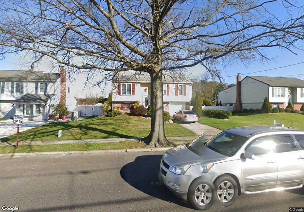
8121 Wyndam Rd Pennsauken, NJ 08109
Estimated Value: $359,000 - $363,544
3
Beds
2
Baths
1,644
Sq Ft
$220/Sq Ft
Est. Value
About This Home
This home is located at 8121 Wyndam Rd, Pennsauken, NJ 08109 and is currently estimated at $361,136, approximately $219 per square foot. 8121 Wyndam Rd is a home located in Camden County with nearby schools including Pennsauken High School and St. Cecilia School.
Ownership History
Date
Name
Owned For
Owner Type
Purchase Details
Closed on
Nov 30, 2004
Sold by
Archer Lisa A
Bought by
Paredes Caroline
Current Estimated Value
Home Financials for this Owner
Home Financials are based on the most recent Mortgage that was taken out on this home.
Original Mortgage
$144,182
Outstanding Balance
$72,014
Interest Rate
5.69%
Estimated Equity
$289,122
Create a Home Valuation Report for This Property
The Home Valuation Report is an in-depth analysis detailing your home's value as well as a comparison with similar homes in the area
Home Values in the Area
Average Home Value in this Area
Purchase History
| Date | Buyer | Sale Price | Title Company |
|---|---|---|---|
| Paredes Caroline | $180,228 | -- |
Source: Public Records
Mortgage History
| Date | Status | Borrower | Loan Amount |
|---|---|---|---|
| Open | Paredes Caroline | $144,182 |
Source: Public Records
Tax History Compared to Growth
Tax History
| Year | Tax Paid | Tax Assessment Tax Assessment Total Assessment is a certain percentage of the fair market value that is determined by local assessors to be the total taxable value of land and additions on the property. | Land | Improvement |
|---|---|---|---|---|
| 2025 | $7,342 | $278,600 | $59,500 | $219,100 |
| 2024 | $7,200 | $168,700 | $50,600 | $118,100 |
| 2023 | $7,200 | $168,700 | $50,600 | $118,100 |
| 2022 | $6,510 | $168,700 | $50,600 | $118,100 |
| 2021 | $6,686 | $168,700 | $50,600 | $118,100 |
| 2020 | $5,989 | $168,700 | $50,600 | $118,100 |
| 2019 | $6,058 | $168,700 | $50,600 | $118,100 |
| 2018 | $6,090 | $168,700 | $50,600 | $118,100 |
| 2017 | $6,102 | $168,700 | $50,600 | $118,100 |
| 2016 | $5,992 | $168,700 | $50,600 | $118,100 |
| 2015 | $6,171 | $168,700 | $50,600 | $118,100 |
| 2014 | $6,029 | $108,400 | $27,900 | $80,500 |
Source: Public Records
Map
Nearby Homes
- 2410 Shelley Ln
- 8221 Corbett Rd
- 2561 Burning Tree Rd
- 7406 Jackson Ave
- 7750 Hesson Ln
- 3002 Gladwyn Ave
- 2603 Manall Ave
- 2657 Rockafellow Ave
- 7487 Githens Ave
- 8704 Park Ave
- 7418 Harvey Ave
- 3422 Palace Ct
- 3423 New Jersey Ct
- 7218 Irving Ave
- 7430 Walnut Ave
- 7263 Cedar Ave
- 8534 Orchard Ave
- 3412 Union Ave Unit C4
- 8331 Stockton Ave
- 7812 Marion Ave
- 8141 Wyndam Rd
- 8101 Wyndam Rd
- 8001 Fenwick Ct
- 8081 Wyndam Rd
- 8120 Wyndam Rd
- 8140 Wyndam Rd
- 8100 Wyndam Rd
- 8061 Wyndam Rd
- 8009 Fenwick Ct
- 8160 Wyndam Rd
- 8161 Wyndam Rd
- 8080 Wyndam Rd
- 8180 Wyndam Rd
- 8041 Wyndam Rd
- 8025 Fenwick Ct
- 8060 Wyndam Rd
- 8017 Fenwick Ct
- 8181 Wyndam Rd
- 8200 Wyndam Rd
- 8040 Wyndam Rd