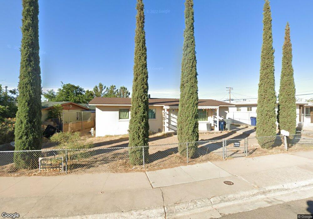
8122 Newland Ct El Paso, TX 79907
Mesa Vista NeighborhoodEstimated Value: $143,000 - $177,000
--
Bed
1
Bath
1,075
Sq Ft
$149/Sq Ft
Est. Value
About This Home
This home is located at 8122 Newland Ct, El Paso, TX 79907 and is currently estimated at $160,382, approximately $149 per square foot. 8122 Newland Ct is a home located in El Paso County with nearby schools including Loma Terrace Elementary School, Bel Air Middle, and Bel Air High School.
Ownership History
Date
Name
Owned For
Owner Type
Purchase Details
Closed on
Feb 28, 1996
Sold by
Gallardo Rafael and Gallardo Vicenta
Bought by
Guzman Ramon and Guzman Juana M
Current Estimated Value
Home Financials for this Owner
Home Financials are based on the most recent Mortgage that was taken out on this home.
Original Mortgage
$52,648
Outstanding Balance
$2,061
Interest Rate
7.01%
Estimated Equity
$158,321
Purchase Details
Closed on
Aug 4, 1995
Sold by
Estabrook David and Estabrook Ruth
Bought by
Gallardo Rafael and Gallardo Vicenta
Home Financials for this Owner
Home Financials are based on the most recent Mortgage that was taken out on this home.
Original Mortgage
$49,000
Interest Rate
7.59%
Create a Home Valuation Report for This Property
The Home Valuation Report is an in-depth analysis detailing your home's value as well as a comparison with similar homes in the area
Home Values in the Area
Average Home Value in this Area
Purchase History
| Date | Buyer | Sale Price | Title Company |
|---|---|---|---|
| Guzman Ramon | -- | -- | |
| Gallardo Rafael | -- | -- |
Source: Public Records
Mortgage History
| Date | Status | Borrower | Loan Amount |
|---|---|---|---|
| Open | Guzman Ramon | $52,648 | |
| Previous Owner | Gallardo Rafael | $49,000 |
Source: Public Records
Tax History Compared to Growth
Tax History
| Year | Tax Paid | Tax Assessment Tax Assessment Total Assessment is a certain percentage of the fair market value that is determined by local assessors to be the total taxable value of land and additions on the property. | Land | Improvement |
|---|---|---|---|---|
| 2025 | $1,522 | $145,316 | -- | -- |
| 2024 | $1,522 | $132,105 | -- | -- |
| 2023 | $1,441 | $120,095 | $0 | $0 |
| 2022 | $3,390 | $109,177 | $0 | $0 |
| 2021 | $3,226 | $99,252 | $12,153 | $87,099 |
| 2020 | $2,976 | $94,225 | $12,153 | $82,072 |
| 2018 | $2,907 | $93,496 | $12,153 | $81,343 |
| 2017 | $2,656 | $86,890 | $12,153 | $74,737 |
| 2016 | $2,656 | $86,890 | $12,153 | $74,737 |
| 2015 | $1,195 | $86,890 | $12,153 | $74,737 |
| 2014 | $1,195 | $88,797 | $12,153 | $76,644 |
Source: Public Records
Map
Nearby Homes
- 1004 Atwood Dr
- 956 Duskin Dr
- 8241 Williamette Ave
- 1121 Stanley St
- 8341 Loma Terrace Rd
- TBD Burnham Dr
- 8181 Staghorn Dr
- TBD Yermoland Dr
- 8004 Gilbert Dr
- 8280 N Loop Dr
- 810 Silvestre Rd
- 7937 San Paulo Dr
- 491 Borrett St
- 7975 Esther Rd
- 859 Destello Rd
- 525 Lafayette Dr
- 8350 Lynn Haven Ave
- 7928 Hermosillo Dr
- 902 Destello Rd
- 837 Destello Rd
- 8126 Newland Ct
- 8116 Newland Ct
- 1001 Atwood Dr
- 8119 Yermoland Dr
- 8115 Yermoland Dr
- 8123 Newland Ct
- 8117 Newland Ct
- 8127 Newland Ct
- 8108 Newland Ct
- 8113 Newland Ct
- 8111 Yermoland Dr
- 1008 Atwood Dr
- 8120 Rolland Ct
- 8109 Newland Ct
- 8124 Rolland Ct
- 8104 Newland Ct
- 8128 Rolland Ct
- 1012 Atwood Dr
- 8107 Yermoland Dr
- 8120 Yermoland Dr