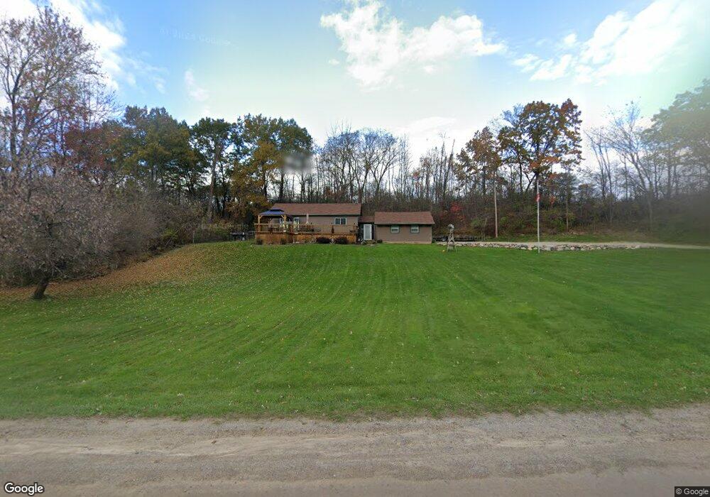
8122 W Rolston Rd Linden, MI 48451
Estimated Value: $216,000 - $284,000
3
Beds
2
Baths
936
Sq Ft
$255/Sq Ft
Est. Value
About This Home
This home is located at 8122 W Rolston Rd, Linden, MI 48451 and is currently estimated at $238,276, approximately $254 per square foot. 8122 W Rolston Rd is a home located in Genesee County with nearby schools including Central Elementary School, Linden Middle School, and Linden High School.
Ownership History
Date
Name
Owned For
Owner Type
Purchase Details
Closed on
Oct 11, 2006
Sold by
Fraser Realty Llc
Bought by
Wolfe Henry and Wolfe Barbara
Current Estimated Value
Purchase Details
Closed on
Jul 28, 2004
Sold by
Fraser Neil J and Fraser Renee D
Bought by
Fraser Realty Llc
Purchase Details
Closed on
Jul 20, 2004
Sold by
Clark Thomas J and Clark Thomas
Bought by
Fraser Neil J and Fraser Renee D
Purchase Details
Closed on
Dec 8, 2003
Sold by
Hitchcock Clark Sandra
Bought by
Clark Thomas J
Create a Home Valuation Report for This Property
The Home Valuation Report is an in-depth analysis detailing your home's value as well as a comparison with similar homes in the area
Home Values in the Area
Average Home Value in this Area
Purchase History
| Date | Buyer | Sale Price | Title Company |
|---|---|---|---|
| Wolfe Henry | $114,000 | Philip R Seaver Title Co Inc | |
| Fraser Realty Llc | -- | -- | |
| Fraser Neil J | $103,300 | Guaranty Title Company | |
| Clark Thomas J | -- | Guaranty Title Company |
Source: Public Records
Tax History Compared to Growth
Tax History
| Year | Tax Paid | Tax Assessment Tax Assessment Total Assessment is a certain percentage of the fair market value that is determined by local assessors to be the total taxable value of land and additions on the property. | Land | Improvement |
|---|---|---|---|---|
| 2025 | $2,019 | $82,700 | $0 | $0 |
| 2024 | $749 | $78,300 | $0 | $0 |
| 2023 | $715 | $71,100 | $0 | $0 |
| 2022 | $1,874 | $66,100 | $0 | $0 |
| 2021 | $1,855 | $60,500 | $0 | $0 |
| 2020 | $635 | $56,700 | $0 | $0 |
| 2019 | $637 | $51,600 | $0 | $0 |
| 2018 | $1,744 | $48,000 | $0 | $0 |
| 2017 | $1,681 | $48,000 | $0 | $0 |
| 2016 | $1,698 | $47,200 | $0 | $0 |
| 2015 | $1,124 | $45,500 | $0 | $0 |
| 2014 | $590 | $43,600 | $0 | $0 |
| 2012 | -- | $35,600 | $35,600 | $0 |
Source: Public Records
Map
Nearby Homes
- 14269 Cole Rd
- 14155 Seymour Rd
- 13065 White Oaks Unit 17
- 9117 Lahring Rd
- 7103 Silver Lake Rd
- Parcel E Hogan Rd
- 8410 Pineview Lake Dr
- 8450 Pineview Lake Dr
- VL Pineview Lake Dr
- 1590 W Rolston Rd
- 5290 Spring Meadows Way
- 9127 Pineview Lake
- 1565 W Rolston Rd
- 12711 Ivy Ln
- 12715 Ivy Ln
- 12859 Ivy Ln
- 13192 Westwinds Dr
- 13144 Westwinds Dr
- 13138 Westwinds Dr
- 13217 Westwinds Dr
- 8178 W Rolston Rd
- 8240 W Rolston Rd
- V/L Cole Rd
- 8058 W Rolston Rd
- 14037 Cole Rd
- 8021 W Rolston Rd
- 14115 Cole Rd
- 14115 Cole Rd
- 7500 W Rolston Rd
- 8280 W Rolston Rd
- 8262 W Rolston Rd
- 14174 Cole Rd
- 14169 Cole Rd
- 8350 W Rolston Rd
- 7468 W Rolston Rd
- 0000 Cole Rd
- 7425 W Rolston Rd
- 7425 W Rolston Rd
- 0 Cole Rd Unit 218021198
- 0 Cole Rd Unit R219001993