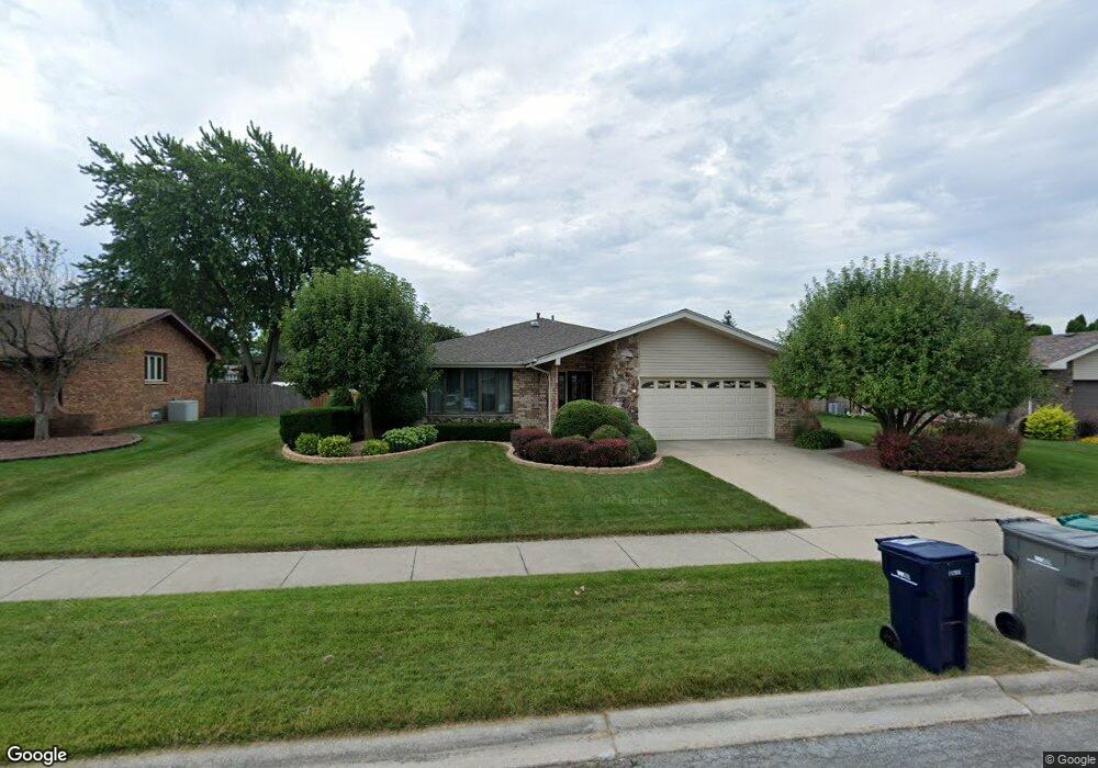
8129 Bob o Link Rd Orland Park, IL 60462
Silver Lake South NeighborhoodEstimated Value: $462,000 - $507,000
4
Beds
3
Baths
2,491
Sq Ft
$193/Sq Ft
Est. Value
About This Home
This home is located at 8129 Bob o Link Rd, Orland Park, IL 60462 and is currently estimated at $481,266, approximately $193 per square foot. 8129 Bob o Link Rd is a home located in Cook County with nearby schools including Prairie Elementary School, Liberty Elementary School, and Jerling Junior High School.
Ownership History
Date
Name
Owned For
Owner Type
Purchase Details
Closed on
Jul 30, 2001
Sold by
Finnelly Geraldine A
Bought by
Finnelly Geraldine A and Labiak Lisa M
Current Estimated Value
Purchase Details
Closed on
Apr 5, 2000
Sold by
Old Kent Bank
Bought by
Finnelly Geraldine A
Home Financials for this Owner
Home Financials are based on the most recent Mortgage that was taken out on this home.
Original Mortgage
$140,000
Outstanding Balance
$48,067
Interest Rate
8.26%
Estimated Equity
$433,199
Purchase Details
Closed on
Dec 18, 1996
Sold by
Harper David A and Harper Kathy
Bought by
First National Bank Of Evergreen Park and Trust #15228
Purchase Details
Closed on
Oct 8, 1993
Sold by
Harper Kathy and Harper David A
Bought by
Harper David A and Harper Kathy
Create a Home Valuation Report for This Property
The Home Valuation Report is an in-depth analysis detailing your home's value as well as a comparison with similar homes in the area
Home Values in the Area
Average Home Value in this Area
Purchase History
| Date | Buyer | Sale Price | Title Company |
|---|---|---|---|
| Finnelly Geraldine A | -- | -- | |
| Finnelly Geraldine A | $246,500 | -- | |
| First National Bank Of Evergreen Park | -- | -- | |
| Harper David A | -- | -- |
Source: Public Records
Mortgage History
| Date | Status | Borrower | Loan Amount |
|---|---|---|---|
| Open | Finnelly Geraldine A | $140,000 |
Source: Public Records
Tax History Compared to Growth
Tax History
| Year | Tax Paid | Tax Assessment Tax Assessment Total Assessment is a certain percentage of the fair market value that is determined by local assessors to be the total taxable value of land and additions on the property. | Land | Improvement |
|---|---|---|---|---|
| 2024 | $8,930 | $39,001 | $6,448 | $32,553 |
| 2023 | $7,496 | $39,001 | $6,448 | $32,553 |
| 2022 | $7,496 | $28,445 | $5,674 | $22,771 |
| 2021 | $7,265 | $28,443 | $5,673 | $22,770 |
| 2020 | $7,057 | $28,443 | $5,673 | $22,770 |
| 2019 | $6,977 | $28,849 | $5,158 | $23,691 |
| 2018 | $6,784 | $28,849 | $5,158 | $23,691 |
| 2017 | $7,527 | $28,849 | $5,158 | $23,691 |
| 2016 | $6,007 | $25,809 | $4,642 | $21,167 |
| 2015 | $5,890 | $25,809 | $4,642 | $21,167 |
| 2014 | $5,828 | $25,809 | $4,642 | $21,167 |
| 2013 | $6,001 | $27,921 | $4,642 | $23,279 |
Source: Public Records
Map
Nearby Homes
- 15229 Bunker Dr
- 15024 S 81st Ave
- 8215 Saint Andrews Dr
- 14939 S 81st Ct
- 7922 Sycamore Dr
- 15426 S 82nd Ave
- 7991 Forestview Dr
- 15543 Brassie Dr
- 15624 Sunset Ridge Dr
- 7820 Forestview Dr
- 7712 Sequoia Ct
- 7825 Braeloch Ct
- 7842 Sea Pines Rd
- 7617 Sycamore Dr
- 15702 Deerfield Ct Unit 2S
- 15713 Brassie Ct Unit 1S
- 15636 Chapel Hill Rd
- 7911 W 157th St Unit 2W
- 8624 Kendall Ln
- 7747 Cashew Dr
- 8135 Bob o Link Rd
- 8132 Bunker Dr
- 8126 Bunker Dr
- 8138 Bunker Dr
- 8141 Bob o Link Rd
- 8117 Bob o Link Rd
- 8132 Bob o Link Rd
- 8126 Bob o Link Rd
- 8120 Bunker Dr
- 8138 Bob o Link Rd
- 8120 Bob o Link Rd
- 8111 Bob o Link Rd
- 8147 Bob o Link Rd
- 8114 Bunker Dr
- 8150 Bunker Dr
- 15135 S 82nd Ave
- 8114 Bob o Link Rd
- 15229 Saint James Dr
- 15226 Saint James Dr
- 8105 Bob o Link Rd