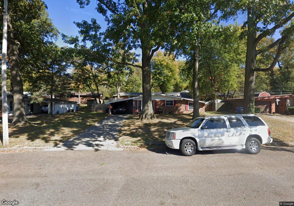
813 Amherst Dr East Alton, IL 62024
Estimated Value: $113,000 - $148,000
3
Beds
1
Bath
1,100
Sq Ft
$122/Sq Ft
Est. Value
About This Home
This home is located at 813 Amherst Dr, East Alton, IL 62024 and is currently estimated at $134,492, approximately $122 per square foot. 813 Amherst Dr is a home located in Madison County with nearby schools including Eastwood Elementary School, East Alton Middle School, and East Alton-Wood River High School.
Ownership History
Date
Name
Owned For
Owner Type
Purchase Details
Closed on
May 13, 2003
Sold by
Jeannotte Arthur and Laughlin Kerri
Bought by
Waggoner Kenneth R
Current Estimated Value
Home Financials for this Owner
Home Financials are based on the most recent Mortgage that was taken out on this home.
Original Mortgage
$58,500
Outstanding Balance
$25,573
Interest Rate
5.87%
Mortgage Type
Purchase Money Mortgage
Estimated Equity
$108,919
Create a Home Valuation Report for This Property
The Home Valuation Report is an in-depth analysis detailing your home's value as well as a comparison with similar homes in the area
Home Values in the Area
Average Home Value in this Area
Purchase History
| Date | Buyer | Sale Price | Title Company |
|---|---|---|---|
| Waggoner Kenneth R | $65,000 | -- |
Source: Public Records
Mortgage History
| Date | Status | Borrower | Loan Amount |
|---|---|---|---|
| Open | Waggoner Kenneth R | $58,500 |
Source: Public Records
Tax History Compared to Growth
Tax History
| Year | Tax Paid | Tax Assessment Tax Assessment Total Assessment is a certain percentage of the fair market value that is determined by local assessors to be the total taxable value of land and additions on the property. | Land | Improvement |
|---|---|---|---|---|
| 2024 | $2,790 | $35,270 | $5,180 | $30,090 |
| 2023 | $2,790 | $32,880 | $4,830 | $28,050 |
| 2022 | $2,800 | $30,350 | $4,460 | $25,890 |
| 2021 | $2,558 | $28,290 | $4,160 | $24,130 |
| 2020 | $2,456 | $27,250 | $4,010 | $23,240 |
| 2019 | $2,412 | $26,440 | $3,890 | $22,550 |
| 2018 | $2,351 | $25,130 | $3,700 | $21,430 |
| 2017 | $2,198 | $24,530 | $3,610 | $20,920 |
| 2016 | $2,156 | $24,530 | $3,610 | $20,920 |
| 2015 | $2,064 | $24,270 | $3,570 | $20,700 |
| 2014 | $2,064 | $24,270 | $3,570 | $20,700 |
| 2013 | $2,064 | $24,620 | $3,620 | $21,000 |
Source: Public Records
Map
Nearby Homes
- 604 Wood River Ave
- 283 Hi Pointe Place
- 250 Hi Pointe Place
- 345 Illinois Ave
- 523 Lincoln Ave
- 104 Whitelaw Ave
- 121 Whitelaw Ave
- 98 Wood River Ave
- 420 Bowman Ave
- 959 Cedar Dr
- 133 Lincoln Ave
- 225 Lakeside Ave
- 211 S 9th St
- 523 Broadway
- 523 Wilson Ave
- 141 S 9th St
- 144 S 9th St
- 833 State St
- 777 Condit St
- 209 Elble Ave
- 811 Amherst Dr
- 815 Amherst Dr
- 816 Bee Tree Ln
- 818 Bee Tree Ln
- 809 Amherst Dr
- 814 Bee Tree Ln
- 810 Amherst Dr
- 817 Amherst Dr
- 812 Amherst Dr
- 808 Amherst Dr
- 814 Amherst Dr
- 807 Amherst Dr
- 812 Bee Tree Ln
- 822 Bee Tree Ln
- 806 Amherst Dr
- 819 Amherst Dr
- 816 Amherst Dr
- 809 Vernon St
- 810 Willoway Ave
- 824 Bee Tree Ln