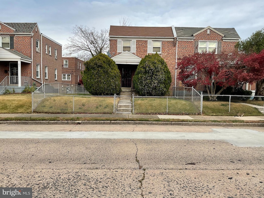
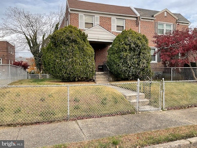
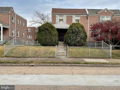
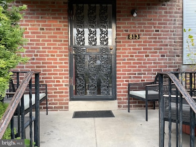
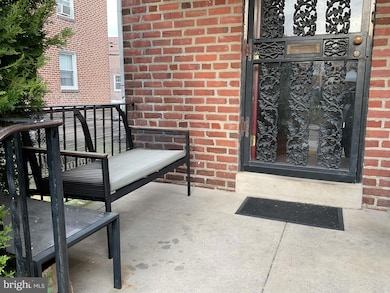
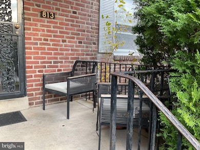
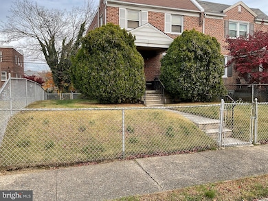
813 Arbor Rd Lansdowne, PA 19050
Estimated payment $1,151/month
Highlights
- Traditional Architecture
- No HOA
- Level Entry For Accessibility
- Wood Flooring
- 1 Car Attached Garage
- Central Air
About This Home
Charming 3-bedroom home on a beautifully maintained block in Yeadon. This property needs updating but has great bones and timeless appeal. Hardwood floors—protected under carpet for years—are ready to shine again. The home offers a spacious layout with 3 large bedrooms, 11⁄2 baths, and a 1-car garage. Enjoy the character of the house along with the warmth and pride of the surrounding neighborhood. A wonderful opportunity to make this inviting home your own. Property is being sold in current condition (as-is condition) and the seller will not make any repairs. Please bring your best offers.
Listing Agent
(610) 565-1995 klrw709@kw.com Keller Williams Real Estate - Media Brokerage Phone: 6107083087 License #2439163 Listed on: 11/17/2025

Townhouse Details
Home Type
- Townhome
Est. Annual Taxes
- $1,468
Year Built
- Built in 1945
Lot Details
- 2,178 Sq Ft Lot
- Lot Dimensions are 33.00 x 76.00
- Property is in average condition
Parking
- 1 Car Attached Garage
- Rear-Facing Garage
- On-Street Parking
Home Design
- Semi-Detached or Twin Home
- Traditional Architecture
- Brick Exterior Construction
- Slab Foundation
Interior Spaces
- 1,344 Sq Ft Home
- Property has 3 Levels
- Wood Flooring
- Stove
- Washer and Dryer Hookup
- Unfinished Basement
Bedrooms and Bathrooms
- 3 Main Level Bedrooms
Accessible Home Design
- Level Entry For Accessibility
Utilities
- Central Air
- Heating System Uses Natural Gas
- Hot Water Heating System
- Natural Gas Water Heater
- Municipal Trash
Listing and Financial Details
- Tax Lot 802-000
- Assessor Parcel Number 48-00-00113-00
Community Details
Overview
- No Home Owners Association
- Yeadon Subdivision
Pet Policy
- Pets Allowed
Map
Home Values in the Area
Average Home Value in this Area
Tax History
| Year | Tax Paid | Tax Assessment Tax Assessment Total Assessment is a certain percentage of the fair market value that is determined by local assessors to be the total taxable value of land and additions on the property. | Land | Improvement |
|---|---|---|---|---|
| 2025 | $4,937 | $115,620 | $32,330 | $83,290 |
| 2024 | $4,937 | $115,620 | $32,330 | $83,290 |
| 2023 | $4,484 | $115,620 | $32,330 | $83,290 |
| 2022 | $4,276 | $115,620 | $32,330 | $83,290 |
| 2021 | $6,465 | $115,620 | $32,330 | $83,290 |
| 2020 | $4,219 | $67,550 | $18,650 | $48,900 |
| 2019 | $4,144 | $67,550 | $18,650 | $48,900 |
| 2018 | $4,087 | $67,550 | $0 | $0 |
| 2017 | $4,001 | $67,550 | $0 | $0 |
| 2016 | $371 | $67,550 | $0 | $0 |
| 2015 | $378 | $67,550 | $0 | $0 |
| 2014 | $371 | $67,550 | $0 | $0 |
Property History
| Date | Event | Price | List to Sale | Price per Sq Ft |
|---|---|---|---|---|
| 11/17/2025 11/17/25 | For Sale | $200,000 | -- | $149 / Sq Ft |
Purchase History
| Date | Type | Sale Price | Title Company |
|---|---|---|---|
| Deed | -- | None Listed On Document | |
| Deed | -- | None Listed On Document | |
| Quit Claim Deed | -- | -- |
Source: Bright MLS
MLS Number: PADE2104026
APN: 48-00-00113-00
Disclaimer: Certain information contained herein is derived from information provided by parties other than Homes.com. All information provided is deemed reliable, but is not guaranteed to be accurate and should be independently verified.
![]() The data relating to real estate for sale on this website appears in part through the BRIGHT Internet Data Exchange program, a voluntary cooperative exchange of property listing data between licensed real estate brokerage firms, and is provided by BRIGHT through a licensing agreement.
The data relating to real estate for sale on this website appears in part through the BRIGHT Internet Data Exchange program, a voluntary cooperative exchange of property listing data between licensed real estate brokerage firms, and is provided by BRIGHT through a licensing agreement.
Listing information is from various brokers who participate in the Bright MLS IDX program and not all listings may be visible on the site.
The property information being provided on or through the website is for the personal, non-commercial use of consumers and such information may not be used for any purpose other than to identify prospective properties consumers may be interested in purchasing.
Some properties which appear for sale on the website may no longer be available because they are for instance, under contract, sold or are no longer being offered for sale.
Property information displayed is deemed reliable but is not guaranteed.
Copyright 2026 Bright MLS, Inc.
- 825 Laurel Rd
- 727 Fern St
- 912 Whitby Ave
- 711 Yeadon Ave
- 1016 Whitby Ave
- 808 Serrill Ave
- 702 Cedar Ave
- 911 W Cobbs Creek Pkwy
- 6535 Windsor St
- 1781 S 65th St
- 622 Yeadon Ave
- 6528 Windsor St
- 1757 S Avondale St
- 1303 Manor Rd
- 1861 S 65th St
- 6514 Chester Ave
- 1903 S 65th St
- 6951 Chester Ave
- 6310 Chester Ave
- 503 Bonsall Ave
- 6635 Chester Ave
- 1908 S 65th St
- 1132 Duncan Ave
- 15 S Church Ln Unit 1A
- 2105 S Simpson St
- 104 Chester Ave Unit A
- 609 Cedar Ave
- 6055 Allman St
- 5847 Willows Ave Unit 2
- 5847 Willows Ave Unit 1
- 5847 Willows Ave Unit 3
- 1203 Edgehill Rd
- 300 N Front St
- 229 N 9th St Unit 1ST FL
- 5813 Hadfield St
- 5822 Warrington Ave
- 211 Wright Ave
- 51 Lewis Ave Unit B
- 1122 Cobbs Creek Pkwy
- 6746 Linmore Ave
Ask me questions while you tour the home.